Martha Jefferson Historic District
|
Martha Jefferson Historic District | |
 | |
  | |
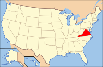
| Location | Includes parts of Lexington, Locust & Grove Aves., & E. High, Maple, Sycamore, Poplar & Hazel Sts., Charlottesville, Virginia |
|---|---|
| Coordinates | 38°02′02″N 78°28′08″W / 38.03389°N 78.46889°WCoordinates: 38°02′02″N 78°28′08″W / 38.03389°N 78.46889°W |
| Area | 58.9 acres (23.8 ha) |
| Built | 1827 |
| Built by | Locust Grove Investment Co.; et al. |
| Architectural style | Late Victorian, Colonial Revival |
| NRHP Reference # | 08000066[1] |
| VLR # | 104-5144 |
| Significant dates | |
| Added to NRHP | February 21, 2008 |
| Designated VLR | December 5, 2007[2] |
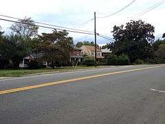
Martha Jefferson Historic District, also known as Locust Grove Addition, is a national historic district located at Charlottesville, Virginia. The district encompasses 154 contributing buildings, 1 contributing site (Maplewood Cemetery), and 1 contributing structure in a primarily residential section of the city of Charlottesville. It was developed between 1893 and 1957 and includes examples of the Late Victorian and Colonial Revival styles. Notable buildings include the Eddins-Tilden House (1901), Dorothy S. Marshall House (1941), and Martha Jefferson Hospital (1928-1929). Located in the district is the separately listed Locust Grove.[3]
It was listed on the National Register of Historic Places in 2008.[1]
References
- 1 2 National Park Service (2010-07-09). "National Register Information System". National Register of Historic Places. National Park Service.
- ↑ "Virginia Landmarks Register". Virginia Department of Historic Resources. Retrieved 5 June 2013.
- ↑ Lydia Mattice Brandt (July 2007). "National Register of Historic Places Inventory/Nomination: Martha Jefferson Historic District" (PDF). Virginia Department of Historic Resources. and Accompanying four photos and Accompanying map

This article is issued from Wikipedia - version of the 11/30/2016. The text is available under the Creative Commons Attribution/Share Alike but additional terms may apply for the media files.