Mantua, Utah
| Mantua, Utah | |
|---|---|
| Town | |
|
Mantua as seen from U.S. Route 91 | |
 Location in Box Elder County and the state of Utah. | |
 Location of Utah in the United States | |
| Coordinates: 41°29′51″N 111°56′32″W / 41.49750°N 111.94222°WCoordinates: 41°29′51″N 111°56′32″W / 41.49750°N 111.94222°W | |
| Country | United States |
| State | Utah |
| County | Box Elder |
| Settled | 1863 |
| Incorporated | 1911 |
| Named for | Mantua, Ohio |
| Area | |
| • Total | 5.6 sq mi (14.5 km2) |
| • Land | 4.9 sq mi (12.6 km2) |
| • Water | 0.7 sq mi (1.9 km2) |
| Elevation[1] | 5,200 ft (1,585 m) |
| Population (2012) | |
| • Total | 673 |
| • Density | 162.5/sq mi (62.8/km2) |
| Time zone | Mountain (MST) (UTC-7) |
| • Summer (DST) | MDT (UTC-6) |
| ZIP code | 84324 |
| Area code(s) | 435 |
| FIPS code | 49-47840[2] |
| GNIS feature ID | 1443141[1] |

Mantua /ˈmænəweɪ/ is a town in eastern Box Elder County, Utah, United States. The population was 687 at the 2010 census. Mantua was settled in the mid-19th century when future LDS President and then apostle and head church authority in Box Elder County Lorenzo Snow sent settlers to the valley to grow flax. The first group arrived in Mantua in 1863, and were all emigres from Denmark and their local leader was Hans Jens Jensen. Snow was from Mantua, Ohio, and the town was named after the Ohio community in his honor.[3]
Geography
Mantua lies in Box Elder Canyon.
According to the United States Census Bureau, the town has a total area of 5.6 square miles (14.5 km²), of which 4.9 square miles (12.6 km²) are land and 0.7 square mile (1.9 km²) (13.21%) is water.
Climate
According to the Köppen Climate Classification system, Mantua has a dry summer continental climate, abbreviated "Dsa" on climate maps.[4]
Demographics
| Historical population | |||
|---|---|---|---|
| Census | Pop. | %± | |
| 1870 | 184 | — | |
| 1880 | 356 | 93.5% | |
| 1890 | 337 | −5.3% | |
| 1900 | 350 | 3.9% | |
| 1910 | 377 | 7.7% | |
| 1920 | 354 | −6.1% | |
| 1930 | 314 | −11.3% | |
| 1940 | 319 | 1.6% | |
| 1950 | 271 | −15.0% | |
| 1960 | 275 | 1.5% | |
| 1970 | 413 | 50.2% | |
| 1980 | 484 | 17.2% | |
| 1990 | 665 | 37.4% | |
| 2000 | 791 | 18.9% | |
| 2010 | 687 | −13.1% | |
| Est. 2015 | 732 | [5] | 6.6% |
As of the census[2] of 2000, there were 791 people, 218 households, and 189 families residing in the town. The population density was 162.5 people per square mile (62.7/km²). There were 231 housing units at an average density of 47.5 per square mile (18.3/km²). The racial makeup of the town was 96.33% White, 0.63% African American, 0.51% Native American, 0.25% Asian, 0.51% from other races, and 1.77% from two or more races. Hispanic or Latino of any race were 0.88% of the population.
There were 218 households out of which 52.8% had children under the age of 18 living with them, 79.4% were married couples living together, 5.0% had a female householder with no husband present, and 13.3% were non-families. 12.4% of all households were made up of individuals and 5.5% had someone living alone who was 65 years of age or older. The average household size was 3.63 and the average family size was 4.01.
In the town the population was spread out with 38.2% under the age of 18, 10.1% from 18 to 24, 23.3% from 25 to 44, 20.1% from 45 to 64, and 8.3% who were 65 years of age or older. The median age was 30 years. For every 100 females there were 108.7 males. For every 100 females age 18 and over, there were 103.8 males.
The median income for a household in the town was $60,234, and the median income for a family was $61,964. Males had a median income of $42,100 versus $26,875 for females. The per capita income for the town was $17,798. About 0.5% of families and 1.7% of the population were below the poverty line, including 2.1% of those under age 18 and 3.4% of those age 65 or over.
Government
Mantua is still widely considered to be a speed trap. In 1997, its two police officers issued over 1,300 speeding tickets, amounting to fines of approximately $60,000, or more than half of the city's total yearly revenue.[7] In 2014, it issued over 2,100 traffic tickets, amounting to approximately $220,000 in fines, or more than one-third of total yearly revenue.[8] The sole full-time police officer (and now also mayor) objected to the term "speed trap" as he said he did not hide his truck, and fatal accidents have decreased since he began patrolling. Most tickets are issued along the town's section of U.S. Routes 89/91.[9] However, a state legislator counters that reduced speed limits, installed barriers, and rumble strips have reduced traffic fatalities, calling into question the justification for such a large ratio (compared to number of residents) of issued traffic tickets in the area.[10]
References
- 1 2 U.S. Geological Survey Geographic Names Information System: Mantua
- 1 2 "American FactFinder". United States Census Bureau. Retrieved 2008-01-31.
- ↑ Jenson, Andrew (1920). "Origin of Western Geographic Names". The Utah genealogical and historical magazine. 11 (2): 83.
But in 1864 the settlement was named Mantua, after Mantua, Portage County, Ohio, the birthplace of President Lorenzo Snow.
- ↑ Climate Summary for Mantua, Utah
- ↑ "Annual Estimates of the Resident Population for Incorporated Places: April 1, 2010 to July 1, 2015". Retrieved July 2, 2016.
- ↑ "Census of Population and Housing". Census.gov. Retrieved June 4, 2015.
- ↑ "Mantua boasts mean speed trap". Deseret News. 10 March 1998. Retrieved 6 October 2009.
- ↑ "Mantua fuming over speed trap bill". The Herald Journal. 30 Jan 2016. Retrieved 10 May 2016.
- ↑ "Mantua boasts mean speed trap". Deseret News. 10 March 1998. Retrieved 6 October 2009.
- ↑ "Mantua fuming over speed trap bill". The Herald Journal. 30 Jan 2016. Retrieved 10 May 2016.
External links
![]() Media related to Mantua, Utah at Wikimedia Commons
Media related to Mantua, Utah at Wikimedia Commons
 |
Honeyville | Wellsville | Hyrum | |
| Brigham City Perry |
|
Paradise | ||
| ||||
| | ||||
| Willard Pleasant View |
North Ogden | Huntsville |
Municipalities and communities of Box Elder County, Utah, United States | ||
|---|---|---|
| Cities | 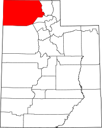 | |
| Towns | ||
| CDPs | ||
| Unincorporated areas | ||
| Ghost towns | ||