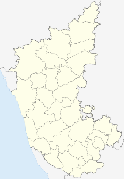
Manhalli
| Manhalli | |
|---|---|
| village | |
 Manhalli  Manhalli Location in Karnataka, India | |
| Coordinates: 17°55′N 77°32′E / 17.91°N 77.53°ECoordinates: 17°55′N 77°32′E / 17.91°N 77.53°E | |
| Country |
|
| State | Karnataka |
| District | Bidar |
| Talukas | Bidar |
| Area | |
| • Total | 3 km2 (1 sq mi) |
| Population (2012) | |
| • Total | 19,124 |
| • Density | 6,400/km2 (17,000/sq mi) |
| Languages | |
| • Official | Kannada |
| Time zone | IST (UTC+5:30) |
| Vehicle registration | KA38 |
Manhalli is a village in the southern state of Karnataka, India.[1][2] It is located in the Bidar taluk of Bidar district in Karnataka.
Demographics
As of 2001 India census, Manhalli had a population of 19124 with 10089 males and 9035 females.the education literacy is 54% .Manhalli main road is state highway no 258 it goes to Bangalore and connect to the NH-9 also.
Lake
Manhalli famous pound area around 3 square kilometer. It is located on Bidar road manhalli also state highway no -258 near opposite of Darwesh colony manhalli.
Temples
- Shree Panduranga Temple
- Shree Hanuman Temple
- Shree Beereshwar Temple
- Shree Basaveshwar Temple
- Shree Bakkaprabhu Temple
- Shree Veerabhadreshwar Temple
- Shree Bhavani Mata Temple
- Shree Siddeshwar Temple
Education
- Basva school manhalli
- Government DED college manhalli
- BBA college manhalli
- Government BA college manhalli
- Vidyaniketan ITI college manhalli
- Government PUC college of science and arts
- Government first grade college manahlli
Economics
- SBI CO-Branch Apna Csp Manhalli
- Sugar cane
- Rice
- Vegetable
- grain nuts
Hospitals
- Government Hospital
- Prabhusetty hospital
- Govt Veterinary Hospital
Hotel
- Hotel Ashok
- Prabhu Hotel
See also
References
- ↑ Village code= 452900 "Census of India : Villages with population 5000 & above". Retrieved 2008-12-18.
|first1=missing|last1=in Authors list (help) - ↑ "Yahoomaps India :". Retrieved 2008-12-18. Manhalli, Bidar, Karnataka
External links
This article is issued from Wikipedia - version of the 10/11/2016. The text is available under the Creative Commons Attribution/Share Alike but additional terms may apply for the media files.