Attur
| Attur ஆத்தூர் Aaththur | |
|---|---|
| Town | |
|
Aaththur Fort | |
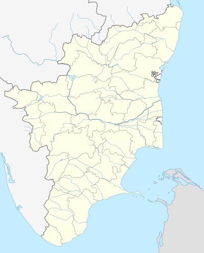 Attur Location in Tamil Nadu, India | |
| Coordinates: 11°35′58″N 78°35′52″E / 11.599341°N 78.597752°ECoordinates: 11°35′58″N 78°35′52″E / 11.599341°N 78.597752°E | |
| Country |
|
| State | Tamil Nadu |
| District | Salem |
| Government | |
| • Type | Selection Grade Municipality |
| • Body | Attur Municipality |
| Elevation | 212 m (696 ft) |
| Population (2011) | |
| • Total | 61,973 |
| Languages | |
| • Official | Tamil |
| Time zone | IST (UTC+5:30) |
| PIN | 636 102 |
| Telephone code | 04282 |
| Vehicle registration | TN-77 |
| Website |
www |

Attur or Aaththur is a town, municipality and headquarters of Attur taluk in the Salem district in the state of Tamil Nadu, India. It is known as Sago City. As of 2011, the town had a population of 61,793. outgrowth of Attur town is Narasingapuram Municipality.Total UA population of Attur town is around 85000.Attur is the second largest town in the district after the district capital Salem. The villages nearby are Manivizhundhan North, Manivizhundhan South, North Pudur and South Pudur.
Attur became municipality in 1965. In 2008, Attur was upgraded as Selection Grade Municipality.
Etymology
The name of the town derives from the word "Aaaru", meaning "River" and "O0tru ooru", meaning "fountain" - Vasishta Nadi (literally, Attur "River Town"). Attur is one of the king's city. This name of the city call for the reason in long long years ago the situated in the river banks vasista nadhi took the water from this river by making the fountain by their hand.
History
C.Lakshmana Nayakan (17th Century), local Palayakarar, built the Attur Fort. Gatti Mudalis built the temples inside the fort. Attur has an ancient fort with all facilities and is one of the busy business centers in Salem till date. People are very generous, soft natured and have great tendency to help others and for the down-trodden.
Economy
Attur is the main shopping center for the neighboring region. Attur region is principally an agricultural area. Attur is also famous for tapioca (cassava roots), and there are several tapioca-based industries today which manufacture products like "javvarisi" (sago) for markets all over India. It has many medicinal plant cultivars. Some of them are MGP (Coleus-medicinal plant), south India herbs (coleus).
Attur is one of the four places in India to produce hybrid seeds (cotton, Bt cotton) on an Industrial scale. Attur is also notified for Rice Mills which supplies Rice to all parts of India.
Muttal is one of the village with fertile soil and it is great source of drinking water for Attur town.The main source of water for Attur is Muttal lake. Muttal is geographically surrounded by forest on the north side thatswhy water from the forest stored in the lake . But the only painful thing is Attur town needs drinking water from the Muttal lake but don't want to maintain Muttal lake.
Transport

Attur lies on NH 79. Attur is well connected with other cities & towns.It is on NH-68. three State highways originates from Attur. SH-30 Attur-Thuraiyur-Musuri, SH-79 Attur-Rasipuram-Erode, SH-157 Attur-Perambalur. Attur is well connected with Salem on the east (north-east) at 45 kilometres on the Salem-Ulunderpet via Kallakkurichi NH 68 which in turn connects to Chennai through arterial NH 45 at Ulunderpet and NH 47 (Salem-Kanyakumari via Coimbatore, Cochin, Trivandrum)at Salem with a number of bus routes.
Attur town have two bus stands. Attur is well connected by bus services to Salem, Coimbatore, Chennai, Trichy,Erode, Pondy. Train services are also available between Attur to Salem, Attur to Virudhachalam and Salem-Chennai Egmore express train runs via Attur . Pondicherry-Bangalore AC express train is expected to run shortly and runs via Attur. Newly proposed route to Ariyalur via Perambalur will turn Attur railway station to Attur Junction. Land acquisation has been done and stopped due to insufficient funds. There are direct buses to Coimbatore via Avinashi.
Attur is landlocked and depends on the Port of Chennai for most oceangoing freight.
Nearest airport is Trichy which is 120 km away from the town. Chennai airport is 264 km from Attur
Geography
Attur is situated approximately 55 km to the east of Salem. The town has a fort on the northern banks of the Vasishta Nadhi river that flows from the Kalvarayan Hills (misspelt in English as Kalrayan). Attur has a small dam across Vashistanadi river in the west end of town. The average elevation of the town is 212 metres (695 feet) above mean sea level (msl).
Demographics
According to 2011 census, Attur had a population of 61,793 with a sex-ratio of 1,021 females for every 1,000 males, much above the national average of 929.[1] A total of 6,147 were under the age of six, constituting 3,209 males and 2,938 females. Scheduled Castes and Scheduled Tribes accounted for 22.33% and .62% of the population respectively. The average literacy of the city was 74.65%, compared to the national average of 72.99%.[1] The city had a total of 16,371 households. There were a total of 25,949 workers, comprising 1,417 cultivators, 3,740 main agricultural labourers, 735 in house hold industries, 17,482 other workers, 2,575 marginal workers, 36 marginal cultivators, 703 marginal agricultural labourers, 176 marginal workers in household industries and 1,660 other marginal workers.[2] As per the religious census of 2011, Attur had 90.7% Hindus, 7.24% Muslims, 1.88% Christians, 0.03% Sikhs, 0.01% Buddhists, 0.04% Jains, 0.11% following other religions and 0.0% following no religion or did not indicate any religious preference.[3]
Politics
Attur assembly constituency is part of Kallakurichi (Lok Sabha constituency).[4]
References
- 1 2 "Census Info 2011 Final population totals". Office of The Registrar General and Census Commissioner, Ministry of Home Affairs, Government of India. 2013. Retrieved 26 January 2014.
- ↑ "Census Info 2011 Final population totals - Attur". Office of The Registrar General and Census Commissioner, Ministry of Home Affairs, Government of India. 2013. Retrieved 26 January 2014.
- ↑ "Population By Religious Community - Tamil Nadu" (XLS). Office of The Registrar General and Census Commissioner, Ministry of Home Affairs, Government of India. 2011. Retrieved 13 September 2015.
- ↑ "List of Parliamentary and Assembly Constituencies" (PDF). Tamil Nadu. Election Commission of India. Archived from the original (PDF) on 31 October 2008. Retrieved 2008-10-09.
External links
| Wikimedia Commons has media related to Attur. |
See also
| State symbols |
|
|---|---|
| Governance |
|
| Topics | |
| Districts |
|
| Major cities | |