Madison Township, Pike County, Indiana
| Madison Township Pike County | |
|---|---|
| Township | |
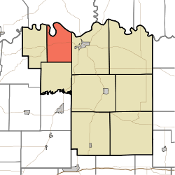 Location in Pike County | |
| Coordinates: 38°29′28″N 87°21′37″W / 38.49111°N 87.36028°WCoordinates: 38°29′28″N 87°21′37″W / 38.49111°N 87.36028°W | |
| Country |
|
| State |
|
| County | Pike |
| Government | |
| • Type | Indiana township |
| Area | |
| • Total | 22.07 sq mi (57.2 km2) |
| • Land | 21.65 sq mi (56.1 km2) |
| • Water | 0.42 sq mi (1.1 km2) 1.90% |
| Elevation | 446 ft (136 m) |
| Population (2010) | |
| • Total | 382 |
| • Density | 17.6/sq mi (6.8/km2) |
| ZIP code | 47567 |
| GNIS feature ID | 0453596 |
Madison Township is one of nine townships in Pike County, Indiana, United States. As of the 2010 census, its population was 382 and it contained 175 housing units.[1]
Geography
According to the 2010 census, the township has a total area of 22.07 square miles (57.2 km2), of which 21.65 square miles (56.1 km2) (or 98.10%) is land and 0.42 square miles (1.1 km2) (or 1.90%) is water.[1] The White River defines the township's northern border, as well as the northern border of Pike County.
Unincorporated towns
- Bartons Location at 38°31′45″N 87°20′22″W / 38.529215°N 87.339460°W
- Bowman at 38°29′47″N 87°20′49″W / 38.496437°N 87.346960°W
(This list is based on USGS data and may include former settlements.)
Cemeteries
The township contains these six cemeteries: Blaize, Fowler, Poplar Grove, Stewart, Weathers and Weist.
School districts
- Pike County School Corporation
Political districts
- State House District 64
- State Senate District 48
References
- "Madison Township, Pike County, Indiana". Geographic Names Information System. United States Geological Survey. Retrieved 2009-11-26.
- United States Census Bureau 2009 TIGER/Line Shapefiles
- IndianaMap
- 1 2 "Population, Housing Units, Area, and Density: 2010 - County -- County Subdivision and Place -- 2010 Census Summary File 1". United States Census. Retrieved 2013-05-10.
External links
- Indiana Township Association
- United Township Association of Indiana
- City-Data.com page for Madison Township
 |
Harrison Township, Knox County | | ||
| Clay Township | |
Washington Township | ||
| ||||
| | ||||
| Logan Township |
Municipalities and communities of Pike County, Indiana, United States | ||
|---|---|---|
| City | ||
| Towns | ||
| Townships | ||
| CDP | ||
| Other unincorporated communities |
| |
| Footnotes | ‡This populated place also has portions in an adjacent county or counties | |
This article is issued from Wikipedia - version of the 10/15/2014. The text is available under the Creative Commons Attribution/Share Alike but additional terms may apply for the media files.