Machang District
| Machang Jawi: ماچڠ Thai: มาจัง | ||
|---|---|---|
| District of Malaysia | ||
| ||
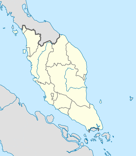 Machang Peninsular Malaysia | ||
| Coordinates: 5°45′39″N 102°12′57″E / 5.76083°N 102.21583°ECoordinates: 5°45′39″N 102°12′57″E / 5.76083°N 102.21583°E | ||
| Country |
| |
| State |
| |
| Opened | 1880 | |
| Minor Territory | 1949 | |
| Full Territory | 1st January 1952 | |
| Founded by | Senik Awang Kecik | |
| Seat | Machang | |
| Government | ||
| • Elected MP | Ahmad Jazlan Yaakub (BN (UMNO)) | |
| • District President | Haji Mohd Zainudin B. Mohamed | |
| Area | ||
| • Total | 546.26 km2 (210.91 sq mi) | |
| Population (2010)[1] | ||
| • Total | 93,087 | |
| • Estimate (2014) | 111,700 | |
| • Density | 170/km2 (440/sq mi) | |
| Time zone | UTC +8 | |
| Postcode | 18XXX | |
| Area code(s) | +609 | |
| Vehicle registration | D (for all vehicle except taxis) | |

Machang (Jawi: ماچڠ, Thai: มาจัง, Chinese: 马樟) is one of the administrative territories (jajahan) or districts in the state of Kelantan, Malaysia. It is situated at the centre of the state, bordering with Kelantanese territories of Kota Bharu to the north, Pasir Puteh to the east, Tanah Merah to the west and Kuala Krai to the south. It is a home to one of the main campuses of Universiti Teknologi MARA. Its major town and administrative centre is Bandar Machang.
History
The territory of Machang originated as a village of the same name, Kampung Machang. It was opened in 1880 by a group of settlers from Pasir Tumboh, Kota Bharu led by Senik Awang Kecik. On its inception, the territory was mainly economically agrarian with some of the population involved in commerce.[2]
Around 1949, Machang was delineated as a autonomous sub-district of Kelantan; owing to its rapid pace of development and active economic sector, Machang was upgraded as a full Territory on January 1, 1952.[3] The territory is still largely agrarian home to a lot of paddy fields, palm and rubber plantations.
Etymology
Machang is named after the Malay name for horse mango, machang (Mangifera foetida).
Point of Interest
Cek Mek Molek Street Murals
Opened to public in 2015, Cek Mek Molek Street is the latest artistic installation of its kind within the territory. It was a previously an unkempt back alley before it was then transformed as an open mural gallery.[4]
Leaning Minaret of Pulai Condong Mosque
The Minaret of Pulai Condong Mosque, a local flagship structure, was designed and built by Hj. Ab. Samad bin Hj. Abdullah in year 1856 (1273H). The minaret is also known as Pulai Condong Mosque Tower from a loose English translation from the Malay language.
Standing at 18 metres high and about 2.8 metres width, the minaret was built with an unroofed pole at its core which acts as an axis.
The minaret was said to be made in cooperation of hundreds of men. The structure is made from chengal wood by only adze (Malay: beliung), axe and chisel. The structural integrity of the minaret is really strong considering it is still standing after Kelantan was hit by a big flood and storm in 1880 (1297H). This minaret remained in a good condition today and still serving its original purpose as a place where muezzin calls out the call for prayers.
Bukit Bakar Recreational Forest
Bukir Bakar Recreational Forest or Hutan Lipur Bukit Bakar was first opened in 1975. It covers an area of 3.14 hectares, within the Ulu Sat Forest Reserve. This recreational forest is a perfect getaway, especially for families. The facilities within the area includes a children's playground, a number of rest areas and huts, a bathing pond, a hanging bridge, and restrooms, to improve visitors' appreciation of the flowing cool waters, flora and fauna, and intense forest greeneries. The site has a free entry for guests between 7am to 7pm. Campers, on the other hand, will need to get a permission from the Recreational Forest authorities, on behalf of the Kelantan State Forestry Director.
Jeram Linang Waterfall and Recreational Forest
Jeram Linang Waterfall was one of the first to be developed by the state. Located in the Ulu Sat Forest Reserve, its cool waters always crystal clear despite the location's popularity. The state government has provided facilities including public restrooms, rest areas, Muslim prayer facilities, restaurants and car park. Visitors to Jeram Linang come not only to bathe, but also to jungle trek, and pitch their tents up for an eco-friendly vacation at the camp site provided.
Guillemard Bridge
Guillemard Bridge is a railway bridge erected across Sungai Kelantan in Kusial near Tanah Merah. The bridge is the longest railway bridge in Malaysia. The construction began in year 1920 and completed in July 1924. When it was first opened, the bridge was used by all types of vehicles including trains and motor vehicles. It was inaugurated by then Sultan of Kelantan, HRH Sultan Ismail Ibni Al-Marhum Sultan Muhammad IV of Kelantan in year 1925. The name "Guillemard" was taken from Sir Laurence Guillemard who was then the British Governor of Strait Settlements and High Commissioner of Malaya.
The bridge was detonated by the British troops on 12 December 1941 to slow down the advancement of Japanese military troops during the Japanese Invasion of Malaya before they retreated to Kuala Krai. Railway bridge was soon repaired and reopened to traffic on 7 September 1948. Upon the completion of a new bridge in a nearby area, Guillemard Bridge is now only used by trains and access to other vehicles is permanently closed.
Temangan Ore Mine
Temangan iron ore mine was operated by Oriental Mining Co., a Japanese company in Bukit Besi, Temangan. Once extracted, the iron ores were transported by train to Tumpat Harbour. The iron ore then put into a special container where it would be transported aboard a ship to be exported to Japan.
During the Japanese Invasion of Malaya (1941-1945) iron ore production was continued by the Japanese army. After World War II, iron ore was still in production, committed by same company albeit under British government surveillance. Its production persists up to year 1965 where its operation stopped due to depletion of the mine resources.
Since its closure, the Jambatan Bijih was then abandoned and it was not managed properly. The remains that can be seen as of today is an aftermath from its collapse. One of the areas that were later developed in its place is Sekolah Kebangsaan Temangan, a national school.
Rengas Hot Spring
Rengas Hot Spring is located in Kampong Rengas, Labok about 20 kilometres away from Bandar Machang. It is near to Tok Bok's state road en route to Selising, Pasir Puteh. The temperature of the hot spring is relatively high as compared to other hot springs within Kelantan state. Its area beset trees' greenness and paddy field.
Educational Institution
The territory is the home for the Universiti Teknologi Mara (Machang Branch), 9 national secondary schools, 1 fully residential school, 1 State-Funded Islamic religious school and 20 national primary schools which include a Chinese-medium national primary school.
University
- Universiti Teknologi Mara Machang (UiTM)
Secondary Education
National Schools
- Sekolah Menengah Kebangsaan Machang
- Sekolah Menengah Kebangsaan Hamzah 1
- Sekolah Menengah Kebangsaan Hamzah 2
- Sekolah Menengah Kebangsaan Bandar Machang
- Sekolah Menengah Kebangsaan Abdul Samad
- Sekolah Menengah Kebangsan Agama Wataniah Machang
- Sekolah Menengah Kebangsaan Sri Intan
- Sekolah Menengah Kebangsaan Temangan
- Sekolah Menengah Kebangsaan Pangkal Meleret
Fully Residential School
- Sekolah Menengah Sains Machang
State Funded Islamic Religious School
- Maahad Tahfiz Al Quran Wal Qiraat
- Maahad Syamsul Maarif Lelaki
- Maahad Syamsul Maarif Perempuan
Primary Education
National Schools
- Sekolah Kebangsaan Ayer Merah
- Sekolah Kebangsaan Bandar
- Sekolah Kebangsaan Bukit Tiu
- Sekolah Kebangsaan Belukar
- Sekolah Kebangsaan Dewan Besar
- Sekolah Kebangsaan Hamzah (1)
- Sekolah Kebangsaan Hamzah (2)
- Sekolah Kebangsaan Kampung Pek
- Sekolah Kebangsaan Labok
- Sekolah Kebangsaan Machang (1)
- Sekolah Kebangsaan Machang (2)
- Sekolah Kebangsaan Mata Ayer
- Sekolah Kebangsaan Pulai Chondong
- Sekolah Kebangsaan Pak Roman
- Sekolah Kebangsaan Pangkal Gong
- Sekolah Kebangsaan Pangkal Nering
- Sekolah Kebangsaan Pangkal Jenereh
- Sekolah Kebangsaan Pulai Chondong
- Sekolah Kebangsaan Temangan
- Sekolah Kebangsaan Tok Bok
National School (Chinese Vernacular)
- Sekolah Jenis Kebangsaan (C) Pei Hwa
Demographics
As of 2009, Machang has a population of 98,700 people.
Ranking Population Jajahan Machang.
| Rank | Daerah/Mukim | Population 2000 |
|---|---|---|
| 1 | Ulu Sat | 26,802 |
| 2 | Pulai Chondong | 12,661 |
| 3 | Labok | 12,136 |
| 4 | Panyit | 10,330 |
| 5 | Pangkal Meleret | 10,225 |
| 6 | Temangan | 5,608 |
Notable People
- Dato' Dr. Hasmiza Othman, also known as "Dato' Vida", a successful businesswoman was born in Machang district. Her company, Vida Beauty, is currently the sponsor for Kelantan FA for 2016 and 2017.
Transportation
Highways 4 and 8 intersect in Machang.
KTM Intercity does not serve Machang town; however there is a railway halt in Temangan town about 10 km from Machang town centre.
References
- ↑ http://www.statistics.gov.my/portal/download_Population/files/census2010/Taburan_Penduduk_dan_Ciri-ciri_Asas_Demografi.pdf
- ↑ "Official Portal of Machang District Council - Machang Background". www.mdmachang.gov.my. Retrieved 2016-01-12.
- ↑ "Sejarah". Laman Web Rasmi Pejabat Tanah dan Jajahan Machang. Retrieved 17 October 2016.
- ↑ http://www.mdmachang.gov.my/documents/10124/54147f3d-2bb2-49e6-9fb0-56ce4330a696
External links
Capital: Kota Bharu | |||||||||||
| Topics |
| ||||||||||
| Society |
| ||||||||||
| Administrative divisions |
| ||||||||||
| |||||||||||