Mōkihinui
| Mōkihinui | |
|---|---|
 Mōkihinui | |
| Coordinates: 41°32′2″S 171°57′37″E / 41.53389°S 171.96028°E | |
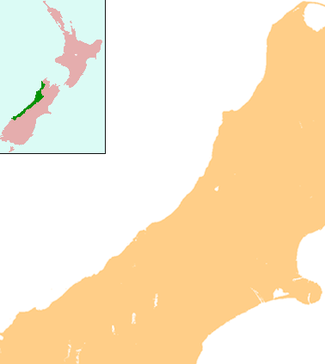
| Country | New Zealand |
| Region | West Coast |
| District | Buller District |
Mōkihinui is a lightly populated locality[1] on the West Coast of New Zealand's South Island.
Mōkihinui is on the Tasman Sea coastline north of Westport and is on the southern side of the Mokihinui River's mouth, the third largest river on the West Coast.[2] Mōkihinui is situated between the sea and the foothills of the Glasgow Range and State Highway 67 passes through Mokihinui just before reaching its northern end on the other side of the river. Statistics New Zealand includes Mokihinui in a statistical area of the same name that covers both the locality itself and its neighbours such as Seddonville and Summerlea. This statistical area had a population of 162 at the 2001 New Zealand Census of Population and Dwellings, a decrease of 60.8% or 72 people since the 1996 census.[3] Mokihinui's population increases during whitebait season, when visitors come to fish in the Mokihinui River's mouth.[4]
In the early 1890s, a branch line railway from Westport was opened to Mokihinui; it ultimately ran through to Seddonville and was known as the Seddonville Branch. Passengers were carried on mixed trains until trains became freight-only on 14 October 1946. The line continued to operate until the end of the 1970s, when the coal mining activity that provided almost the sole freight on the line declined to such a point that revenue was lower than maintenance costs. The railway closed north of Ngakawau on 3 May 1981 and traces of its formation can be seen in the countryside around Mokihinui.[5]
References
- ↑ "Place Name Detail: Mōkihinui". New Zealand Geographic Placenames Database. Land Information New Zealand. Retrieved 24 June 2007.
- ↑ "Save the Mokihinui: Keep it in a Park". Royal Forest and Bird Protection Society of New Zealand. Retrieved 31 October 2015.
- ↑ Statistics New Zealand, Mōkihinui Community Profile, accessed 24 June 2007.
- ↑ Tourism West Coast, "Mokihinui / Seddonville", accessed 24 June 2007.
- ↑ David Leitch and Brian Scott, Exploring New Zealand's Ghost Railways, rev. ed. (Wellington: Grantham House, 1998), 52-4.
Coordinates: 41°31′S 171°56′E / 41.517°S 171.933°E