Lnáře
| Lnáře | |||
| Schlüsselburg | |||
| village | |||
.JPG) | |||
|
|||
| Country | Czech Republic | ||
|---|---|---|---|
| Region | South Bohemian | ||
| District | Strakonice | ||
| Commune | Blatná | ||
| Municipality | Lnáře | ||
| Elevation | 565 m (1,854 ft) | ||
| Coordinates | CZ 49°27′29″N 13°47′16″E / 49.45806°N 13.78778°ECoordinates: CZ 49°27′29″N 13°47′16″E / 49.45806°N 13.78778°E | ||
| Highest point | |||
| - elevation | 577 m (1,893 ft) | ||
| Lowest point | |||
| - elevation | 465 m (1,526 ft) | ||
| Area | 12.51 km2 (4.83 sq mi) | ||
| Population | 734 (2009-28-02) | ||
| Density | 59/km2 (153/sq mi) | ||
| First mentioned | 1318 | ||
| Mayor | Lady Stanislava Mašková | ||
| Timezone | CET (UTC+1) | ||
| - summer (DST) | CEST (UTC+2) | ||
| Postal code | 387 42 | ||
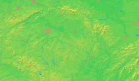  Location in the Czech Republic | |||
| Wikimedia Commons: Lnáře | |||
| Statistics: statnisprava.cz | |||
| Website: www.lnare-obec.cz | |||


Lnáře (German: Schlüsselburg, in English Lnar ) is a small municipality in the Czech Republic located 35 kilometres (22 mi) northwest of Pisek city or 50 kilometres (31 mi) southeast of Pilsen. It is situated on the shores of three ponds within municipal borders in the northwest corner of the formerly autonomous Prachens Region, today in the Strakonice District. The name of municipality is from the Slavic word len ("flix") and combined with a suffix which gives a meaning of "flix-makers" or "flix producers". The German name is in remembrance of a different fact – Schlüssel means "key" and Burg means "stronghold": in the ancient history a golden key was found by plougher in the building site of local New Castle.
History
The municipality is the former centre of a vast agrary husbandry including two small towns and about 50 villages in its proximity (only the small settlement Zahorčice is still administered by Lnáře). Such was the situation between the mid-15th century and the mid-19th century. After this period of relative prosperity (with a few pauses incurred by civil convulsions) emerged an era of nationwide population decline in all counties in Central Europe (with exceptions in entirely undeveloped mountainous counties in the Carpathian Mountains system etc.), and the local population significantly decreased to the current number of fewer than 750 people.
Municipality have got traces of human settlement since 7-6 c. BC. As proof are left burying-grounds with remains of funeral equipment on the shores of pond Měleč (read Myeletsh) close to the municipality. Although continually inhabited, some influx of Slavs also occurred in the 8th century. Since 10th-13th century, the settlement is denser and small stronghold from wood was built. The oldest mention of Lnáře or Schlüsselburg dates back to 1319, when it was referenced to the local Old Chateau (former wooden stronghold) as the site of the landlord of Lnáře district (later Knights of Lnáře). Lnáře was a village drowned in sea of woods on the shores of muddy streams in moorland. This moorland was (as in case of town Třeboň) very soon turned into a basin with dozens of ponds and lakes, later numbering almost four hundred. After 17th century some decline in fishing industry occurred and many ponds and lakes were dried up with these lots have been used for pasture for sheep. As of 1840 there were 13,000 sheep. New kinds of unscaly carp were cultivated in the 19th century by Theodor Mokrý (his activity brought revival of local fishing industry), with the name Lnářský modrák ("Blue carp of Lnáře").
A train line was built between the towns of Blatná and Nepomuk near the start of the 20th century leading near Lnáře municipality, which is still in use. The construction of the European route E49 through Lnáře was also beneficial for the local population.
Lnáře today
Lnáře has two chateaux: the Old Chateau and the New Chateau. The Old Chateau is 690 years old, while the New Chateau is only about 340 years old. Between them is an English garden (4 ha²) with a few pools, many flower-beds of roses, a fountain, a small baroque mosque with two low minarets and beautiful old trees with sculptures of the ancients gods carved by a famous baroque sculptor. The New Chateau is adorned with great paintings of dozens Greek gods. In its Big Hall was signed the treaty for the Dissolution of Czechoslovakia. The Old Chateau is used for municipality needs, including as a gallery and bibliotheca, as well as leasing space for doctors and masseuses and flats for rent.
Lnáře is divided into five quarters: Mala Strana (Lesser Part), Svata Anna (Saint Anna), Pristav (the harbour), Zamky (chateaux) and Centrum (the Centre). Saint Anna, with the Monastery of the shoeless Augustinians and church, dates back to the 18th century. Today these buildings are used for government purposes, mainly as an insane asylum, but it will stop its activity in time. Aside from this, Lnáře has three more places for prayers – the Chapel of Adventist Church in the New Chateau, the Catholic Church by the graveyard and the Chapel of Hussite Church in the centre of municipality.
A new development is the dense system of tourism cycle-ways with rest places. These cycle-ways are created for all kinds of people, allowing them to visit all the landmarks of the unique local landscape.
| Wikimedia Commons has media related to Lnáře. |