Llantwit Fardre railway station
| Llantwit Fardre | |
|---|---|
| Location | |
| Place | Llantwit Fardre |
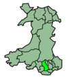
| Area | Rhondda Cynon Taf |
| Coordinates | 51°33′31″N 3°19′56″W / 51.5586°N 3.3321°WCoordinates: 51°33′31″N 3°19′56″W / 51.5586°N 3.3321°W |
| Grid reference | ST077852 |
| Operations | |
| Original company | Llantrisant and Taff Vale Junction Railway |
| Pre-grouping | Taff Vale Railway |
| Post-grouping | Great Western Railway |
| Platforms | 1 |
| History | |
| 21 January 1875 | Station opened as Llantwit |
| 8 October 1936 | Renamed Llantwit Fardre |
| 31 March 1952 | Station closed |
| Disused railway stations in the United Kingdom | |
|
Closed railway stations in Britain A B C D–F G H–J K–L M–O P–R S T–V W–Z | |
|
| |
Llantwit Fardre was a station on the Llantrisant and Taff Vale Junction Railway.[1]
The station consisted of a single platform and station buildings. A small bridge crossed over Crown Hill to the west of the station followed by the Dyffryn Red Ash Colliery sidings and a spur to Cwm Colliery. There were numerous tramways for coal workings in this area. One of the sidings consisted of a weigh bridge. To the west of the station existed sidings for the Dyffryn Red Ash Colliery.
Modern Day
No trace of the railway station and track exist anymore. The railway bridge to the west on Crown Hill of the station was removed in the 1990s. The Dyffryn Red Ash Colliery sidings have now been built upon and no traces of the tramways exist.
References
- ↑ Chapman, C (1996) The Llantrisant Branches of the Taff Vale Railway. The Oakwood Press. ISBN 0-85361-481-4
External links
| Preceding station | Disused railways | Following station | ||
|---|---|---|---|---|
| Church Village Line and station closed |
Llantrisant and Taff Vale Junction Railway Pontypridd-Llantrisant |
Beddau Halt Line and station closed | ||
This article is issued from Wikipedia - version of the 3/6/2015. The text is available under the Creative Commons Attribution/Share Alike but additional terms may apply for the media files.