A468 road
| |
|---|---|
| Route information | |
| Length: | 11.9 mi[1] (19.2 km) |
| Major junctions | |
| east end: |
51°34′33″N 3°02′37″W / 51.5759°N 3.0435°W |
|
| |
| west end: |
51°33′34″N 3°16′06″W / 51.5595°N 3.2683°W |
| Location | |
| Primary destinations: | Newport, Wales |
| Road network | |

The A468 is a principal road from Newport to Nantgarw. The current route begins at the A467 in Bassaleg then passes through Rhiwderin, Machen, Trethomas, Bedwas and Caerphilly, terminating on the A470.
History
Originally the A468 began at the Handpost Pub on the junction with the former A467 (reclassified to B4240) and proceeded west along Bassaleg Road, passing under a pair of stone arch bridges carrying the Ebbw Valley Railway and the Brecon and Merthyr Railway before reaching the current starting point.[2]
References
- ↑ "Driving directions to Caerphilly Rd/A468". Google Maps. Google. Retrieved 28 May 2014.
- ↑ "A468". The Society for All British and Irish Road Enthusiasts. Retrieved 28 May 2014.
Transport in Caerphilly County Borough | ||
|---|---|---|
| Road | 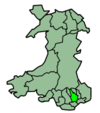 | |
| Bus |
| |
| Railway lines | ||
| Railway stations | ||
| Cycle | ||
| Walk | ||
| Waterways | ||


Coordinates: 51°35′27″N 3°07′38″W / 51.59077°N 3.12724°W
This article is issued from Wikipedia - version of the 1/22/2015. The text is available under the Creative Commons Attribution/Share Alike but additional terms may apply for the media files.