Llanada, California
| Llanada, California | |
|---|---|
| Populated place | |
 Llanada, California | |
| Coordinates: 36°36′33″N 120°55′00″W / 36.60917°N 120.91667°WCoordinates: 36°36′33″N 120°55′00″W / 36.60917°N 120.91667°W | |
| Country | United States |
| State | California |
| County | San Benito |
| Elevation | 1,417 ft (432 m) |
| Time zone | Pacific (PST) (UTC-8) |
| • Summer (DST) | PDT (UTC-7) |
| GNIS feature ID | 252726[1] |
Llanada, (meaning plain, or tract of level ground in Spanish),[2] is a populated place in San Benito County, California. It is located 5 miles west of Panoche, California along County Highway J1.
References
Municipalities and communities of San Benito County, California, United States | ||
|---|---|---|
| Cities | 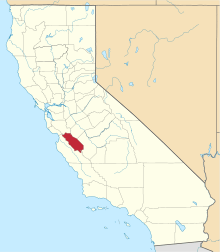 | |
| CDPs | ||
| Unincorporated communities | ||
| Ghost town | ||
| Footnotes | ‡This populated place also has portions in an adjacent county or counties | |
This article is issued from Wikipedia - version of the 11/6/2013. The text is available under the Creative Commons Attribution/Share Alike but additional terms may apply for the media files.