Livingston (Staten Island Railway station)
| Livingston | |||||||||||
|---|---|---|---|---|---|---|---|---|---|---|---|
| Former Staten Island Railway rapid transit station | |||||||||||
|
Western part of station site | |||||||||||
| Station statistics | |||||||||||
| Borough | Staten Island | ||||||||||
| Locale | Livingston | ||||||||||
| Coordinates | 40°38′44″N 74°06′32″W / 40.64545°N 74.1088°WCoordinates: 40°38′44″N 74°06′32″W / 40.64545°N 74.1088°W | ||||||||||
| Line | SIR North Shore Branch | ||||||||||
| Services | none | ||||||||||
| Platforms | 2 side platforms | ||||||||||
| Tracks | 2 | ||||||||||
| Other information | |||||||||||
| Opened | February 23, 1886[1] | ||||||||||
| Closed | March 31, 1953 | ||||||||||
| Former/other names | Livingston Street[2] | ||||||||||
| Station succession | |||||||||||
| |||||||||||

Livingston is a former station on the abandoned North Shore Branch of the Staten Island Railway.[3] Located north of Richmond Terrace at Bard Avenue in the Livingston section of Staten Island, it had two tracks and two side platforms.[3] The site is 1.8 miles (2.9 km) from the Saint George terminal.[4] Closed in 1953, the station was demolished, with few remnants of the site today.[5][6]
History

The station opened on February 23, 1886 along with the other North Shore stations from St. George west to Elm Park.[7] It sits on land formerly occupied by the mansion of Livingston namesake Anson Livingston, also known as the "Bleak House," which was purchased by the North Shore Railroad in 1886. The town name "Livingston" was coined by SIRT officials.[1][8][9][10] The station was located on a wooden trestle on the shore of the Kill Van Kull on the edge of the island, built with two wooden high-level side platforms.[5][9][11][12][13] The former mansion was used as the stationhouse, with an overpass between the platforms on the west end of the station.[9] Industrial buildings were located adjacent to the station, including a power plant of the Richmond Light and Railroad Company, which operated a streetcar line along Richmond Terrace parallel to the SIRT until 1934.[11][14][15][16]
The station was abandoned on March 31, 1953, along with the South Beach Branch and the rest of the North Shore Branch.[7][11] Currently, the station site is occupied by an employee parking lot for the Con Edison facility located across the street.[6][8][17] Just east of the site is a restaurant, R.H. Tugs, which sits adjacent to the tracks.[18] The restaurant closed in August 2011 after 25 years of operation, reopening as Blue Restaurant.[8][19][20] The northern of the line's two tracks has been taken up, and due to coastal erosion of the line's retaining wall, part of the trestle has slid into the Kill Van Kull along with some of the trackage east and west of here.[5][13] Livingston is one of the stations to be returned to operation under the proposals for reactivation of the North Shore branch for rapid transit, light rail, or bus rapid transit service. Under the proposal, the right-of-way would be moved from the coastline to the parking lot site.[5][6][12]
References
- 1 2 "Walker Park: History". New York City Department of Parks and Recreation. Retrieved 2009-07-13.
- ↑ "STATEN ISLAND TRAINS GET A FLORAL GOOD BY". The New York Times. April 1, 1953. Retrieved 6 August 2015.
- 1 2 Darlington, Peggy. "North Shore Line". Retrieved 2009-07-13.
- ↑ Office of Diane J. Savino (2013). "State Senator Diane J. Savino's 2013 Staten Island Railway Rider Report" (PDF). nysenate.gov. New York State Senate. Retrieved 31 July 2015.
- 1 2 3 4 "North Shore Alternatives Analysis: Rail Alignment Drawings Arlington-St. George" (PDF). mta.info. Metropolitan Transportation Authority. September 2010. Retrieved 20 July 2015.
- 1 2 3 "NYCT NORTH SHORE ALTERNATIVES ANALYSIS: Alternatives Analysis Report" (PDF). mta.info. Metropolitan Transportation Authority. August 2012. Retrieved 20 July 2015.
- 1 2 Leigh, Irvin; Matus, Paul (January 2002). "State Island Rapid Transit: The Essential History". thethirdrail.net. The Third Rail Online. Retrieved 27 June 2015.
- 1 2 3 Fioravante, Janice (November 24, 2002). "If You're Thinking of Living In/Livingston, Staten Island; Filmgoers May Find the Streets Familiar". The New York Times. Retrieved 2009-07-14.
- 1 2 3 Farinacci, Amanda (April 15, 2015). "Railroads Above & Below Ground Make Up History of Livingston". ny1.com. NY1. Retrieved 31 July 2015.
- ↑ "Old Town Names". statenislandhistory.com. Retrieved 31 July 2015.
- 1 2 3 Pitanza, Marc (2015). Staten Island Rapid Transit Images of Rail. Arcadia Pubishing. ISBN 978-1-4671-2338-9.
- 1 2 "North Shore Alternatives Analysis: Public Meeting THURSDAY, APRIL 22, 2010 7:00 p.m." (PDF). zetlin.com. Metropolitan Transportation Authority. April 22, 2010. Retrieved 31 July 2015.
- 1 2 Minn, Michael (December 18, 2009). "History and Future of the North Shore Rail Line on Staten Island" (PDF). michaelminn.net. Retrieved 1 August 2015.
- ↑ "Asks City to Seize Staten Island Cars and Lighting Plant". nytimes.com. The New York Times. April 29, 1920. Retrieved 31 July 2015.
- ↑ Electric Railway Journal. McGraw Hill Publishing Company. 1916. p. 1114. Retrieved 31 July 2015.
- ↑ Transit Journal ... McGraw-Hill Publishing Company, Incorporated. 1915. p. 133. Retrieved 31 July 2015.
- ↑ "Feasibility Study of the North Shore Railroad Right-of-Way Project Assessment Report March 2004" (PDF). library.wagner.edu. Office of the Staten Island Borough President, Port Authority of New York and New Jersey, URS, SYSTRA,. March 2004. Retrieved 6 August 2015.
- ↑ McIntosh, Elise G. (August 15, 2009). "Bloomberg optimistic about North Shore rail". silive.com. Staten Island Advance. Retrieved 31 July 2015.
- ↑ Silvestri, Pamela (April 26, 2012). "Staten Island refresher course". silive.com. Staten Island Advance. Retrieved 31 July 2015.
- ↑ Silvestri, Pamela (June 2, 2014). "Restaurant review: With that harbor view, Staten Island's Blue is a winning spot to dine (photos)". silive.com. Staten Island Advance. Retrieved 31 July 2015.
| Lines | 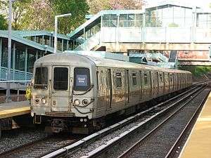 | ||||||||||
|---|---|---|---|---|---|---|---|---|---|---|---|
| Stations |
| ||||||||||
| Infrastructure |
| ||||||||||
| Rolling Stock | |||||||||||
| Other | |||||||||||