Little Shawmere River
| Little Shawmere River | |
| River | |
| Country | Canada |
|---|---|
| Province | Ontario |
| Region | Northeastern Ontario |
| District | Sudbury |
| Part of | James Bay drainage basin |
| Source | Murdock Lake |
| - location | Murdock Township |
| - elevation | 388 m (1,273 ft) |
| - coordinates | 48°06′04″N 82°55′12″W / 48.10111°N 82.92000°W |
| Mouth | Shawmere River |
| - location | Paul Township |
| - elevation | 366 m (1,201 ft) |
| - coordinates | 48°08′38″N 82°51′39″W / 48.14389°N 82.86083°WCoordinates: 48°08′38″N 82°51′39″W / 48.14389°N 82.86083°W |
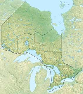 Location of the mouth of the Little Shawmere River in Ontario | |
The Little Shawmere River is a river in Sudbury District in northeastern Ontario, Canada.[1] It is in the James Bay drainage basin, and is a left tributary of the Shawmere River.
The river flows from Murdock Lake in geographic Murdock Township[2] and flows northeast into geographic Paul Township[3] to its mouth at the Shawmere River. The Shawmere River flows via the Ivanhoe River, the Groundhog River, the Mattagami River and the Moose River to James Bay.
References
- ↑ "Little Shawmere River". Geographical Names Data Base. Natural Resources Canada. Retrieved 2016-11-12.
- ↑ "Murdock" (PDF). Geology Ontario - Historic Claim Maps. Ontario Ministry of Northern Development, Mines and Forestry. Retrieved 2016-11-12.
- ↑ "Paul" (PDF). Geology Ontario - Historic Claim Maps. Ontario Ministry of Northern Development, Mines and Forestry. Retrieved 2016-11-12.
Other map sources:
- Map 14 (PDF) (Map). 1 : 1,600,000. Official road map of Ontario. Ministry of Transportation of Ontario. 2010-01-01. Retrieved 2016-11-12.
- Restructured municipalities - Ontario map #3 (Map). Restructuring Maps of Ontario. Ontario Ministry of Municipal Affairs and Housing. 2006. Retrieved 2016-11-12.
This article is issued from Wikipedia - version of the 11/12/2016. The text is available under the Creative Commons Attribution/Share Alike but additional terms may apply for the media files.