| Lighthouse |
Image |
Location
coordinates |
County |
Year built |
Tower height |
Focal height |
Range |
Notes |
| Anvil Point |  | Anvil Point
50°35′31″N 1°57′36″W / 50.5919°N 1.9600°W / 50.5919; -1.9600 (Anvil Point Lighthouse) | Dorset | 1881 | 12 m (39 ft) | 45 m (148 ft) | 9 nmi (17 km) | Trinity House |
| Bamburgh |  | Bamburgh
55°37′00″N 1°43′27″W / 55.6166°N 1.7242°W / 55.6166; -1.7242 (Bamburgh lighthouse) | Northumberland | 1910 | 9 m (30 ft) | 12 m (39 ft) | 12 nmi (22 km) | Trinity House |
| Beachy Head |  | Beachy Head
50°44′01″N 0°14′29″E / 50.7337°N 0.2414°E / 50.7337; 0.2414 (Beachy Head Lighthouse) | East Sussex | 1902 | 43 m (141 ft) | 31 m (102 ft) | 8 nmi (15 km) | Trinity House |
| Belle Tout |  | Beachy Head
50°44′18″N 0°12′52″E / 50.7382°N 0.2145°E / 50.7382; 0.2145 (Belle Tout lighthouse) | East Sussex | 1834 | 14 m (46 ft) | 87 m (285 ft) | Inactive | Decommissioned in 1902 - replaced by Beachy Head |
| Berkeley Pill Front |  | Severn Estuary
51°41′59″N 2°29′24″W / 51.6998°N 2.4901°W / 51.6998; -2.4901 (Berkeley Pill Front) | Gloucestershire | 1937 | 8 m (26 ft) | 5 m (16 ft) | Unknown | |
| Berkeley Pill Rear |  | Severn Estuary
51°41′54″N 2°29′25″W / 51.6982°N 2.4904°W / 51.6982; -2.4904 (Berkeley Pill Rear) | Gloucestershire | 1937 | 12 m (39 ft) | 11 m (36 ft) | Unknown | |
| Berry Head |  | Berry Head
50°23′58″N 3°29′00″W / 50.3994°N 3.4834°W / 50.3994; -3.4834 (Berry Head Lighthouse) | Devon | 1906 | 5 m (16 ft) | 58 m (190 ft) | 19 nmi (35 km) | Trinity House |
| Berwick |  | Berwick-upon-Tweed
55°45′53″N 1°59′03″W / 55.7648°N 1.9842°W / 55.7648; -1.9842 (Berwick Lighthouse) | Northumberland | 1826 | 13 m (43 ft) | 15 m (49 ft) | 6 nmi (11 km) | |
| Bidston |  | Bidston Hill
53°23′49″N 3°04′30″W / 53.3970°N 3.0750°W / 53.3970; -3.0750 (Bidston Lighthouse) | Merseyside | 1873 | 21 m (69 ft) | Unknown | Inactive | |
| Bishop Rock |  | Bishop Rock
49°52′22″N 6°26′45″W / 49.8729°N 6.4458°W / 49.8729; -6.4458 (Bishop Rock Lighthouse) | Isles of Scilly | 1851 | 49 m (161 ft) | 44 m (144 ft) | 24 nmi (44 km) | Trinity House |
| Black Nore |  | Portishead
51°29′05″N 2°47′59″W / 51.4847°N 2.7997°W / 51.4847; -2.7997 (Black Nore lighthouse, Portishead) | Somerset | 1894 | 11 m (36 ft) | Unknown | Inactive | |
| Blyth High |  | Blyth
55°07′32″N 1°29′58″W / 55.1256°N 1.4994°W / 55.1256; -1.4994 (Blyth High Light) | Northumberland | 1788 | 19 m (62 ft) | Unknown | Inactive | |
| Bow Creek |  | Trinity Buoy Wharf
51°30′28″N 0°00′30″E / 51.5077°N 0.0083°E / 51.5077; 0.0083 (Bow Creek Lighthouse) | Greater London | 1863 | Unknown | Unknown | Inactive | Formerly used for lighting trials for Trinity House. |
| Brownsman Island |  | Farne Islands
55°38′03″N 1°37′32″W / 55.6341°N 1.6255°W / 55.6341; -1.6255 (Brownsman Island) | Northumberland | 1811 | 12 m (39 ft) | Unknown | Inactive | |
| Bull Point |  | Mortehoe
51°11′57″N 4°12′04″W / 51.1992°N 4.2011°W / 51.1992; -4.2011 (Bull Point Lighthouse) | Devon | 1879 | 11 m (36 ft) | 54 m (177 ft) | 24 nmi (44 km) | Trinity House |
| Burnham-on-Sea High |  | Burnham-on-Sea
51°14′54″N 3°00′21″W / 51.2483°N 3.0058°W / 51.2483; -3.0058 (Burnham-on-Sea High (Pillar Lighthouse)) | Somerset | 1832 | 30 m (98 ft) | Unknown | Inactive | |
| Burnham-on-Sea Low |  | Burnham-on-Sea
51°14′54″N 3°00′21″W / 51.2483°N 3.0058°W / 51.2483; -3.0058 (Burnham-on-Sea Low) | Somerset | 1832 | 11 m (36 ft) | 7 m (23 ft) | 12 nmi (22 km) | |
| Burnham-on-Sea Round Tower |  | Burnham-on-Sea
51°14′23″N 2°59′54″W / 51.2397°N 2.9983°W / 51.2397; -2.9983 (Burnham-on-Sea Round Tower) | Somerset | 1801 | Unknown | Unknown | Inactive | |
| Chapel Rock |  | Severn Estuary
51°36′26″N 2°39′12″W / 51.6071°N 2.6534°W / 51.6071; -2.6534 (Chapel rock) | Gloucestershire | 1907 | 8 m (26 ft) | 6 m (20 ft) | 8 nmi (15 km) | |
| Coquet Island |  | Coquet Island
55°20′02″N 1°32′23″W / 55.3339°N 1.5397°W / 55.3339; -1.5397 (Coquet Island Lighthouse) | Northumberland | 1841 | 22 m (72 ft) | 25 m (82 ft) | 19 nmi (35 km) | Trinity House |
| Cromer |  | Cromer
52°55′29″N 1°18′59″E / 52.9247°N 1.3165°E / 52.9247; 1.3165 (Cromer Lighthouse) | Norfolk | 1833 | 18 m (59 ft) | 84 m (276 ft) | 21 nmi (39 km) | Trinity House |
| Crow Point |  | Braunton Burrows
51°03′58″N 4°11′23″W / 51.0661°N 4.1897°W / 51.0661; -4.1897 (Crow Point Lighthouse) | Devon | 1954 | 5 m (16 ft) | 8 m (26 ft) | 6 nmi (11 km) | Minor structure categorized as a lighthouse by Trinity House |
| Dovercourt High |  | Dovercourt
51°55′49″N 1°16′31″E / 51.9304°N 1.2753°E / 51.9304; 1.2753 (Dovercourt High) | Essex | 1863 | 14 m (46 ft) | Unknown | Inactive | |
| Dovercourt Low |  | Dovercourt
51°55′48″N 1°16′41″E / 51.9301°N 1.2781°E / 51.9301; 1.2781 (Dovercourt Low) | Essex | 1863 | 8 m (26 ft) | Unknown | Inactive | |
| Dungeness |  | Dungeness
50°54′50″N 0°58′11″E / 50.9138°N 0.9697°E / 50.9138; 0.9697 (Dungeness 1904) | Kent | 1904 | 44 m (144 ft) | Unknown | Inactive | |
| Dungeness |  | Dungeness
50°54′48″N 0°58′34″E / 50.9133°N 0.9761°E / 50.9133; 0.9761 (Dungeness 1961) | Kent | 1961 | 43 m (141 ft) | 40 m (131 ft) | 21 nmi (39 km) | Trinity House |
| Eddystone |  | Eddystone Rocks
50°10′48″N 4°15′54″W / 50.1800°N 4.2650°W / 50.1800; -4.2650 (Eddystone Lighthouse) | Devon | 1882 | 49 m (161 ft) | 41 m (135 ft) | 17 nmi (31 km) | Trinity House |
| Farne |  | Farne Islands
55°36′55″N 1°39′21″W / 55.6153°N 1.6558°W / 55.6153; -1.6558 (Farne Lighthouse) | Northumberland | 1811 | 13 m (43 ft) | 27 m (89 ft) | 10 nmi (19 km) | Trinity House |
| Fish Quay High |  | North Shields
55°00′31″N 1°26′16″W / 55.0086°N 1.4378°W / 55.0086; -1.4378 (Fish Quay High) | Tyne and Wear | 1807 | 18 m (59 ft) | 42 m (138 ft) | Inactive | |
| Fish Quay Low |  | North Shields
55°00′33″N 1°26′04″W / 55.0091°N 1.4344°W / 55.0091; -1.4344 (Fish Quay Low) | Tyne and Wear | 1807 | 26 m (85 ft) | 25 m (82 ft) | Inactive | |
| Fish Quay Old High |  | North Shields
55°00′34″N 1°26′12″W / 55.0094°N 1.4368°W / 55.0094; -1.4368 (Fish Quay Old High) | Tyne and Wear | 1727 | Unknown | Unknown | Inactive | |
| Fish Quay Old Low |  | North Shields
55°00′35″N 1°26′00″W / 55.0098°N 1.4334°W / 55.0098; -1.4334 (Fish Quay Old Low) | Tyne and Wear | 1727 | Unknown | Unknown | Inactive | |
| Flamborough Head |  | Flamborough Head
54°06′59″N 0°04′58″W / 54.1164°N 0.0828°W / 54.1164; -0.0828 (Flamborough Head Lighthouse) | East Yorkshire | 1806 | 27 m (89 ft) | 65 m (213 ft) | 24 nmi (44 km) | Trinity House |
| Fleetwood High |  | Fleetwood
53°55′35″N 3°00′27″W / 53.9265°N 3.0075°W / 53.9265; -3.0075 (Pharos Lighthouse (Fleetwood)) | Lancashire | 1840 | 27 m (89 ft) | 28 m (92 ft) | 9 nmi (17 km) | |
| Fleetwood Low |  | Fleetwood
53°55′43″N 3°00′33″W / 53.9286°N 3.0091°W / 53.9286; -3.0091 (Beach Lighthouse (Fleetwood)) | Lancashire | 1840 | 13 m (43 ft) | 14 m (46 ft) | 9 nmi (17 km) | |
| Godrevy |  | St Ives
50°14′33″N 5°24′01″W / 50.2425°N 5.4003°W / 50.2425; -5.4003 (Godrevy Lighthouse) | Cornwall | 1859 | 26 m (85 ft) | 37 m (121 ft) | Inactive | Still listed by Trinity House, but light now mounted separately |
| Gorleston (Range Rear) |  | Gorleston
52°34′20″N 1°43′56″E / 52.5721°N 1.7323°E / 52.5721; 1.7323 (Gorleston (Range Rear) Lighthouse) | Norfolk | 1878 | 21 m (69 ft) | 20 m (66 ft) | Inactive | Inactive since 2007 |
| Gorleston South Pier |  | Gorleston
52°34′20″N 1°44′17″E / 52.5721°N 1.7380°E / 52.5721; 1.7380 (Gorleston South Pier) | Norfolk | 1955 | 8 m (26 ft) | 11 m (36 ft) | 11 nmi (20 km) | |
| Guile Point |  | Lindisfarne
55°40′00″N 1°48′00″W / 55.6667°N 1.8000°W / 55.6667; -1.8000 (Guile Point) | Northumberland | 1859 | 21 m (69 ft) | 9 m (30 ft) | 4 nmi (7 km) | Minor structures, but categorized as lighthouses by Trinity House |
| Gunfleet |  | Frinton-on-Sea
51°46′45″N 1°21′27″E / 51.7792°N 1.3575°E / 51.7792; 1.3575 (Gunfleet Lighthouse) | Essex | 1850 | 23 m (75 ft) | Unknown | Inactive | Inactive since 1921 |
| Hale Head |  | Hale
53°19′21″N 2°47′39″W / 53.3225°N 2.7943°W / 53.3225; -2.7943 (Hale Head lighthouse) | Cheshire | 1906 | 18 m (59 ft) | Unknown | Inactive | |
| Happisburgh |  | Happisburgh
52°49′10″N 1°32′19″E / 52.8195°N 1.5387°E / 52.8195; 1.5387 (Happisburgh Lighthouse) | Norfolk | 1791 | 26 m (85 ft) | 41 m (135 ft) | 14 nmi (26 km) | |
| Hartland Point | .jpg) | Hartland Point
51°01′03″N 4°31′04″W / 51.0175°N 4.5178°W / 51.0175; -4.5178 (Hartland Point Lighthouse) | Devon | 1874 | 18 m (59 ft) | 37 m (121 ft) | Inactive | Trinity House |
| Harwich High |  | Harwich
51°56′40″N 1°17′19″E / 51.9444°N 1.2885°E / 51.9444; 1.2885 (Harwich High) | Essex | 1818 | 21 m (69 ft) | Unknown | Inactive | |
| Harwich Low |  | Harwich
51°56′36″N 1°17′27″E / 51.9434°N 1.2909°E / 51.9434; 1.2909 (Harwich Low) | Essex | 1818 | 9 m (30 ft) | Unknown | Inactive | |
| Hunstanton |  | Hunstanton
52°56′59″N 0°29′37″E / 52.9496°N 0.4936°E / 52.9496; 0.4936 (Hunstanton Lighthouse) | Norfolk | 1840 | 19 m (62 ft) | Unknown | Inactive | |
| Herd Groyne |  | South Shields
55°00′28″N 1°25′27″W / 55.0079°N 1.4241°W / 55.0079; -1.4241 (Herd Groyne) | Tyne and Wear | 1882 | 15 m (49 ft) | 15 m (49 ft) | 19 nmi (35 km) | |
| Heugh Hill |  | Lindisfarne
55°40′00″N 1°48′00″W / 55.6667°N 1.8000°W / 55.6667; -1.8000 (Heugh Hill, Lindisfarne) | Northumberland | Unknown | 8 m (26 ft) | 24 m (79 ft) | 5 nmi (9 km) | Trinity House |
| Hilbre Island |  | Hilbre Island
53°23′00″N 3°13′43″W / 53.3833°N 3.2286°W / 53.3833; -3.2286 (Hilbre Island) | Merseyside | 1927 | 3 m (10 ft) | 14 m (46 ft) | 5 nmi (9 km) | Minor structure categorized as a lighthouse by Trinity House |
| Hodbarrow |  | Millom
54°11′38″N 3°15′30″W / 54.1940°N 3.2583°W / 54.1940; -3.2583 (Hodbarrow) | Cumbria | 1866 | 18 m (59 ft) | Unknown | Inactive | |
| Hodbarrow Haverigg |  | Haverigg
54°11′25″N 3°16′03″W / 54.1904°N 3.2675°W / 54.1904; -3.2675 (Hodbarrow (Haverigg)) | Cumbria | 1905 | 9 m (30 ft) | 12 m (39 ft) | Unknown | |
| Hoylake Upper |  | Hoylake
53°23′41″N 3°10′50″W / 53.3947°N 3.1806°W / 53.3947; -3.1806 (Hoylake Upper) | Merseyside | 1865 | 17 m (56 ft) | Unknown | Inactive | |
| Hurst Point |  | Hurst Castle
50°42′29″N 1°33′01″W / 50.7081°N 1.5503°W / 50.7081; -1.5503 (Hurst Point Lighthouse) | Hampshire | 1867 | 26 m (85 ft) | 23 m (75 ft) | 13 nmi (24 km) | Trinity House |
| Ilfracombe |  | Ilfracombe
51°12′04″N 4°06′48″W / 51.2010°N 4.1133°W / 51.2010; -4.1133 (Ilfracombe light (St Nicholas Chapel)) | Devon | 1819 | 11 m (36 ft) | 39 m (128 ft) | 6 nmi (11 km) | |
| Killingholme High |  | South Killingholme
53°38′50″N 0°13′08″W / 53.6472°N 0.2188°W / 53.6472; -0.2188 (Killingholme High Light,) | Lincolnshire | 1876 | 24 m (79 ft) | 21 m (69 ft) | 3 nmi (6 km) | |
| Killingholme North Low |  | South Killingholme
53°38′57″N 0°13′11″W / 53.6493°N 0.2197°W / 53.6493; -0.2197 (Killingholme North Low) | Lincolnshire | 1851 | 14 m (46 ft) | Unknown | Inactive | |
| Killingholme South Low |  | South Killingholme
53°38′48″N 0°12′58″W / 53.6466°N 0.2162°W / 53.6466; -0.2162 (Killingholme South Low) | Lincolnshire | 1836 | 14 m (46 ft) | 10 m (33 ft) | 14 nmi (26 km) | |
| Leasowe | -by-Sue-Adair.jpg) | Leasowe
53°24′49″N 3°07′34″W / 53.4136°N 3.1261°W / 53.4136; -3.1261 (Leasowe Lighthouse) | Merseyside | 1763 | 33 m (108 ft) | Unknown | Inactive | |
| Lizard |  | Lizard Point
49°57′36″N 5°12′06″W / 49.9600°N 5.2017°W / 49.9600; -5.2017 (Lizard Lighthouse) | Cornwall | 1751 | 19 m (62 ft) | 70 m (230 ft) | 26 nmi (48 km) | Trinity House |
| Longships |  | Longships
50°04′01″N 5°44′49″W / 50.0669°N 5.7469°W / 50.0669; -5.7469 (Longships Lighthouse) | Cornwall | 1875 | 35 m (115 ft) | 35 m (115 ft) | 15 nmi (28 km) | Trinity House |
| Longstone |  | Farne Islands
55°38′38″N 1°36′35″W / 55.6438°N 1.6097°W / 55.6438; -1.6097 (Longstone Lighthouse) | Northumberland | 1826 | 26 m (85 ft) | 23 m (75 ft) | 24 nmi (44 km) | Trinity House |
| Lowestoft |  | Lowestoft
52°29′13″N 1°45′21″E / 52.4869°N 1.7558°E / 52.4869; 1.7558 (Lowestoft) | Suffolk | 1874 | 16 m (52 ft) | 37 m (121 ft) | 23 nmi (43 km) | Trinity House |
| Lundy Island (Old Light) |  | Lundy
51°11′00″N 4°40′00″W / 51.1833°N 4.6667°W / 51.1833; -4.6667 (Lundy Island (Old Light)) | Devon | 1820 | 29 m (95 ft) | 164 m (538 ft) | Inactive | |
| Lundy Island North | .jpg) | Lundy
51°11′00″N 4°40′00″W / 51.1833°N 4.6667°W / 51.1833; -4.6667 (Lundy Island North) | Devon | 1897 | 17 m (56 ft) | 48 m (157 ft) | 17 nmi (31 km) | Trinity House |
| Lundy Island South |  | Lundy
51°11′00″N 4°40′00″W / 51.1833°N 4.6667°W / 51.1833; -4.6667 (Lundy Island South.) | Devon | 1897 | 16 m (52 ft) | 53 m (174 ft) | 15 nmi (28 km) | Trinity House |
| Lyde Rock |  | Severn Estuary
51°36′53″N 2°38′40″W / 51.6147°N 2.6444°W / 51.6147; -2.6444 (Lyde) | Gloucestershire | 2008 | 10 m (33 ft) | 12 m (39 ft) | 5 nmi (9 km) | |
| Lynmouth Foreland |  | Foreland Point
51°14′44″N 3°47′12″W / 51.2456°N 3.7867°W / 51.2456; -3.7867 (Lynmouth Foreland Lighthouse) | Devon | 1900 | 15 m (49 ft) | 67 m (220 ft) | 18 nmi (33 km) | Trinity House |
| Maryport |  | Maryport
54°43′04″N 3°30′39″W / 54.7178°N 3.5107°W / 54.7178; -3.5107 (Maryport Lighthouse) | Cumbria | 1856/1996 | 6 m (20 ft) | 10 m (33 ft) | 6 nmi (11 km) | |
| Nab Tower |  | Solent
50°40′04″N 0°57′09″W / 50.6678°N 0.9525°W / 50.6678; -0.9525 (Nab Tower) | Isle of Wight | 1920 | 27 m (89 ft) | 27 m (89 ft) | 12 nmi (22 km) | Trinity House |
| Needles |  | Alum Bay
50°39′44″N 1°35′30″W / 50.6622°N 1.5917°W / 50.6622; -1.5917 (Needles Lighthouse) | Isle of Wight | 1859 | 31 m (102 ft) | 24 m (79 ft) | 17 nmi (31 km) | Trinity House |
| New Brighton |  | New Brighton
53°26′40″N 3°02′32″W / 53.4444°N 3.0423°W / 53.4444; -3.0423 (New Brighton Lighthouse) | Merseyside | 1830 | 29 m (95 ft) | 23 m (75 ft) | Inactive | Also known as Perch Rock |
| North Foreland |  | North Foreland
51°22′30″N 1°26′42″E / 51.3749°N 1.4451°E / 51.3749; 1.4451 (North Foreland Lighthouse) | Kent | 1691 | 26 m (85 ft) | 57 m (187 ft) | 19 nmi (35 km) | Trinity House |
| Orfordness |  | Orfordness
52°05′02″N 1°34′27″E / 52.0839°N 1.5743°E / 52.0839; 1.5743 (Orfordness Lighthouse) | Suffolk | 1793 | 30 m (98 ft) | Unknown | Inactive | |
| Pakefield |  | Pakefield
52°26′13″N 1°43′45″E / 52.4370°N 1.7293°E / 52.4370; 1.7293 (Pakefield Lighthouse) | Suffolk | 1832 | 9 m (30 ft) | 20 m (66 ft) | Inactive | |
| Paull Lighthouse |  | Paull
53°43′08″N 0°14′04″W / 53.7189°N 0.2345°W / 53.7189; -0.2345 (Paull) | East Yorkshire | 1836 | 14 m (46 ft) | Unknown | Inactive | |
| Pendeen |  | Pendeen
50°09′54″N 5°40′19″W / 50.1650°N 5.6719°W / 50.1650; -5.6719 (Pendeen Lighthouse) | Cornwall | 1900 | 17 m (56 ft) | 59 m (194 ft) | 16 nmi (30 km) | Trinity House |
| Peninnis |  | Peninnis Head
49°54′17″N 6°18′13″W / 49.9046°N 6.3035°W / 49.9046; -6.3035 (Peninnis Lighthouse) | Isles of Scilly | 1911 | 14 m (46 ft) | 36 m (118 ft) | 9 nmi (17 km) | Trinity House |
| Plover Scar |  | Cockersand Abbey
53°58′48″N 2°52′58″W / 53.9800°N 2.8828°W / 53.9800; -2.8828 (Plover Scar lighthouse) | Lancashire | 1847 | 8 m (26 ft) | 6 m (20 ft) | 6 nmi (11 km) | |
| Plymouth Breakwater |  | Plymouth Breakwater
50°20′04″N 4°09′31″W / 50.3345°N 4.1587°W / 50.3345; -4.1587 (Plymouth Breakwater lighthouse) | Devon | 1844 | 23 m (75 ft) | 19 m (62 ft) | 12 nmi (22 km) | |
| Portishead Point |  | Portishead
51°29′38″N 2°46′19″W / 51.4939°N 2.7719°W / 51.4939; -2.7719 (Portishead Point lighthouse) | Somerset | 1931 | 9 m (30 ft) | 9 m (30 ft) | 16 nmi (30 km) | Also known as Battery Point lighthouse |
| Portland Bill |  | Portland Bill
50°30′51″N 2°27′23″W / 50.5141°N 2.4563°W / 50.5141; -2.4563 (Portland Bill Lighthouse) | Dorset | 1906 | 41 m (135 ft) | 43 m (141 ft) | 25 nmi (46 km) | Trinity House |
| Portland Bill High |  | Portland Bill
50°31′20″N 2°27′23″W / 50.5223°N 2.4564°W / 50.5223; -2.4564 (Portland Bill High) | Dorset | 1869 | 12 m (39 ft) | Unknown | Inactive | |
| Portland Bill Low |  | Portland Bill
50°31′11″N 2°27′04″W / 50.5196°N 2.4511°W / 50.5196; -2.4511 (Portland Bill Low) | Dorset | 1869 | 25 m (82 ft) | Unknown | Inactive | |
| Portland Breakwater |  | Isle of Portland
50°34′06″N 2°25′34″W / 50.5682°N 2.4261°W / 50.5682; -2.4261 (Portland Breakwater) | Dorset | 1905 | 22 m (72 ft) | 22 m (72 ft) | 10 nmi (19 km) | |
| Rampside |  | Rampside
54°05′11″N 3°09′40″W / 54.0864°N 3.1612°W / 54.0864; -3.1612 (Rampside) | Cumbria | 1875 | 16 m (52 ft) | 14 m (46 ft) | 14 nmi (26 km) | |
| Roker Pier |  | Roker
54°55′17″N 1°21′09″W / 54.9214°N 1.3524°W / 54.9214; -1.3524 (Roker Pier, Sunderland) | Tyne and Wear | 1903 | 23 m (75 ft) | 25 m (82 ft) | 18 nmi (33 km) | |
| Round Island |  | Isles of Scilly
49°58′42″N 6°19′21″W / 49.9783°N 6.3225°W / 49.9783; -6.3225 (Round Island Lighthouse) | Isles of Scilly | 1887 | 19 m (62 ft) | 55 m (180 ft) | 24 nmi (44 km) | Trinity House |
| Royal Sovereign |  | Eastbourne
50°43′00″N 0°26′00″E / 50.7168°N 0.4334°E / 50.7168; 0.4334 (Royal Sovereign lighthouse.) | East Sussex | 1971 | 36 m (118 ft) | 28 m (92 ft) | 12 nmi (22 km) | Trinity House |
| Scarborough Pier |  | Scarborough
54°16′55″N 0°23′24″W / 54.2819°N 0.3899°W / 54.2819; -0.3899 (Scarborough lighthouse) | North Yorkshire | 1931 | 15 m (49 ft) | 17 m (56 ft) | 9 nmi (17 km) | |
| Seaton Tower | 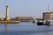 | Hartlepool
54°41′29″N 1°12′08″W / 54.6915°N 1.2022°W / 54.6915; -1.2022 (Seaton Tower) | Durham | 1839 | 19 m (62 ft) | Unknown | Inactive | Rebuilt in Hartlepool |
| Shoreham |  | Kingston by Sea
50°49′51″N 0°14′54″W / 50.8309°N 0.2483°W / 50.8309; -0.2483 (Shoreham) | West Sussex | 1846 | 12 m (39 ft) | 13 m (43 ft) | 10 nmi (19 km) | |
| Smeaton's Tower | .JPG) | Plymouth Hoe
50°21′52″N 4°08′30″W / 50.3644°N 4.1418°W / 50.3644; -4.1418 (Smeaton's Tower) | Devon | 1759 | 22 m (72 ft) | Unknown | Inactive | Moved from Eddystone to Plymouth Hoe in 1883 |
| Souter Point |  | Marsden
54°58′15″N 1°21′51″W / 54.9708°N 1.3642°W / 54.9708; -1.3642 (Souter Point Lighthouse) | Tyne and Wear | 1871 | 23 m (75 ft) | Unknown | Inactive | |
| South Foreland High |  | South Foreland
51°08′25″N 1°22′16″E / 51.1404°N 1.3711°E / 51.1404; 1.3711 (South Foreland High) | Kent | 1843 | 21 m (69 ft) | Unknown | Inactive | |
| South Foreland Low |  | South Foreland
51°08′28″N 1°22′34″E / 51.1410°N 1.3761°E / 51.1410; 1.3761 (South Foreland Low) | Kent | 1793 | 15 m (49 ft) | Unknown | Inactive | |
| South Gare |  | South Gare
54°38′51″N 1°08′15″W / 54.6474°N 1.1375°W / 54.6474; -1.1375 (South Gare Lighthouse) | North Yorkshire | 1884 | 13 m (43 ft) | 16 m (52 ft) | 17 nmi (31 km) | |
| Southsea Castle |  | Southsea Castle
50°46′42″N 1°05′18″W / 50.7783°N 1.0883°W / 50.7783; -1.0883 (Southsea Castle lighthouse) | Hampshire | 1828 | 10 m (33 ft) | 16 m (52 ft) | 11 nmi (20 km) | |
| Southwold |  | Southwold
52°19′38″N 1°40′53″E / 52.3272°N 1.6814°E / 52.3272; 1.6814 (Southwold Lighthouse) | Suffolk | 1890 | 31 m (102 ft) | 37 m (121 ft) | 24 nmi (44 km) | |
| Spurn Point |  | Spurn Point
53°34′45″N 0°07′06″E / 53.5792°N 0.1183°E / 53.5792; 0.1183 (Spurn Point) | East Yorkshire | 1895 | 39 m (128 ft) | Unknown | Inactive | |
| Spurn Point Low |  | Spurn Point
53°34′44″N 0°06′58″E / 53.5790°N 0.1160°E / 53.5790; 0.1160 (Spurn Point Low) | East Yorkshire | 1852 | 27 m (89 ft) | Unknown | Inactive | |
| St Andrew's Church |  | Burnham-on-Sea
51°14′21″N 2°59′49″W / 51.2392°N 2.9969°W / 51.2392; -2.9969 (St Andrew's Church) | Somerset | Unknown | 11 m (36 ft) | 12 m (39 ft) | 3 nmi (6 km) | |
| St Anthony's |  | St Anthony Head
50°08′28″N 5°00′58″W / 50.1412°N 5.0161°W / 50.1412; -5.0161 (St Anthony's Lighthouse) | Cornwall | 1835 | 19 m (62 ft) | 22 m (72 ft) | 22 nmi (41 km) | Trinity House |
| St Bees |  | St Bees Head
54°30′49″N 3°38′11″W / 54.5137°N 3.6365°W / 54.5137; -3.6365 (St Bees Lighthouse) | Cumbria | 1867 | 17 m (56 ft) | 102 m (335 ft) | 18 nmi (33 km) | Trinity House |
| St. Agnes |  | St. Agnes
49°53′33″N 6°20′43″W / 49.8925°N 6.3454°W / 49.8925; -6.3454 (St. Agnes Lighthouse) | Isles of Scilly | 1680 | 21 m (69 ft) | Unknown | Inactive | |
| St. Catherine's |  | St. Catherine's Point
50°34′33″N 1°17′54″W / 50.5758°N 1.2983°W / 50.5758; -1.2983 (St. Catherine's Lighthouse) | Isle of Wight | 1838 | 27 m (89 ft) | 41 m (135 ft) | 25 nmi (46 km) | Trinity House |
| St. Catherine's Oratory | _-_geograph.org.uk_-_1414128.jpg) | St. Catherine's Down
50°35′36″N 1°18′15″W / 50.5932°N 1.3041°W / 50.5932; -1.3041 (St. Catherine's Oratory) | Isle of Wight | 1328 | 11 m (36 ft) | 240 m (787 ft) | Inactive | |
| St. Mary's |  | St Mary's Island
55°04′18″N 1°26′58″W / 55.0717°N 1.4494°W / 55.0717; -1.4494 (St. Mary's Lighthouse) | Tyne and Wear | 1898 | 46 m (151 ft) | Unknown | Inactive | |
| Start Point |  | Start Point
50°13′17″N 3°38′19″W / 50.2214°N 3.6386°W / 50.2214; -3.6386 (Start Point lighthouse) | Devon | 1836 | 28 m (92 ft) | 62 m (203 ft) | 25 nmi (46 km) | Trinity House |
| Tater Du |  | Tregurnow
50°03′07″N 5°34′36″W / 50.0520°N 5.5767°W / 50.0520; -5.5767 (Tater Du Lighthouse) | Cornwall | 1965 | 15 m (49 ft) | 20 m (66 ft) | 23 nmi (43 km) | Trinity House |
| The Heugh |  | Hartlepool
54°41′49″N 1°10′31″W / 54.6969°N 1.1753°W / 54.6969; -1.1753 (The Heugh lighthouse,) | Durham | 1927 | 16 m (52 ft) | 19 m (62 ft) | 19 nmi (35 km) | |
| Thorngumbald Clough High |  | Paull
53°42′29″N 0°13′33″W / 53.7081°N 0.2257°W / 53.7081; -0.2257 (Thorngumbald Clough High) | East Yorkshire | 1870 | 15 m (49 ft) | 13 m (43 ft) | 9 nmi (17 km) | |
| Thorngumbald Clough Low |  | Paull
53°42′32″N 0°13′37″W / 53.7088°N 0.2269°W / 53.7088; -0.2269 (Thorngumbald Clough Low) | East Yorkshire | 1870 | 9 m (30 ft) | 8 m (26 ft) | 9 nmi (17 km) | |
| Trevose Head |  | Trevose Head
50°32′58″N 5°02′11″W / 50.5495°N 5.0363°W / 50.5495; -5.0363 (Trevose Head Lighthouse) | Cornwall | 1847 | 27 m (89 ft) | 62 m (203 ft) | 20 nmi (37 km) | Trinity House |
| Tyne North Pier |  | Tynemouth
55°00′52″N 1°24′10″W / 55.0145°N 1.4028°W / 55.0145; -1.4028 (Tyne North Pier) | Tyne and Wear | 1903 | 23 m (75 ft) | 26 m (85 ft) | 26 nmi (48 km) | |
| Tyne South Pier |  | South Shields
55°00′42″N 1°24′06″W / 55.0117°N 1.4017°W / 55.0117; -1.4017 (Tyne South Pier) | Tyne and Wear | 1895 | 12 m (39 ft) | 15 m (49 ft) | 13 nmi (24 km) | |
| Walney |  | Walney Island
54°02′55″N 3°10′38″W / 54.0486°N 3.1772°W / 54.0486; -3.1772 (Walney Lighthouse.) | Cumbria | 1804 | 24 m (79 ft) | 21 m (69 ft) | 23 nmi (43 km) | |
| Watchet Harbour | .jpg) | Watchet
51°11′03″N 3°19′43″W / 51.1842°N 3.3286°W / 51.1842; -3.3286 (Watchet Harbour Lighthouse) | Somerset | 1862 | 7 m (23 ft) | 9 m (30 ft) | 9 nmi (17 km) | |
| Whitby |  | Whitby
54°28′40″N 0°34′06″W / 54.4778°N 0.5683°W / 54.4778; -0.5683 (Whitby Lighthouse.) | North Yorkshire | 1858 | 13 m (43 ft) | 73 m (240 ft) | 18 nmi (33 km) | Trinity House |
| Whitby Harbour East |  | Whitby
54°29′39″N 0°36′44″W / 54.4941°N 0.6123°W / 54.4941; -0.6123 (Whitby Harbour East) | North Yorkshire | 1855 | 17 m (56 ft) | Unknown | Inactive | |
| Whitby Harbour East |  | Whitby
54°29′39″N 0°36′44″W / 54.4941°N 0.6123°W / 54.4941; -0.6123 (Whitby Harbour East) | North Yorkshire | 1914 | 7 m (23 ft) | 14 m (46 ft) | 5 nmi (9 km) | |
| Whitby Harbour West |  | Whitby
54°29′39″N 0°36′48″W / 54.4942°N 0.6133°W / 54.4942; -0.6133 (Whitby Harbour West) | North Yorkshire | 1831 | 25 m (82 ft) | Unknown | Inactive | |
| Whitby Harbour West |  | Whitby
54°29′39″N 0°36′48″W / 54.4942°N 0.6133°W / 54.4942; -0.6133 (Whitby Harbour West) | North Yorkshire | 1914 | 7 m (23 ft) | 14 m (46 ft) | 5 nmi (9 km) | |
| Whitgift |  | Whitgift
53°41′57″N 0°45′28″W / 53.6991°N 0.7577°W / 53.6991; -0.7577 (Whitgift Lighthouse) | East Yorkshire | Unknown | 14 m (46 ft) | 12 m (39 ft) | Unknown | |
| Winterton |  | Winterton-on-Sea
52°42′47″N 1°41′43″E / 52.7130°N 1.6953°E / 52.7130; 1.6953 (Winterton Lighthouse) | Norfolk | 1867 | 19 m (62 ft) | Unknown | Inactive | |
| Withernsea |  | Withernsea
53°43′51″N 0°01′43″E / 53.7309°N 0.0287°E / 53.7309; 0.0287 (Withernsea Lighthouse) | East Yorkshire | 1894 | 38 m (125 ft) | Unknown | Inactive | |
| Wolf Rock |  | Wolf Rock
49°56′42″N 5°48′36″W / 49.9450°N 5.8100°W / 49.9450; -5.8100 (Wolf Rock Lighthouse) | Cornwall | 1870 | 41 m (135 ft) | 34 m (112 ft) | 23 nmi (43 km) | Trinity House |
|
 = operational lighthouse
 = deactivated lighthouse
_Flamborough_-_geograph.org.uk_-_1207040.jpg)


 Media related to Lighthouses in England by name at Wikimedia Commons
_-_cropped.jpg)