List of Category A listed buildings in the Western Isles

The Western Isles shown within Scotland

This is a list of Category A listed buildings in the Western Isles of Scotland (Scottish Gaelic: Na h-Eileanan Siar).

In Scotland, the term listed building refers to a building or other structure officially designated as being of "special architectural or historic interest".[1] Category A structures are those considered to be "buildings of national or international importance, either architectural or historic, or fine little-altered examples of some particular period, style or building type."[2] Listing was begun by a provision in the Town and Country Planning (Scotland) Act 1947, and the current legislative basis for listing is the Planning (Listed Buildings and Conservation Areas) (Scotland) Act 1997.[3] The authority for listing rests with Historic Scotland, an executive agency of the Scottish Government, which inherited this role from the Scottish Development Department in 1991. Once listed, severe restrictions are imposed on the modifications allowed to a building's structure or its fittings. Listed building consent must be obtained from local authorities prior to any alteration to such a structure.[3] There are approximately 47,400 listed buildings in Scotland, of which around 8% (or approximately 3,800) are Category A.[4]

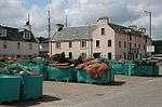
The council area of Na h-Eileanan Siar (Western Isles) comprises an archipelago of over 100 islands and small skerries, including 14 inhabited islands with a total population of around 26,500. There are 18 Category A listed buildings on the islands, representing a variety of types and ages of structure. The 13th-century Church of St Moluag is one of three A-listed church buildings. Kisimul Castle, built on a tiny island off the shore of Castlebay, dates from the 15th century,[5] while the two other A-listed castles at Amhuinnsuidhe and Lews are Victorian. Functional architecture includes three important lighthouses, including Eilean Glas, the first lighthouse in the Western Isles. More prosaic building types are well represented, with eight traditional thatched cottages meriting Category A listing.

Listed buildings

Name Location Date Listed Grid Ref. [note 1] Geo-coordinates Notes HB Number [note 2] Image
Butt of Lewis Lighthouse Butt of Lewis 25/3/1971 NB5197066483 58°30′56″N 6°15′39″W / 58.515625°N 6.260874°W / 58.515625; -6.260874 (Butt of Lewis Lighthouse) Built in the 1860s and designed by David Stevenson 5768

Upload another image
See more images

Barra Head Lighthouse Barra Head 5/10/1971 NL5489880253 56°47′08″N 7°39′13″W / 56.785421°N 7.653546°W / 56.785421; -7.653546 (Barra Head Lighthouse) Designed by Robert Stevenson and opened in 1833 5893

Upload another image
See more images

Kisimul Castle Castlebay, Barra 5/10/1971 NL6651997944 56°57′07″N 7°29′15″W / 56.952082°N 7.487415°W / 56.952082; -7.487415 (Kisimul Castle) 16th-century castle on an island in Castle Bay 5901

Upload another image
See more images

St Moluag's Church (Teampull Mholuaidh) Eoropie, Lewis 25/3/1971 NB5192865157 58°30′13″N 6°15′37″W / 58.503725°N 6.260151°W / 58.503725; -6.260151 (St Moluag's Church (Teampull Mholuaidh)) 13th-century church 6603

Upload another image
See more images

Amhuinnsuidhe Castle Harris 5/10/1971 NB0495607806 57°57′41″N 6°59′26″W / 57.961378°N 6.990431°W / 57.961378; -6.990431 (Amhuinnsuidhe Castle) 19th-century Scots baronial country house, designed by David Bryce 12767

Upload another image
See more images

St Clement's Church Rodel, Harris 5/10/1971 NG0477383184 57°44′27″N 6°57′47″W / 57.740937°N 6.963033°W / 57.740937; -6.963033 (St Clement's Church) 15th-century church 12912

Upload another image
See more images

Eilean Glas Lighthouse Scalpay 30/3/1994 NG2474394715 57°51′25″N 6°38′31″W / 57.856854°N 6.641999°W / 57.856854; -6.641999 (Eilean Glas Lighthouse) The first lighthouse erected in the Western Isles, built 1789 by Thomas Smith 13487

Upload another image
See more images

9 Locheport Locheport, North Uist 5/10/1971 NF8775863156 57°33′01″N 7°13′18″W / 57.550289°N 7.221786°W / 57.550289; -7.221786 (9 Locheport) Hebridean-type thatched cottage 17570
29 Locheport Locheport, North Uist 5/10/1971 NF8491063485 57°33′05″N 7°16′11″W / 57.551258°N 7.269597°W / 57.551258; -7.269597 (29 Locheport) Hebridean-type thatched cottage 17571
Struan Cottage Malaclete, North Uist 15/1/1980 NF7938573724 57°38′20″N 7°22′30″W / 57.638945°N 7.375041°W / 57.638945; -7.375041 (Struan Cottage) Hebridean-type thatched cottage 17582

Upload another image

Ardheisker thatched cottage Ardheisker, North Uist 5/10/1971 NF7644167334 57°34′47″N 7°24′56″W / 57.579703°N 7.4156°W / 57.579703; -7.4156 (Ardheisker thatched cottage) Hebridean-type thatched cottage 17585
Lews Castle Stornoway, Lewis 25/3/1971 NB4200933175 58°12′42″N 6°23′39″W / 58.211582°N 6.394058°W / 58.211582; -6.394058 (Lews Castle) Mid 19th-century country house 18677

Upload another image
See more images

472b South Lochboisdale Lochboisdale, South Uist 15/1/1980 NF7852817489 57°08′07″N 7°18′57″W / 57.135399°N 7.315826°W / 57.135399; -7.315826 (472b South Lochboisdale) Skye-type thatched cottage 18746
77 Ardmanonie Eochar, South Uist 15/1/1980 NF7731946134 57°23′27″N 7°22′23″W / 57.390742°N 7.37299°W / 57.390742; -7.37299 (77 Ardmanonie) Skye-type thatched cottage 18767
Lews Castle Lodges, Boundary Walls, Sea Walls and Tower Stornoway, Lewis 25/3/1971 NB4213133002 58°12′36″N 6°23′30″W / 58.210104°N 6.391796°W / 58.210104; -6.391796 (Lews Castle Lodges, Boundary Walls, Sea Walls and Tower) 19th-century walls around Lews Castle 19206
St Columba's Church (Eye Church) Aignish, Lewis 25/3/1971 NB4846932260 58°12′26″N 6°17′00″W / 58.207119°N 6.283444°W / 58.207119; -6.283444 (St Columba's Church (Eye Church)) Late medieval church, now partly ruined 19210

Upload another image

Bualadubh Eochar, South Uist 15/1/1980 NF7882346166 57°23′32″N 7°20′53″W / 57.392092°N 7.34812°W / 57.392092; -7.34812 (Bualadubh) Skye-type thatched cottage 19908
North Beach Quay/North Beach Old Sail Loft North Beach, Stornoway, Lewis 25/3/1971 NB4211932816 58°12′30″N 6°23′30″W / 58.208431°N 6.391794°W / 58.208431; -6.391794 (North Beach Quay/North Beach Old Sail Loft) Large 19th-century warehouse with adjoining house 41735

Upload another image

Notes

  1. Sometimes known as OSGB36, the grid reference (where provided) is based on the British national grid reference system used by the Ordnance Survey.
    "Guide to National Grid". Ordnance Survey. Retrieved 2007-12-12.
    "Get-a-map". Ordnance Survey. Retrieved 2007-12-17.
  2. The "HB Number" is a unique number assigned to each listed building by Historic Scotland.

References

  1. Guide to the Protection of Scotland’s Listed Buildings (PDF). Historic Scotland. 2009. p. 4. ISBN 978-1-84917-013-0. Retrieved 2010-05-05.
  2. "What is Listing?". Historic Scotland. Retrieved 2010-05-05.
  3. 1 2 Scottish Historic Environment Policy (PDF). Historic Scotland. October 2008. pp. 24–25. ISBN 978-1-84917-002-4. Retrieved 2010-05-05.
  4. Guide to the Protection of Scotland’s Listed Buildings, p. 17.
  5. "Kisimul Castle, Listed Building Report". Historic Scotland. Retrieved 2010-05-10.

Media related to Category A listed buildings in the Western Isles at Wikimedia Commons

This article is issued from Wikipedia - version of the 2/18/2014. The text is available under the Creative Commons Attribution/Share Alike but additional terms may apply for the media files.