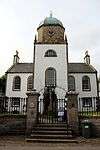
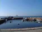
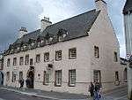
List of Category A listed buildings in Highland

Highland shown within Scotland

This is a list of Category A listed buildings in the Highland council area of northern Scotland.

In Scotland, the term listed building refers to a building or other structure officially designated as being of "special architectural or historic interest".[1] Category A structures are those considered to be "buildings of national or international importance, either architectural or historic, or fine little-altered examples of some particular period, style or building type."[2] Listing was begun by a provision in the Town and Country Planning (Scotland) Act 1947, and the current legislative basis for listing is the Planning (Listed Buildings and Conservation Areas) (Scotland) Act 1997.[3] The authority for listing rests with Historic Scotland, an executive agency of the Scottish Government, which inherited this role from the Scottish Development Department in 1991. Once listed, severe restrictions are imposed on the modifications allowed to a building's structure or its fittings. Listed building consent must be obtained from local authorities prior to any alteration to such a structure.[3] There are approximately 47,400 listed buildings in Scotland, of which around 8% (some 3,800) are Category A.[4]

The council area of Highland is the largest in Scotland, covering 30,659 square kilometres (11,838 sq mi), and it has a population of around 220,500. There are 185 Category A listed buildings in the area.

Listed buildings

Name Location Date Listed Grid Ref. [note 1] Geo-coordinates Notes HB Number [note 2] Image
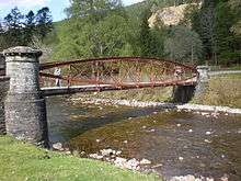
Sluggan Bridge over River Dulnain Sluggan, Carrbridge NH8698922008 57°16′29″N 3°52′33″W / 57.274691°N 3.875884°W / 57.274691; -3.875884 (Sluggan Bridge over River Dulnain) [5] 240

Upload another image
See more images

Muckrach Castle Dulnain Bridge NH9858925051 57°18′17″N 3°41′05″W / 57.304737°N 3.684851°W / 57.304737; -3.684851 (Muckrach Castle) [6] 249

Upload another image
See more images

Croft House Coylumbridge, Rothiemurchus NH9029309343 57°09′42″N 3°48′56″W / 57.161785°N 3.815525°W / 57.161785; -3.815525 (Croft House) [7] 251

Upload another image

Aviemore railway station Aviemore NH8955312344 57°11′19″N 3°49′45″W / 57.188552°N 3.829084°W / 57.188552; -3.829084 (Aviemore railway station) [8] 257

Upload another image
See more images

Broomhill Bridge over River Spey Broomhill, Nethy Bridge NH9969122357 57°16′51″N 3°39′56″W / 57.280791°N 3.665476°W / 57.280791; -3.665476 (Broomhill Bridge over River Spey) [9] 260

Upload another image
See more images

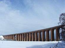
Shin Railway Viaduct over Kyle of Sutherland Kyle of Sutherland NH5789395274 57°55′27″N 4°24′04″W / 57.924102°N 4.40098°W / 57.924102; -4.40098 (Shin Railway Viaduct over Kyle of Sutherland) [10] 279

Upload another image
See more images

Borrodale Viaduct over Borrodale Burn Arisaig NM6974685492 56°54′12″N 5°46′59″W / 56.90339°N 5.783152°W / 56.90339; -5.783152 (Borrodale Viaduct over Borrodale Burn) [11] 302

Upload another image

Castle Tioram Loch Moidart, Lochaber NM6621172431 56°47′04″N 5°49′45″W / 56.784552°N 5.829072°W / 56.784552; -5.829072 (Castle Tioram) [12] 305

Upload another image
See more images

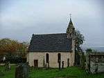
St Finnan's Chapel and Burial Ground Eilean Fhianain, Loch Shiel NM7520468276 56°45′06″N 5°40′43″W / 56.75173°N 5.678545°W / 56.75173; -5.678545 (St Finnan's Chapel and Burial Ground) [13] 306

Upload another image

Glenfinnan Monument Glenfinnan NM9061680575 56°52′09″N 5°26′13″W / 56.869195°N 5.437078°W / 56.869195; -5.437078 (Glenfinnan Monument) [14] 308

Upload another image
See more images

Glenfinnan Railway Viaduct over River Finnan Glenfinnan NM9098681349 56°52′35″N 5°25′54″W / 56.876303°N 5.431656°W / 56.876303; -5.431656 (Glenfinnan Railway Viaduct over River Finnan) [15] 310

Upload another image
See more images

Kinlochmoidart House Kinlochmoidart NM7162472384 56°47′13″N 5°44′26″W / 56.786816°N 5.740628°W / 56.786816; -5.740628 (Kinlochmoidart House) [16] 317
Old Spey Bridge over River Spey Speybridge, Grantown-on-Spey NJ0397726337 57°19′03″N 3°35′45″W / 57.31745°N 3.595963°W / 57.31745; -3.595963 (Old Spey Bridge over River Spey) [17] 335

Upload another image
See more images

Castle Grant Grantown-on-Spey NJ0413730181 57°21′07″N 3°35′41″W / 57.352°N 3.594803°W / 57.352; -3.594803 (Castle Grant) [18] 348

Upload another image
See more images

Castle Grant East Lodge, railway bridge over A939 road, and entrance arch to drive Grantown-on-Spey NJ0326830205 57°21′07″N 3°36′33″W / 57.352032°N 3.609248°W / 57.352032; -3.609248 (Castle Grant East Lodge, railway bridge over A939 road, and entrance arch to drive) [19] 349

Upload another image
See more images

Rosehaugh Estate, The Dairy Avoch NH6817255670 57°34′18″N 4°12′21″W / 57.571799°N 4.20582°W / 57.571799; -4.20582 (Rosehaugh Estate, The Dairy) [20] 374
Glendale Mill and Kiln (now museum) Glendale, Skye NG1681249801 57°26′59″N 6°43′21″W / 57.449858°N 6.722543°W / 57.449858; -6.722543 (Glendale Mill and Kiln (now museum)) [21] 467

Upload another image
See more images

Cape Wrath Lighthouse Cape Wrath NC2595574726 58°37′31″N 4°59′57″W / 58.62541°N 4.99915°W / 58.62541; -4.99915 (Cape Wrath Lighthouse) [22] 488

Upload another image
See more images

Dunvegan Parish Church Dunvegan, Skye NG2508847951 57°26′18″N 6°34′59″W / 57.438378°N 6.583012°W / 57.438378; -6.583012 (Dunvegan Parish Church) [23] 498

Upload another image
See more images

Dunvegan Castle Dunvegan, Skye NG2474049106 57°26′55″N 6°35′24″W / 57.448509°N 6.590088°W / 57.448509; -6.590088 (Dunvegan Castle) [24] 501

Upload another image
See more images

Dunvegan Castle, The Laundry Dunvegan, Skye NG2466949025 57°26′52″N 6°35′28″W / 57.44774°N 6.591176°W / 57.44774; -6.591176 (Dunvegan Castle, The Laundry) [25] 503

Upload another image

Balnakeil House Balnakeil, Durness NC3919668634 58°34′33″N 4°46′02″W / 58.575873°N 4.767108°W / 58.575873; -4.767108 (Balnakeil House) [26] 517

Upload another image
See more images

Ardnamurchan Lighthouse Ardnamurchan Point NM4158767473 56°43′38″N 6°13′34″W / 56.727126°N 6.226016°W / 56.727126; -6.226016 (Ardnamurchan Lighthouse) [27] 521

Upload another image
See more images

Glenborrodale Castle Glenborrodale NM6062560888 56°40′42″N 5°54′34″W / 56.678259°N 5.909513°W / 56.678259; -5.909513 (Glenborrodale Castle) [28] 524

Upload another image
See more images

Mingary Castle Kilchoan NM5027463101 56°41′34″N 6°04′49″W / 56.692677°N 6.080171°W / 56.692677; -6.080171 (Mingary Castle) [29] 527

Upload another image
See more images

Aldourie Castle Dores, Loch Ness NH6012937212 57°24′13″N 4°19′47″W / 57.403719°N 4.329597°W / 57.403719; -4.329597 (Aldourie Castle) [30] 535

Upload another image
See more images

Aultmore House Nethy Bridge NJ0144021662 57°16′30″N 3°38′10″W / 57.274932°N 3.636202°W / 57.274932; -3.636202 (Aultmore House) [31] 549
Ardclach Bell Tower Ardclach, Ferness NH9538145334 57°29′10″N 3°44′48″W / 57.486123°N 3.746715°W / 57.486123; -3.746715 (Ardclach Bell Tower) [32] 551

Upload another image
See more images

Dulsie Bridge over River Findhorn Dulsie, Ferness NH9319541443 57°27′02″N 3°46′53″W / 57.450679°N 3.781457°W / 57.450679; -3.781457 (Dulsie Bridge over River Findhorn) [33] 557

Upload another image
See more images

Glenferness House Ferness NH9371842842 57°27′48″N 3°46′24″W / 57.463363°N 3.773354°W / 57.463363; -3.773354 (Glenferness House) [34] 560
Logie Bridge over River Findhorn Ferness NH9596146227 57°29′39″N 3°44′15″W / 57.494275°N 3.737427°W / 57.494275; -3.737427 (Logie Bridge over River Findhorn) [35] 564

Upload another image

Skibo Castle Dornoch NH7362489052 57°52′23″N 4°07′56″W / 57.872995°N 4.132295°W / 57.872995; -4.132295 (Skibo Castle) [36] 597

Upload another image
See more images

Embo House Embo, Dornoch NH8089092242 57°54′13″N 4°00′41″W / 57.903627°N 4.011482°W / 57.903627; -4.011482 (Embo House) [37] 608

Upload another image

Boath House Auldearn NH9195955826 57°34′46″N 3°48′30″W / 57.579517°N 3.808423°W / 57.579517; -3.808423 (Boath House) [38] 1649

Upload another image

Brightmony House Auldearn NH9295253754 57°33′40″N 3°47′27″W / 57.561151°N 3.790912°W / 57.561151; -3.790912 (Brightmony House) [39] 1657
Culloden Moor, Memorial Cairn Culloden NH7417344983 57°28′39″N 4°06′00″W / 57.47758°N 4.100039°W / 57.47758; -4.100039 (Culloden Moor, Memorial Cairn) [40] 1699

Upload another image
See more images

Nairn Viaduct over River Nairn, otherwise known as Culloden Moor Viaduct Clava, Culloden NH7641344972 57°28′41″N 4°03′46″W / 57.478098°N 4.062705°W / 57.478098; -4.062705 (Nairn Viaduct over River Nairn, otherwise known as Culloden Moor Viaduct) [41] 1709

Upload another image
See more images

Dalcross Castle Dalcross, Croy NH7786048289 57°30′30″N 4°02′25″W / 57.508266°N 4.040252°W / 57.508266; -4.040252 (Dalcross Castle) [42] 1713

Upload another image
See more images

Fort George Ardersier, Inverness NH7607956674 57°34′59″N 4°04′27″W / 57.58305°N 4.07423°W / 57.58305; -4.07423 (Fort George) [43] 1721

Upload another image
See more images

Budgate House Cawdor NH8361149491 57°31′14″N 3°56′42″W / 57.520572°N 3.944903°W / 57.520572; -3.944903 (Budgate House) [44] 1727

Upload another image

Cawdor Castle Cawdor NH8471849870 57°31′27″N 3°55′36″W / 57.524257°N 3.926612°W / 57.524257; -3.926612 (Cawdor Castle) [45] 1728

Upload another image
See more images

Cawdor Parish Church Cawdor NH8436149947 57°31′29″N 3°55′57″W / 57.524858°N 3.932606°W / 57.524858; -3.932606 (Cawdor Parish Church) [46] 1760

Upload another image
See more images

Coul House Contin NH4624956404 57°34′17″N 4°34′21″W / 57.571457°N 4.572446°W / 57.571457; -4.572446 (Coul House) [47] 1769

Upload another image

Contin Bridge over the Black Water Contin NH4540356672 57°34′25″N 4°35′12″W / 57.573573°N 4.586746°W / 57.573573; -4.586746 (Contin Bridge over the Black Water) [48] 1789

Upload another image

Canisbay Parish Church (St Drostan's) Canisbay ND3434972853 58°38′19″N 3°07′57″W / 58.638569°N 3.132592°W / 58.638569; -3.132592 (Canisbay Parish Church (St Drostan's)) [49] 1795

Upload another image
See more images

Castle of Mey Mey ND2903273889 58°38′49″N 3°13′28″W / 58.647032°N 3.224483°W / 58.647032; -3.224483 (Castle of Mey) [50] 1797

Upload another image
See more images

Freswick House Freswick ND3780167142 58°35′16″N 3°04′18″W / 58.587798°N 3.07157°W / 58.587798; -3.07157 (Freswick House) [51] 1799

Upload another image

Holme Rose Croy NH8065248630 57°30′43″N 3°59′38″W / 57.512072°N 3.993851°W / 57.512072; -3.993851 (Holme Rose) [52] 1812
Cromarty House Cromarty NH7929567018 57°40′36″N 4°01′32″W / 57.676777°N 4.025647°W / 57.676777; -4.025647 (Cromarty House) [53] 1818
Cromarty House, Stables Cromarty NH7938566857 57°40′31″N 4°01′27″W / 57.675356°N 4.024058°W / 57.675356; -4.024058 (Cromarty House, Stables) [54] 1820
Kilravock Castle Croy NH8140949361 57°31′08″N 3°58′54″W / 57.518833°N 3.98158°W / 57.518833; -3.98158 (Kilravock Castle) [55] 1841

Upload another image
See more images

White Bridge over River Nairn Clephanton NH8242150223 57°31′37″N 3°57′54″W / 57.526835°N 3.965112°W / 57.526835; -3.965112 (White Bridge over River Nairn) [56] 1843

Upload another image

Fort Augustus Abbey Fort Augustus NH3814809154 57°08′41″N 4°40′36″W / 57.144664°N 4.676667°W / 57.144664; -4.676667 (Fort Augustus Abbey) [57] 1861

Upload another image
See more images

Fort Augustus Abbey Church Fort Augustus NH3814809154 57°08′41″N 4°40′36″W / 57.144664°N 4.676667°W / 57.144664; -4.676667 (Fort Augustus Abbey Church) [58] 1862
Oich Old Bridge over River Oich Aberchalder NH3376603612 57°05′36″N 4°44′43″W / 57.093372°N 4.745313°W / 57.093372; -4.745313 (Oich Old Bridge over River Oich) [59] 1872

Upload another image

Old Bridge over River Foyers, Whitebridge Whitebridge NH4891515369 57°12′15″N 4°30′10″W / 57.204108°N 4.502683°W / 57.204108; -4.502683 (Old Bridge over River Foyers, Whitebridge) [60] 1874

Upload another image
See more images

Dunnet Parish Church (Church Of Scotland) Dunnet ND2198771183 58°37′17″N 3°20′42″W / 58.621525°N 3.344895°W / 58.621525; -3.344895 (Dunnet Parish Church (Church Of Scotland)) [61] 1888

Upload another image
See more images

Edderton Old Parish Church and Burial Ground Edderton NH7191884231 57°49′45″N 4°09′30″W / 57.829237°N 4.158442°W / 57.829237; -4.158442 (Edderton Old Parish Church and Burial Ground) [62] 4572

Upload another image
See more images

Keppoch Barn Roybridge NN2695380925 56°53′14″N 4°50′31″W / 56.88731°N 4.842039°W / 56.88731; -4.842039 (Keppoch Barn) [63] 6837
Commando Memorial Spean Bridge NN2078882369 56°53′53″N 4°56′39″W / 56.897923°N 4.944103°W / 56.897923; -4.944103 (Commando Memorial) [64] 6842

Upload another image
See more images

Mucomir Bridge over River Lochy Gairlochy, Caledonian Canal NN1836083824 56°54′36″N 4°59′06″W / 56.910031°N 4.984949°W / 56.910031; -4.984949 (Mucomir Bridge over River Lochy) [65] 6868
Garvamore Barracks Garvamore, Laggan NN5280494305 57°00′59″N 4°25′34″W / 57.016326°N 4.425978°W / 57.016326; -4.425978 (Garvamore Barracks) [66] 6899

Upload another image

Garva Bridge over River Spey (St George's Bridge) Garvamore, Laggan NN5217494750 57°01′12″N 4°26′12″W / 57.020118°N 4.436605°W / 57.020118; -4.436605 (Garva Bridge over River Spey (St George's Bridge)) [67] 6900

Upload another image
See more images

Ardverikie House Loch Laggan NN5078987555 56°57′18″N 4°27′18″W / 56.955098°N 4.455137°W / 56.955098; -4.455137 (Ardverikie House) [68] 6910

Upload another image
See more images

Ardverikie Gate Lodge, gate piers and bridge over River Pattack Ardverikie House, Loch Laggan NN5394089689 56°58′31″N 4°24′17″W / 56.975257°N 4.404611°W / 56.975257; -4.404611 (Ardverikie Gate Lodge, gate piers and bridge over River Pattack) [69] 6911

Upload another image
See more images

Cluny Castle Balgowan, Laggan NN6456894290 57°01′11″N 4°13′57″W / 57.019794°N 4.232388°W / 57.019794; -4.232388 (Cluny Castle) [70] 6914
Plockton Church and Graveyard Plockton, Innes Street NG8027933303 57°20′14″N 5°39′09″W / 57.337127°N 5.652572°W / 57.337127; -5.652572 (Plockton Church and Graveyard) [71] 6927

Upload another image

12 Lower Ardelve Ardelve NG8741326671 57°16′52″N 5°31′43″W / 57.281048°N 5.528586°W / 57.281048; -5.528586 (12 Lower Ardelve) [72] 6999

Upload another image

Mound Bridge and Keeper's Cottage The Mound, Loch Fleet NH7754998219 57°57′23″N 4°04′15″W / 57.956372°N 4.070904°W / 57.956372; -4.070904 (Mound Bridge and Keeper's Cottage) [73] 7022

Upload another image
See more images

St Andrew's Parish Church Golspie, Main Street NC8377500225 57°58′34″N 3°58′00″W / 57.976049°N 3.966753°W / 57.976049; -3.966753 (St Andrew's Parish Church) [74] 7036

Upload another image

Dunrobin Castle Golspie NC8504900820 57°58′54″N 3°56′44″W / 57.981721°N 3.945517°W / 57.981721; -3.945517 (Dunrobin Castle) [75] 7044

Upload another image
See more images

Dunrobin Castle, Garden Pavilion (Museum) and Walled Garden Golspie NC8518000774 57°58′53″N 3°56′36″W / 57.981342°N 3.943281°W / 57.981342; -3.943281 (Dunrobin Castle, Garden Pavilion (Museum) and Walled Garden) [76] 7045

Upload another image
See more images

Caledonian Canal, Glen Loy Aqueduct over the River Loy Strone, Muirshearlich NN1492181771 56°53′25″N 5°02′23″W / 56.890254°N 5.039845°W / 56.890254; -5.039845 (Caledonian Canal, Glen Loy Aqueduct over the River Loy) [77] 7085

Upload another image
See more images

Caledonian Canal sluice by Carn Phail Strone, Muirshearlich NN1488681251 56°53′08″N 5°02′24″W / 56.885575°N 5.04004°W / 56.885575; -5.04004 (Caledonian Canal sluice by Carn Phail) [78] 7089

Upload another image
See more images

Caledonian Canal, Torcastle Acqueduct over the Allt Sheangain Torcastle, Muirshearlich NN1318279159 56°51′58″N 5°03′59″W / 56.866126°N 5.066425°W / 56.866126; -5.066425 (Caledonian Canal, Torcastle Acqueduct over the Allt Sheangain) [79] 7090

Upload another image
See more images

Callert House Loch Leven NN0914160401 56°41′46″N 5°07′07″W / 56.696219°N 5.118604°W / 56.696219; -5.118604 (Callert House) [80] 7091

Upload another image

Fasnakyle Power Station Cannich NH3186729626 57°19′34″N 4°47′39″W / 57.326087°N 4.794209°W / 57.326087; -4.794209 (Fasnakyle Power Station) [81] 7118

Upload another image
See more images

Glen Affric Lodge Glen Affric NH1841222919 57°15′39″N 5°00′45″W / 57.260765°N 5.012421°W / 57.260765; -5.012421 (Glen Affric Lodge) [82] 7121

Upload another image

Beauly Priory Beauly NH5275846489 57°29′05″N 4°27′28″W / 57.484647°N 4.457732°W / 57.484647; -4.457732 (Beauly Priory) [83] 7129

Upload another image
See more images

Loth Parish Church Lothmore, Helmsdale NC9709311380 58°04′46″N 3°44′48″W / 58.079476°N 3.746584°W / 58.079476; -3.746584 (Loth Parish Church) [84] 7149

Upload another image

Bighouse, Garden Pavilion and Walled Garden Melvich NC8920164831 58°33′27″N 3°54′22″W / 58.557371°N 3.905973°W / 58.557371; -3.905973 (Bighouse, Garden Pavilion and Walled Garden) [85] 7160
Croick Parish Church and Burial Ground Croick, Strathcarron, Bonar Bridge NH4568291476 57°53′09″N 4°36′16″W / 57.885964°N 4.604445°W / 57.885964; -4.604445 (Croick Parish Church and Burial Ground) [86] 7181

Upload another image
See more images

Helmsdale Bridge over River Helmsdale Helmsdale ND0258915383 58°07′00″N 3°39′18″W / 58.116657°N 3.655103°W / 58.116657; -3.655103 (Helmsdale Bridge over River Helmsdale) [87] 7193

Upload another image
See more images

Eilean Donan Castle Dornie, Loch Duich NG8812725836 57°16′26″N 5°30′58″W / 57.273894°N 5.516051°W / 57.273894; -5.516051 (Eilean Donan Castle) [88] 7209

Upload another image
See more images

Glenelg War Memorial Glenelg NG8097219198 57°12′40″N 5°37′43″W / 57.211013°N 5.628607°W / 57.211013; -5.628607 (Glenelg War Memorial) [89] 7236

Upload another image
See more images

40 Bornesketaig, Beaton's Cottage Bornesketaig, Skye NG3780670740 57°39′00″N 6°23′47″W / 57.649996°N 6.39635°W / 57.649996; -6.39635 (40 Bornesketaig, Beaton's Cottage) [90] 7240

Upload another image

Bernera Barracks Glenelg NG8151819741 57°12′58″N 5°37′12″W / 57.216142°N 5.620063°W / 57.216142; -5.620063 (Bernera Barracks) [91] 7252

Upload another image
See more images

New Kelso House Strathcarron NG9397842854 57°25′45″N 5°26′00″W / 57.429162°N 5.433431°W / 57.429162; -5.433431 (New Kelso House) [92] 7262
Ruthven Barracks Ruthven, Kingussie NN7647399756 57°04′20″N 4°02′21″W / 57.072207°N 4.039132°W / 57.072207; -4.039132 (Ruthven Barracks) [93] 7659

Upload another image
See more images

Auchindrean Bridge, over River Broom Auchindrean NH1953880589 57°46′43″N 5°02′11″W / 57.778512°N 5.036505°W / 57.778512; -5.036505 (Auchindrean Bridge, over River Broom) [94] 7754

Upload another image

Former Ullapool Parish Church and Burial Ground Ullapool, West Argyle Street NH1268593998 57°53′45″N 5°09′44″W / 57.895958°N 5.162084°W / 57.895958; -5.162084 (Former Ullapool Parish Church and Burial Ground) [95] 7764

Upload another image

Fearn Abbey Fearn Abbey NH8374077288 57°46′13″N 3°57′22″W / 57.770141°N 3.956134°W / 57.770141; -3.956134 (Fearn Abbey) [96] 7780

Upload another image
See more images

Old Wardlaw Church, with Lovat Burial Aisle and Burial Ground Kirkhill NH5496745705 57°28′42″N 4°25′14″W / 57.478323°N 4.420457°W / 57.478323; -4.420457 (Old Wardlaw Church, with Lovat Burial Aisle and Burial Ground) [97] 7815

Upload another image
See more images

Castle Leod Strathpeffer NH4860359325 57°35′54″N 4°32′06″W / 57.598464°N 4.534954°W / 57.598464; -4.534954 (Castle Leod) [98] 7826

Upload another image
See more images

Tarbat House Milton NH7701373611 57°44′07″N 4°04′02″W / 57.73534°N 4.067255°W / 57.73534; -4.067255 (Tarbat House) [99] 7848

Upload another image
See more images

Kilmuir Easter Parish Church and Burial Ground Kilmuir Easter NH7575673194 57°43′53″N 4°05′17″W / 57.731251°N 4.088134°W / 57.731251; -4.088134 (Kilmuir Easter Parish Church and Burial Ground) [100] 7876

Upload another image
See more images

Udrigle House Achgarve NG8956993617 57°52′56″N 5°33′03″W / 57.882245°N 5.550953°W / 57.882245; -5.550953 (Udrigle House) [101] 7902

Upload another image

Wyvis Lodge Loch Glass, Evanton NH4849173661 57°43′37″N 4°32′45″W / 57.727069°N 4.545828°W / 57.727069; -4.545828 (Wyvis Lodge) [102] 7906

Upload another image

Flowerdale House (including Westerdale) Charlestown, Wester Ross NG8141575364 57°42′53″N 5°40′17″W / 57.714717°N 5.671488°W / 57.714717; -5.671488 (Flowerdale House (including Westerdale)) [103] 7910

Upload another image
See more images

Foulis Castle Evanton NH5893164107 57°38′41″N 4°21′54″W / 57.644728°N 4.3651°W / 57.644728; -4.3651 (Foulis Castle) [104] 7911

Upload another image
See more images

Foulis Point Granary Evanton NH5996463589 57°38′25″N 4°20′51″W / 57.640401°N 4.34751°W / 57.640401; -4.34751 (Foulis Point Granary) [105] 7914

Upload another image

The Corr Latheron ND2025035706 58°18′10″N 3°21′45″W / 58.302676°N 3.362412°W / 58.302676; -3.362412 (The Corr) [106] 7935

Upload another image

Dunbeath Castle Dunbeath ND1580128264 58°14′06″N 3°26′08″W / 58.235026°N 3.43559°W / 58.235026; -3.43559 (Dunbeath Castle) [107] 7936

Upload another image
See more images

Forse House Dovecote Latheron ND2115635361 58°17′59″N 3°20′49″W / 58.299742°N 3.346841°W / 58.299742; -3.346841 (Forse House Dovecote) [108] 7949
Laidhay Croft Museum Dunbeath ND1739530541 58°15′21″N 3°24′33″W / 58.255773°N 3.409265°W / 58.255773; -3.409265 (Laidhay Croft Museum) [109] 7951

Upload another image
See more images

Kilcoy Castle Muir of Ord NH5766251236 57°31′44″N 4°22′44″W / 57.528816°N 4.378784°W / 57.528816; -4.378784 (Kilcoy Castle) [110] 8007
Old Allangrange House Munlochy NH6244351390 57°31′54″N 4°17′57″W / 57.531677°N 4.2991°W / 57.531677; -4.2991 (Old Allangrange House) [111] 8013
Dochfour House Dochgarroch NH6045739204 57°25′18″N 4°19′31″W / 57.421698°N 4.325276°W / 57.421698; -4.325276 (Dochfour House) [112] 8028

Upload another image
See more images

Culloden House Culloden NH7210746479 57°29′26″N 4°08′07″W / 57.49043°N 4.13525°W / 57.49043; -4.13525 (Culloden House) [113] 8039

Upload another image
See more images

Inshes House, tower house in grounds Inshes, Inverness NH6950343692 57°27′53″N 4°10′38″W / 57.464672°N 4.177166°W / 57.464672; -4.177166 (Inshes House, tower house in grounds) [114] 8050
Leys Castle Milton of Leys NH6800840986 57°26′24″N 4°12′02″W / 57.43995°N 4.200609°W / 57.43995; -4.200609 (Leys Castle) [115] 8053
Beaufort Castle Beauly NH5067343006 57°27′10″N 4°29′25″W / 57.452708°N 4.490345°W / 57.452708; -4.490345 (Beaufort Castle) [116] 8068

Upload another image
See more images

Lovat Bridge over River Beauly Beauly NH5161544964 57°28′14″N 4°28′33″W / 57.470588°N 4.475851°W / 57.470588; -4.475851 (Lovat Bridge over River Beauly) [117] 8083

Upload another image
See more images

Culloden House, Stables and Yard Wall Culloden NH7206846262 57°29′18″N 4°08′09″W / 57.488472°N 4.135786°W / 57.488472; -4.135786 (Culloden House, Stables and Yard Wall) [118] 10954

Upload another image

Raasay House Raasay NG5475036597 57°21′13″N 6°04′44″W / 57.353631°N 6.078883°W / 57.353631; -6.078883 (Raasay House) [119] 13932

Upload another image
See more images

Ardtornish Tower, Mansion and Clock Tower Lochaline NM7032747531 56°33′48″N 5°44′23″W / 56.563385°N 5.739641°W / 56.563385; -5.739641 (Ardtornish Tower, Mansion and Clock Tower) [120] 13951
Armadale Castle, Stables Armadale, Skye NG6387404371 57°04′11″N 5°53′49″W / 57.069641°N 5.897006°W / 57.069641; -5.897006 (Armadale Castle, Stables) [121] 14004
Fairburn Tower Marybank NH4695252356 57°32′07″N 4°33′29″W / 57.535371°N 4.558155°W / 57.535371; -4.558155 (Fairburn Tower) [122] 14030

Upload another image
See more images

Nigg Parish Church (Church of Scotland) and Graveyard Nigg NH8044171708 57°43′09″N 4°00′32″W / 57.719184°N 4.008774°W / 57.719184; -4.008774 (Nigg Parish Church (Church of Scotland) and Graveyard) [123] 14044

Upload another image
See more images

Rait Castle Nairn NH8938252527 57°32′57″N 3°51′00″W / 57.549276°N 3.849989°W / 57.549276; -3.849989 (Rait Castle) [124] 14058

Upload another image
See more images

Ackergill Tower Wick ND3528454669 58°28′32″N 3°06′41″W / 58.47543°N 3.111305°W / 58.47543; -3.111305 (Ackergill Tower) [125] 14072

Upload another image
See more images

Keiss Harbour and Warehouse Keiss ND3510160877 58°31′52″N 3°06′58″W / 58.531147°N 3.116211°W / 58.531147; -3.116211 (Keiss Harbour and Warehouse) [126] 14085

Upload another image
See more images

Noss Head Lighthouse Wick ND3881255012 58°28′44″N 3°03′03″W / 58.47902°N 3.050919°W / 58.47902; -3.050919 (Noss Head Lighthouse) [127] 14087

Upload another image
See more images

Sibster Farm Steading Sibster, Wick ND3230752994 58°27′36″N 3°09′43″W / 58.459938°N 3.16184°W / 58.459938; -3.16184 (Sibster Farm Steading) [128] 14088
Southern Warehouse (Telford House) Portmahomack, Harbour Street NH9155184647 57°50′17″N 3°49′42″W / 57.838165°N 3.828241°W / 57.838165; -3.828241 (Southern Warehouse (Telford House)) [129] 14091
Tarbat Ness Lighthouse Portmahomack NH9469587559 57°51′54″N 3°46′36″W / 57.865059°N 3.776605°W / 57.865059; -3.776605 (Tarbat Ness Lighthouse) [130] 14100

Upload another image
See more images

Ballone Castle Portmahomack NH9288183728 57°49′49″N 3°48′20″W / 57.830235°N 3.80544°W / 57.830235; -3.80544 (Ballone Castle) [131] 14104

Upload another image
See more images

Kinloch Castle Isle of Rùm NM4016399544 57°00′49″N 6°16′55″W / 57.013644°N 6.281993°W / 57.013644; -6.281993 (Kinloch Castle) [132] 14125

Upload another image
See more images

Aultnaslanach Viaduct (or Moy Viaduct) over Allt na Slanaich Moy NH7601034937 57°23′16″N 4°03′52″W / 57.387906°N 4.06434°W / 57.387906; -4.06434 (Aultnaslanach Viaduct (or Moy Viaduct) over Allt na Slanaich) [133] 14887

Upload another image
See more images

Kinkell Castle Conon Bridge NH5538854333 57°33′21″N 4°25′07″W / 57.555889°N 4.418565°W / 57.555889; -4.418565 (Kinkell Castle) [134] 14906

Upload another image
See more images

Castle Craig (or Castlecraig) Culbokie, Black Isle NH6320063813 57°38′36″N 4°17′37″W / 57.643406°N 4.293478°W / 57.643406; -4.293478 (Castle Craig (or Castlecraig)) [135] 14938

Upload another image
See more images

Newhall House Balblair, Black Isle NH6983965568 57°39′40″N 4°11′00″W / 57.661126°N 4.183296°W / 57.661126; -4.183296 (Newhall House) [136] 14942

Upload another image
See more images

Poyntzfield House Jemimaville, Black Isle NH7106764259 57°38′59″N 4°09′43″W / 57.64973°N 4.162031°W / 57.64973; -4.162031 (Poyntzfield House) [137] 14949

Upload another image
See more images

Achingale Mill Watten, Caithness ND2405353471 58°27′46″N 3°18′12″W / 58.462861°N 3.303417°W / 58.462861; -3.303417 (Achingale Mill) [138] 14976

Upload another image
See more images

Sandside House Kiln Barn, and single storey range of former byres, cottage and dairy, and implement shed Reay, Caithness NC9521665234 58°33′45″N 3°48′10″W / 58.56248°N 3.802842°W / 58.56248; -3.802842 (Sandside House Kiln Barn, and single storey range of former byres, cottage and dairy, and implement shed) [139] 14986
Sandside Harbour and Fishing Store Fresgoe, Caithness NC9581966070 58°34′12″N 3°47′34″W / 58.570129°N 3.792866°W / 58.570129; -3.792866 (Sandside Harbour and Fishing Store) [140] 14988

Upload another image
See more images

Reay Parish Church Reay, Caithness NC9673364822 58°33′33″N 3°46′36″W / 58.559145°N 3.776593°W / 58.559145; -3.776593 (Reay Parish Church) [141] 14992

Upload another image
See more images

Torgoyle Bridge (or Torgyle Bridge) over River Moriston Glenmoriston NH3090912923 57°10′33″N 4°47′55″W / 57.175872°N 4.798707°W / 57.175872; -4.798707 (Torgoyle Bridge (or Torgyle Bridge) over River Moriston) [142] 14996

Upload another image
See more images

Corrimony Grange Barn Corrimony, Glenurquhart NH3770030435 57°20′08″N 4°41′53″W / 57.335459°N 4.697984°W / 57.335459; -4.697984 (Corrimony Grange Barn) [143] 14997
Invermoriston Home Farm Invermoriston NH4311116515 57°12′45″N 4°35′58″W / 57.212442°N 4.599374°W / 57.212442; -4.599374 (Invermoriston Home Farm) [144] 15021
Urquhart Castle Loch Ness NH5309528647 57°19′29″N 4°26′29″W / 57.324634°N 4.441436°W / 57.324634; -4.441436 (Urquhart Castle) [145] 15026

Upload another image
See more images

Ardross Castle Ardross NH6113674118 57°44′07″N 4°20′02″W / 57.735259°N 4.333966°W / 57.735259; -4.333966 (Ardross Castle) [146] 15031

Upload another image
See more images

Old Rosskeen Parish Church and Burial Ground Rosskeen, Invergordon NH6883769250 57°41′38″N 4°12′07″W / 57.693883°N 4.20208°W / 57.693883; -4.20208 (Old Rosskeen Parish Church and Burial Ground) [147] 15040

Upload another image
See more images

Castle Stuart Tornagrain NH7415949797 57°31′15″N 4°06′10″W / 57.520789°N 4.102756°W / 57.520789; -4.102756 (Castle Stuart) [148] 17591

Upload another image
See more images

Tongue Parish Church Tongue, Sutherland NC5908657041 58°28′44″N 4°25′06″W / 58.478755°N 4.418256°W / 58.478755; -4.418256 (Tongue Parish Church) [149] 18456

Upload another image

Tongue House Tongue, Sutherland NC5916158752 58°29′39″N 4°25′05″W / 58.494132°N 4.418026°W / 58.494132; -4.418026 (Tongue House) [150] 18458
The Gardener's House Cromarty, Black Isle NH7929767213 57°40′43″N 4°01′33″W / 57.678528°N 4.025711°W / 57.678528; -4.025711 (The Gardener's House) [151] 23570

Upload another image
See more images

Court House, Prison and Gatepiers Cromarty, Church Street NH7897767390 57°40′48″N 4°01′52″W / 57.680031°N 4.031162°W / 57.680031; -4.031162 (Court House, Prison and Gatepiers) [152] 23585

Upload another image
See more images

Miller House Cromarty, Church Street NH7899667390 57°40′48″N 4°01′51″W / 57.680036°N 4.030844°W / 57.680036; -4.030844 (Miller House) [153] 23587
Hugh Miller's Cottage Cromarty, Church Street NH7899967381 57°40′48″N 4°01′51″W / 57.679956°N 4.030789°W / 57.679956; -4.030789 (Hugh Miller's Cottage) [154] 23588

Upload another image
See more images

East Parish Church Cromarty, Church Street NH7909567267 57°40′44″N 4°01′45″W / 57.678958°N 4.029123°W / 57.678958; -4.029123 (East Parish Church) [155] 23595

Upload another image
See more images

Lighthouse and Lighthouse Keeper's House Cromarty, George Street NH7867067735 57°40′59″N 4°02′11″W / 57.683045°N 4.03648°W / 57.683045; -4.03648 (Lighthouse and Lighthouse Keeper's House) [156] 23680

Upload another image
See more images

Townlands Barn Cromarty, High Street NH7873967457 57°40′50″N 4°02′07″W / 57.680568°N 4.035184°W / 57.680568; -4.035184 (Townlands Barn) [157] 23695

Upload another image
See more images

Cromarty Harbour Cromarty, Marine Terrace NH7854067723 57°40′58″N 4°02′19″W / 57.682902°N 4.038653°W / 57.682902; -4.038653 (Cromarty Harbour) [158] 23700

Upload another image
See more images

St Clements Church Dingwall, Church Street NH5493458961 57°35′50″N 4°25′44″W / 57.597277°N 4.428912°W / 57.597277; -4.428912 (St Clements Church) [159] 24516

Upload another image
See more images

Caisteal Gorach Dingwall NH5444861131 57°37′00″N 4°26′18″W / 57.616594°N 4.438339°W / 57.616594; -4.438339 (Caisteal Gorach) [160] 24520

Upload another image

Dornoch Cathedral Dornoch, High Street NH7972089692 57°52′50″N 4°01′48″W / 57.880424°N 4.029919°W / 57.880424; -4.029919 (Dornoch Cathedral) [161] 24632

Upload another image
See more images

Roman Catholic Church of St. Mary and the Immaculate Conception Fort William, Belford Road NN1068574110 56°49′11″N 5°06′13″W / 56.819823°N 5.103568°W / 56.819823; -5.103568 (Roman Catholic Church of St. Mary and the Immaculate Conception) [162] 31780
St Andrew's Episcopal Church Fort William, High Street NN1036174005 56°49′07″N 5°06′32″W / 56.818749°N 5.108789°W / 56.818749; -5.108789 (St Andrew's Episcopal Church) [163] 31788
Chanonry Lighthouse Chanonry Point NH7492955708 57°34′27″N 4°05′35″W / 57.574062°N 4.092951°W / 57.574062; -4.092951 (Chanonry Lighthouse) [164] 31799

Upload another image
See more images

Fortrose Cathedral Fortrose NH7270556522 57°34′51″N 4°07′50″W / 57.580747°N 4.130537°W / 57.580747; -4.130537 (Fortrose Cathedral) [165] 31812

Upload another image
See more images

Fortrose Cathedral Chapter House Fortrose NH7273756536 57°34′51″N 4°07′48″W / 57.580882°N 4.130009°W / 57.580882; -4.130009 (Fortrose Cathedral Chapter House) [166] 31813

Upload another image

Speyside House (former orphanage) Grantown-on-Spey, The Square NJ0336327912 57°19′53″N 3°36′24″W / 57.331463°N 3.60677°W / 57.331463; -3.60677 (Speyside House (former orphanage)) [167] 34073

Upload another image

28-34 (even nos only) Academy Street (National Bank Of Scotland) Inverness, Academy Street NH6672645421 57°28′46″N 4°13′28″W / 57.479383°N 4.224366°W / 57.479383; -4.224366 (28-34 (even nos only) Academy Street (National Bank Of Scotland)) [168] 35127

Upload another image
See more images

Inverness Town Steeple Inverness, Bridge Street NH6664745218 57°28′39″N 4°13′32″W / 57.477538°N 4.225571°W / 57.477538; -4.225571 (Inverness Town Steeple) [169] 35153

Upload another image
See more images

Inverness Sheriff Court and Police Station (Inverness Castle) Inverness, Castle Wynd NH6663645116 57°28′36″N 4°13′33″W / 57.476619°N 4.225699°W / 57.476619; -4.225699 (Inverness Sheriff Court and Police Station (Inverness Castle)) [170] 35166

Upload another image
See more images

Old High Church Inverness, Church Street NH6646345514 57°28′49″N 4°13′44″W / 57.480141°N 4.228799°W / 57.480141; -4.228799 (Old High Church) [171] 35179

Upload another image
See more images

Dunbar's Hospital Inverness, Church Street NH6651745498 57°28′48″N 4°13′40″W / 57.480013°N 4.22789°W / 57.480013; -4.22789 (Dunbar's Hospital) [172] 35184

Upload another image
See more images

9 and 11 High Street, Bank Of Scotland (former Caledonian Bank head office) Inverness, High Street NH6667645251 57°28′40″N 4°13′30″W / 57.477843°N 4.225106°W / 57.477843; -4.225106 (9 and 11 High Street, Bank Of Scotland (former Caledonian Bank head office)) [173] 35251

Upload another image
See more images

Inverness Post Office Inverness, High Street 22/12/1976 NH6680345260 57°28′41″N 4°13′23″W / 57.477961°N 4.222995°W / 57.477961; -4.222995 (Inverness Post Office) [174] 35259

Upload another image
See more images

Inverness Town House Inverness, High Street NH6668045186 57°28′38″N 4°13′30″W / 57.477261°N 4.225004°W / 57.477261; -4.225004 (Inverness Town House) [175] 35260

Upload another image
See more images

St Mary's Roman Catholic Church Inverness, Huntly Street NH6637845266 57°28′40″N 4°13′48″W / 57.47789°N 4.23008°W / 57.47789; -4.23008 (St Mary's Roman Catholic Church) [176] 35272

Upload another image

Balnain House Inverness, Huntly Street NH6631245365 57°28′44″N 4°13′52″W / 57.478759°N 4.231234°W / 57.478759; -4.231234 (Balnain House) [177] 35276

Upload another image

Inverness Public Library, former Farraline Park School Inverness, Margaret Street NH6672345606 57°28′52″N 4°13′28″W / 57.481043°N 4.224517°W / 57.481043; -4.224517 (Inverness Public Library, former Farraline Park School) [178] 35311

Upload another image
See more images

Cathedral Church of St Andrew (Episcopal) Inverness, Ardross Street NH6642144883 57°28′28″N 4°13′45″W / 57.474465°N 4.229154°W / 57.474465; -4.229154 (Cathedral Church of St Andrew (Episcopal)) [179] 35330

Upload another image
See more images

Nairn Old Parish Church Nairn, Academy Street NH8791656405 57°35′01″N 3°52′35″W / 57.58373°N 3.876261°W / 57.58373; -3.876261 (Nairn Old Parish Church) [180] 38400

Upload another image
See more images

Marine Road, Bandstand Nairn, Marine Road NH8823156861 57°35′16″N 3°52′16″W / 57.587902°N 3.871206°W / 57.587902; -3.871206 (Marine Road, Bandstand) [181] 38450

Upload another image
See more images

St Duthus Collegiate Church Tain, Castle Brae NH7801582187 57°48′45″N 4°03′17″W / 57.812594°N 4.054807°W / 57.812594; -4.054807 (St Duthus Collegiate Church) [182] 41843
Tolbooth and Sheriff Court Tain, High Street NH7800382124 57°48′43″N 4°03′18″W / 57.812026°N 4.054977°W / 57.812026; -4.054977 (Tolbooth and Sheriff Court) [183] 41867

Upload another image
See more images

Old St Peter's Church Thurso, Wilson Lane ND1204368616 58°35′48″N 3°30′54″W / 58.596575°N 3.515042°W / 58.596575; -3.515042 (Old St Peter's Church) [184] 42044

Upload another image
See more images

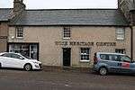
Wick Heritage Centre Wick, Bank Row 14/09/1983 ND3652550671 58°26′23″N 3°05′20″W / 58.439713°N 3.088922°W / 58.439713; -3.088922 (Wick Heritage Centre) [185] 42286

Upload another image
See more images

Dunbar Memorial, Wick Old Parish Church Wick, High Street ND3618851137 58°26′38″N 3°05′41″W / 58.443848°N 3.094823°W / 58.443848; -3.094823 (Dunbar Memorial, Wick Old Parish Church) [186] 44956
Road Viaduct at Leven Road Kinlochleven, Leven Road NN1827661893 56°42′48″N 4°58′15″W / 56.713248°N 4.970705°W / 56.713248; -4.970705 (Road Viaduct at Leven Road) [187] 46265
Kinlochleven Aluminium Works, Power House Kinlochleven NN1905061826 56°42′47″N 4°57′29″W / 56.712947°N 4.958031°W / 56.712947; -4.958031 (Kinlochleven Aluminium Works, Power House) [188] 49944
Eden Court Theatre Inverness, Bishop's Road NH6631644732 57°28′23″N 4°13′51″W / 57.473078°N 4.230821°W / 57.473078; -4.230821 (Eden Court Theatre) [189] 49959

Upload another image
See more images

Notes

  1. Sometimes known as OSGB36, the grid reference (where provided) is based on the British national grid reference system used by the Ordnance Survey.
    "Guide to National Grid". Ordnance Survey. Retrieved 2007-12-12.
    "Get-a-map". Ordnance Survey. Retrieved 2007-12-17.
  2. The "HB Number" is a unique number assigned to each listed building by Historic Scotland.

References

  1. Guide to the Protection of Scotland’s Listed Buildings (PDF). Historic Scotland. 2009. p. 4. ISBN 978-1-84917-013-0. Retrieved 2010-05-05.
  2. "What is Listing?". Historic Scotland. Retrieved 2010-05-05.
  3. 1 2 Scottish Historic Environment Policy (PDF). Historic Scotland. October 2008. pp. 24–25. ISBN 978-1-84917-002-4. Retrieved 2010-05-05.
  4. Guide to the Protection of Scotland’s Listed Buildings, p. 17.
  5. "Sluggan Bridge Over River Dulnain: Listed Building Report". Historic Scotland.
  6. "Muckrach Castle: Listed Building Report". Historic Scotland.
  7. "Rothiemurchus, Croft House: Listed Building Report". Historic Scotland.
  8. "Aviemore Railway Station With Island Platform, Footbridge And Fencing: Listed Building Report". Historic Scotland.
  9. "Broomhill Bridge Over River Spey: Listed Building Report". Historic Scotland.
  10. "Shin Viaduct Over Kyle Of Sutherland: Listed Building Report". Historic Scotland.
  11. "Arisaig, Borrodale Railway Viaduct Over The Borrodale Burn: Listed Building Report". Historic Scotland.
  12. "Castle Tiorim (Eilean Tiorim): Listed Building Report". Historic Scotland.
  13. "Eilean Fhianain, St Finnan's Chapel And Burial Ground: Listed Building Report". Historic Scotland.
  14. "Glenfinnan Monument: Listed Building Report". Historic Scotland.
  15. "Glenfinnan Railway Viaduct Over River Finnan: Listed Building Report". Historic Scotland.
  16. "Kinlochmoidart House: Listed Building Report". Historic Scotland.
  17. "(Old) Spey Bridge Over River Spey: Listed Building Report". Historic Scotland.
  18. "Castle Grant: Listed Building Report". Historic Scotland.
  19. "Castle Grant, East Lodge. Railway Bridge Over A939 Road And Entrance Arch To Drive.: Listed Building Report". Historic Scotland.
  20. "Rosehaugh Estate The Dairy: Listed Building Report". Historic Scotland.
  21. "Glendale Mill And Kiln (Now Museum): Listed Building Report". Historic Scotland.
  22. "Cape Wrath Lighthouse And Keepers' Cottages: Listed Building Report". Historic Scotland.
  23. "Dunvegan Parish Church (Church Of Scotland): Listed Building Report". Historic Scotland.
  24. "Dunvegan Castle, Approach Causeway And Bridges: Listed Building Report". Historic Scotland.
  25. "Dunvegan Castle The Laundry: Listed Building Report". Historic Scotland.
  26. "Balnakeil House, Walled Garden, Enclosing Walls And Gate Piers: Listed Building Report". Historic Scotland.
  27. "Ardnamurchan Lighthouse, Keepers' Houses, Sundial Former Steading And Enclosing Perimeter Wall: Listed Building Report". Historic Scotland.
  28. "Glenborrodale Castle Hotel, Garden Terraces, Stables And Walled Garden: Listed Building Report". Historic Scotland.
  29. "Kilchoan, Mingary Castle: Listed Building Report". Historic Scotland.
  30. "Aldourie Castle: Listed Building Report". Historic Scotland.
  31. "Nethy Bridge, Aultmore House Garden Pavilions Terrace Walls And Walled Garden: Listed Building Report". Historic Scotland.
  32. "Ardclach Bell Tower: Listed Building Report". Historic Scotland.
  33. "Dulsie Bridge (Over River Findhorn): Listed Building Report". Historic Scotland.
  34. "Glenferness House: Listed Building Report". Historic Scotland.
  35. "Logie Bridge, Ferness (Over River Findhorn): Listed Building Report". Historic Scotland.
  36. "Skibo Castle And Garden Terraces, Walled Garden And Glasshouses: Listed Building Report". Historic Scotland.
  37. "Embo House: Listed Building Report". Historic Scotland.
  38. "Boath House: Listed Building Report". Historic Scotland.
  39. "Brightmony House, Garden Walls With Garden House And Pair Gate Piers: Listed Building Report". Historic Scotland.
  40. "Culloden Moor, Memorial Cairn: Listed Building Report". Historic Scotland.
  41. "Clava, Nairn Viaduct Over The Nairn River, Otherwise Known As Culloden Moor Viaduct: Listed Building Report". Historic Scotland.
  42. "Dalcross Castle And Garden Wall: Listed Building Report". Historic Scotland.
  43. "Fort George: Listed Building Report". Historic Scotland.
  44. "Budgate House: Listed Building Report". Historic Scotland.
  45. "Cawdor Castle: Listed Building Report". Historic Scotland.
  46. "Cawdor Village Cawdor Parish Church And Burial Ground: Listed Building Report". Historic Scotland.
  47. "Coul House Hotel Formerly Coul House: Listed Building Report". Historic Scotland.
  48. "Contin Bridge Over River Black Water: Listed Building Report". Historic Scotland.
  49. "Canisbay Parish Church, Kirkstyle And Burial Ground. (St Drostan's Church Of Scotland): Listed Building Report". Historic Scotland.
  50. "Castle Of Mey And Garden Walls: Listed Building Report". Historic Scotland.
  51. "Freswick House Courtyard Walls: Listed Building Report". Historic Scotland.
  52. "Holme Rose: Listed Building Report". Historic Scotland.
  53. "Cromarty House: Listed Building Report". Historic Scotland.
  54. "Cromarty House Stables: Listed Building Report". Historic Scotland.
  55. "Kilravock Castle, Dovecote And Garden Walls: Listed Building Report". Historic Scotland.
  56. "White Bridge By Clephanton Over River Nairn: Listed Building Report". Historic Scotland.
  57. "Fort Augustus Abbey, Monastery And School: Listed Building Report". Historic Scotland.
  58. "Fort Augustus Abbey Church: Listed Building Report". Historic Scotland.
  59. "Oich, Old Bridge Over River Oich: Listed Building Report". Historic Scotland.
  60. "Whitebridge, Old Bridge Over River Foyers: Listed Building Report". Historic Scotland.
  61. "Dunnet Parish Church (Church Of Scotland) And Burial Ground: Listed Building Report". Historic Scotland.
  62. "Old Parish Church And Burial Ground: Listed Building Report". Historic Scotland.
  63. "Roybridge, Keppoch Barn: Listed Building Report". Historic Scotland.
  64. "Spean Bridge, Commando Memorial: Listed Building Report". Historic Scotland.
  65. "Gairlochy, Mucomir Bridge Over River Lochy: Listed Building Report". Historic Scotland.
  66. "Garvamore Barracks: Listed Building Report". Historic Scotland.
  67. "Garvamore, Garva Bridge Over River Spey (St George's Bridge): Listed Building Report". Historic Scotland.
  68. "Ardverikie House, Outbuildings, Game Larders, Boat House And Walled Garden: Listed Building Report". Historic Scotland.
  69. "Ardverikie Gate Lodge, Gate Piers And Bridge Over River Pattack: Listed Building Report". Historic Scotland.
  70. "Cluny Castle: Listed Building Report". Historic Scotland.
  71. "Plockton Innes Street Plockton Church (Church Of Scotland) And Graveyard: Listed Building Report". Historic Scotland.
  72. "Ardelve, 12 Lower Ardelve: Listed Building Report". Historic Scotland.
  73. "Mound Bridge And Keeper's Cottage: Listed Building Report". Historic Scotland.
  74. "Golspie Main Street St Andrew's Parish Church (Church Of Scotland And Burial Ground): Listed Building Report". Historic Scotland.
  75. "Dunrobin Castle: Listed Building Report". Historic Scotland.
  76. "Dunrobin Castle Garden Pavilion (Museum) And Walled Garden: Listed Building Report". Historic Scotland.
  77. "Caledonian Canal, Acqueduct Over The River Loy: Listed Building Report". Historic Scotland.
  78. "Caledonian Canal, Sluice By Carn Phail: Listed Building Report". Historic Scotland.
  79. "Caledonian Canal, Torcastle Acqueduct Over The Allt Sheangain: Listed Building Report". Historic Scotland.
  80. "Callert House: Listed Building Report". Historic Scotland.
  81. "Fasnakyle Power Station: Listed Building Report". Historic Scotland.
  82. "Glen Affric Lodge: Listed Building Report". Historic Scotland.
  83. "Beauly Priory: Listed Building Report". Historic Scotland.
  84. "Loth Parish Church (Church Of Scotland): Listed Building Report". Historic Scotland.
  85. "Bighouse, Garden Pavilion And Walled Garden: Listed Building Report". Historic Scotland.
  86. "Strathcarron Croick Parish Church (Church Of Scotland) And Burial Ground: Listed Building Report". Historic Scotland.
  87. "Helmsdale Bridge Over River Helmsdale: Listed Building Report". Historic Scotland.
  88. "Eilean Donan Castle: Listed Building Report". Historic Scotland.
  89. "Glenelg War Memorial: Listed Building Report". Historic Scotland.
  90. "40 Bornesketaig: Listed Building Report". Historic Scotland.
  91. "Bernera Barracks: Listed Building Report". Historic Scotland.
  92. "New Kelso House: Listed Building Report". Historic Scotland.
  93. "Ruthven Barracks And Stables: Listed Building Report". Historic Scotland.
  94. "Auchindrean Bridge, Over River Broom: Listed Building Report". Historic Scotland.
  95. "Ullapool Argyle Street Former Ullapool Parish Church And Burial Ground: Listed Building Report". Historic Scotland.
  96. "Fearn Abbey (Church Of Scotland Parish Church): Listed Building Report". Historic Scotland.
  97. "Kirkhill, Old Wardlaw Church With Lovat Burial Aisle And Burial Ground: Listed Building Report". Historic Scotland.
  98. "Castle Leod: Listed Building Report". Historic Scotland.
  99. "Tarbat House And Stables: Listed Building Report". Historic Scotland.
  100. "Kilmuir Easter Parish Church (Church Of Scotland) And Burial Ground: Listed Building Report". Historic Scotland.
  101. "Udrigle House: Listed Building Report". Historic Scotland.
  102. "Wyvis Lodge, Stables And Game Larders: Listed Building Report". Historic Scotland.
  103. "Flowerdale House (Including Westerdale) And Walled Garden: Listed Building Report". Historic Scotland.
  104. "Foulis Castle: Listed Building Report". Historic Scotland.
  105. "Foulis Point Granary: Listed Building Report". Historic Scotland.
  106. "The Corr: Listed Building Report". Historic Scotland.
  107. "Dunbeath Castle, Walled Gardens And Garden Pavilion: Listed Building Report". Historic Scotland.
  108. "Forse House Dovecote: Listed Building Report". Historic Scotland.
  109. "Laidhay Croft Museum Croft House And Barn: Listed Building Report". Historic Scotland.
  110. "Kilcoy Castle: Listed Building Report". Historic Scotland.
  111. "Old Allangrange: Listed Building Report". Historic Scotland.
  112. "Dochfour House: Listed Building Report". Historic Scotland.
  113. "Culloden House, Gate Piers And Gardeners' Bothy: Listed Building Report". Historic Scotland.
  114. "Inshes House, Tower House In Grounds: Listed Building Report". Historic Scotland.
  115. "Leys Castle And Garden Terraces: Listed Building Report". Historic Scotland.
  116. "Beaufort Castle: Listed Building Report". Historic Scotland.
  117. "Lovat Bridge Over River Beauly: Listed Building Report". Historic Scotland.
  118. "Culloden House Stables And Yard Wall: Listed Building Report". Historic Scotland.
  119. "Raasay House: Listed Building Report". Historic Scotland.
  120. "Ardtornish Estate Ardtornish Tower, Mansion And Clock Tower: Listed Building Report". Historic Scotland.
  121. "Armadale Castle Stables: Listed Building Report". Historic Scotland.
  122. "Fairburn Tower: Listed Building Report". Historic Scotland.
  123. "Nigg Parish Church (Church Of Scotland) And Graveyard: Listed Building Report". Historic Scotland.
  124. "Rait Castle: Listed Building Report". Historic Scotland.
  125. "Ackergill Tower, Garden Walls, Walled Gardens And Stable Range: Listed Building Report". Historic Scotland.
  126. "Keiss Harbour And Warehouse: Listed Building Report". Historic Scotland.
  127. "Noss Head Lighthouse Keepers' Houses And Offices: Listed Building Report". Historic Scotland.
  128. "Sibster Farm Steading: Listed Building Report". Historic Scotland.
  129. "Portmahomack Harbour Street Southern Warehouse: Listed Building Report". Historic Scotland.
  130. "Tarbat Ness Lighthouse, Keepers' Cottages And Enclosing Wall: Listed Building Report". Historic Scotland.
  131. "Ballone Castle: Listed Building Report". Historic Scotland.
  132. "Isle Of Rhum, Kinloch Castle: Listed Building Report". Historic Scotland.
  133. "Moy, Aultnaslanach Viaduct Over Allt Na Slanaich Burn: Listed Building Report". Historic Scotland.
  134. "Kinkell Castle And Surrounding Wall And Studio Cottage: Listed Building Report". Historic Scotland.
  135. "Castle Craig: Listed Building Report". Historic Scotland.
  136. "Newhall: Listed Building Report". Historic Scotland.
  137. "Poyntzfield House: Listed Building Report". Historic Scotland.
  138. "Achingale Mill: Listed Building Report". Historic Scotland.
  139. "Sandside House Kiln Barn And Single Storey Range Of Former Byres, Cottage And Dairy, And Implement Shed: Listed Building Report". Historic Scotland.
  140. "Sandside Harbour 1 And 2, Sandside And Fishing Store: Listed Building Report". Historic Scotland.
  141. "Reay Parish Church And Enclosure Wall: Listed Building Report". Historic Scotland.
  142. "Glenmoriston, Torgoyle Bridge Over River Moriston: Listed Building Report". Historic Scotland.
  143. "Glenurquhart, Corrimony Grange Barn: Listed Building Report". Historic Scotland.
  144. "Invermoriston, Home Farm And Former Barn To Rear.: Listed Building Report". Historic Scotland.
  145. "Urquhart Castle: Listed Building Report". Historic Scotland.
  146. "Ardross Castle, Terraces And Gate Piers: Listed Building Report". Historic Scotland.
  147. "Old Rosskeen Parish Church And Burial Ground: Listed Building Report". Historic Scotland.
  148. "Castle Stuart And Gatepiers: Listed Building Report". Historic Scotland.
  149. "Tongue Parish Church (C Of S ), Burial Ground And Gatepiers: Listed Building Report". Historic Scotland.
  150. "Tongue House: Listed Building Report". Historic Scotland.
  151. "Causeway, The Gardener's House And Garden Walls: Listed Building Report". Historic Scotland.
  152. "Church Street, Court House, Prison And Gatepiers: Listed Building Report". Historic Scotland.
  153. "Church Street, Miller House: Listed Building Report". Historic Scotland.
  154. "Church Street, Hugh Miller's Cottage: Listed Building Report". Historic Scotland.
  155. "Church Street, East Parish Church: Listed Building Report". Historic Scotland.
  156. "George Street, Lighthouse And Lighthouse Keeper's House: Listed Building Report". Historic Scotland.
  157. "Cromarty, High Street Townlands Barn: Listed Building Report". Historic Scotland.
  158. "Cromarty Harbour: Listed Building Report". Historic Scotland.
  159. "Tulloch Street, St Clements Church (C Of S Parish Church), Gatepiers And Burial Ground: Listed Building Report". Historic Scotland.
  160. "Caisteal Gorach: Listed Building Report". Historic Scotland.
  161. "Castle Street Dornoch Cathedral And Walled Grave Yard. (Cathedral Of St. Mary And St Gilbert. Church Of Scotland Parish Church): Listed Building Report". Historic Scotland.
  162. "Belford Road, Roman Catholic Church Of St. Mary And The Immaculate Conception And Enclosing Walls With Gate Piers.: Listed Building Report". Historic Scotland.
  163. "High Street, St Andrew's Episcopal Church, Burial Ground, Lych Gate (To High Street) And Entrance To Bank Street: Listed Building Report". Historic Scotland.
  164. "Chanonry Chanonry Lighthouse, Keeper's House, Wall And Gatepiers: Listed Building Report". Historic Scotland.
  165. "Fortrose Cathedral Square, Fortrose Cathedral (Ss. Peter And Bonifacius Graveyard And Walls: Listed Building Report". Historic Scotland.
  166. "Fortrose Cathedral Square Chapter House: Listed Building Report". Historic Scotland.
  167. "The Square Speyside Home (Former Orphanage): Listed Building Report". Historic Scotland.
  168. "28-34 (Even Nos Only) Academy Street: Listed Building Report". Historic Scotland.
  169. "2 Bridge Street And Church Street, Town Steeple: Listed Building Report". Historic Scotland.
  170. "Castle Wynd, Sheriff Court And Police Station, Castle Hill: Listed Building Report". Historic Scotland.
  171. "Church Street, Old High Church: Listed Building Report". Historic Scotland.
  172. "86 And 88 Church Street Dunbar's Hospital: Listed Building Report". Historic Scotland.
  173. "9 And 11 High Street Bank Of Scotland: Listed Building Report". Historic Scotland.
  174. "54-60 (Even Numbers Only) High Street: Listed Building Report". Historic Scotland.
  175. "High Street, Town House: Listed Building Report". Historic Scotland.
  176. "Huntly Street, St Mary's Rc Church: Listed Building Report". Historic Scotland.
  177. "Huntly Street, Balnain House: Listed Building Report". Historic Scotland.
  178. "Margaret Street, Former Farraline Park School: Listed Building Report". Historic Scotland.
  179. "Ness Walk, Cathedral Church Of St Andrew (Episcopal): Listed Building Report". Historic Scotland.
  180. "Academy Street, Old Parish Church: Listed Building Report". Historic Scotland.
  181. "Marine Road, Bandstand: Listed Building Report". Historic Scotland.
  182. "Castle Brae St Duthus Collegiate Church With St Duthus Church, Graveyard And Retaining Wall: Listed Building Report". Historic Scotland.
  183. "High Street Tolbooth And Sheriff Court: Listed Building Report". Historic Scotland.
  184. "Wilson Lane, Old St Peter`S Church And Burial Ground: Listed Building Report". Historic Scotland.
  185. "19 - 27 (Odd) Bank Row (Wick Heritage Centre): Listed Building Report". Historic Scotland.
  186. "High Street, Wick Old Parish Church Churchyard, Dunbar Memorial: Listed Building Report". Historic Scotland.
  187. "Kinlochleven, Road Viaduct At Leven Road: Listed Building Report". Historic Scotland.
  188. "Kinlochleven, Power House: Listed Building Report". Historic Scotland.
  189. "Ness Walk, Eden Court Theatre Including Sculpture: Listed Building Report". Historic Scotland.

Media related to Category A listed buildings in Highland (council area) at Wikimedia Commons

This article is issued from Wikipedia - version of the 9/22/2016. The text is available under the Creative Commons Attribution/Share Alike but additional terms may apply for the media files.