Lindenberg im Allgäu
| Lindenberg im Allgäu | ||
|---|---|---|
|
View of the town | ||
| ||
 Lindenberg im Allgäu | ||
Location of Lindenberg im Allgäu within Lindau district 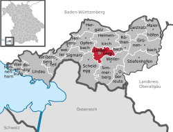 | ||
| Coordinates: 47°36′N 09°54′E / 47.600°N 9.900°ECoordinates: 47°36′N 09°54′E / 47.600°N 9.900°E | ||
| Country | Germany | |
| State | Bavaria | |
| Admin. region | Schwaben | |
| District | Lindau | |
| Government | ||
| • Mayor | Eric Ballerstedt (CSU) | |
| Area | ||
| • Total | 11.85 km2 (4.58 sq mi) | |
| Population (2015-12-31)[1] | ||
| • Total | 11,295 | |
| • Density | 950/km2 (2,500/sq mi) | |
| Time zone | CET/CEST (UTC+1/+2) | |
| Postal codes | 88161 | |
| Dialling codes | 08381 | |
| Vehicle registration | LI | |
| Website | www.lindenberg.de | |


Lindenberg im Allgäu is the second largest town of the district of Lindau in Bavaria, Germany. It is an acknowledged air health resort.
History
The town was first mentioned in 857, when two nobles donated in "Lintiberc" to the monastery of St. Gall.
In 1570, the Austrian branch of the House of Habsburg acquired the demesne of the heirless sovereignty of Altenburg, including Lindenberg, back then a consolidation of about 70 farms.
The city fell to Bavaria in 1805 as part of Napoleon's Treaty of Pressburg
As early as 1656 straw hats from Lindenberg were sold by peddling and in markets. In 1755, the production and shipping of straw hats became organized. The hat industry has declined in recent decades and now has hardly any economic importance. Hat making is still remembered today in an annual "Huttag" ("hat day") as well as in a hat museum.
Education
The main school of the Humboldt Institute is in Lindenberg.
Geographical Features
Waldsee
The Waldsee is one of the highest moors in Germany at 765.4 m (2511.2 ft). It was initially established as a fish pond in the Middle Ages, but today it is used as a swimming area.[2]
Economy
Important employers are:
- Liebherr-Aerospace Lindenberg GmbH
- Mayser GmbH & Co.KG
International relations
Lindenberg im Allgäu is twinned with:
- 1999: Vallauris-Golfe-Juan
 France
 - 2003: Saline, Michigan
 USA
USA
Notable people from Lindenberg
- Heike Allgayer (born 1969), physician and molecular biologist
- Arthur Burkhard (born 1928], picture journalist
- Anton Fehr (1881–1954), agricultural scientist and politician
- Otto Geßler (1875–1955), politician and president of the German Red Cross
- Klaus Gietinger (born 1955), film director and script writer
- Stephan Huber (born 1952), sculptor
- Markus Miller (born 1982), football goalkeeper
- Johann Georg Specht (1720–1803), architect
- Werner Specht (born 1942), painter and chansonnier
- Tobias Steinhauser (born 1972), Cyclist
Towns and municipalities in Lindau | ||
|---|---|---|