Lincoln County, New Mexico
| Lincoln County, New Mexico | ||
|---|---|---|
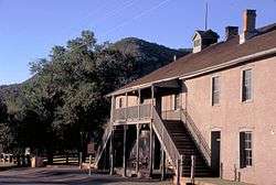 Old Lincoln County courthouse in Lincoln | ||
| ||
 Location in the U.S. state of New Mexico | ||
 New Mexico's location in the U.S. | ||
| Founded | 1869 | |
| Named for | Abraham Lincoln[1] | |
| Seat | Carrizozo | |
| Largest village | Ruidoso | |
| Area | ||
| • Total | 4,831 sq mi (12,512 km2) | |
| • Land | 4,831 sq mi (12,512 km2) | |
| • Water | 0.2 sq mi (1 km2), 0.0% | |
| Population | ||
| • (2010) | 20,497 | |
| • Density | 4.2/sq mi (2/km²) | |
| Congressional district | 2nd | |
| Time zone | Mountain: UTC-7/-6 | |
| Website |
www | |

Lincoln County is a county located in the U.S. state of New Mexico. As of the 2010 census, the population was 20,497.[2] Its county seat is Carrizozo,[3] while its largest community is Ruidoso.
History
It was once the largest county in the United States. In the late 1870s the so-called Lincoln County War broke out between ranchers and the owners of the county's largest general store. William Bonney, better known as Billy the Kid, became involved on the side of the ranchers after his friend and employer was killed. In the end, Bonney killed the deputy that killed his friend, another deputy, and the county sheriff. Several other people were slain in the conflict, which included the other leader of the rancher faction. His death ended the conflict. In 1878, the new territorial governor, retired Union General Lew Wallace, offered an amnesty to the combatants in order to bring a long-lasting truce between the factions.
Today, Lincoln County is a much more peaceful county. Most of the population is centered in the southern portion of the county in the Greater Ruidoso Area. The town of Carrizozo serves as the county seat and is located in the Tularosa Basin northwest of Ruidoso. Ruidoso boasts several small suburbs and neighbor communities including Ruidoso Downs, Hollywood, Mescalero, and Alto which contribute to the Ruidoso Micropolitan Statistical Area's population of 21,224. Ruidoso serves as the second largest city in south central New Mexico behind Alamogordo which is 46 miles southwest of the village. Ruidoso Downs located on the southern end of the county and southeast of Ruidoso operates the Ruidoso Downs Racetrack and Casino. The track hosts both thoroughbred and quarter horse racing, notably the All American Futurity, the richest race in quarter horse racing. Historical figures from Lincoln County include Billy the Kid and Smokey Bear, whose names help drive the tourism trade that is heavily popularized within the county.
Geography
According to the U.S. Census Bureau, the county has a total area of 4,831 square miles (12,510 km2), virtually all of which is land.[4]
Adjacent counties
- Torrance County - north
- Guadalupe County - north
- De Baca County - northeast
- Chaves County - east
- Otero County - south
- Sierra County - southwest
- Socorro County - west
National protected areas
- Cibola National Forest (part)
- Fort Stanton – Snowy River Cave National Conservation Area
- Lincoln National Forest (part)
Demographics
| Historical population | |||
|---|---|---|---|
| Census | Pop. | %± | |
| 1910 | 7,822 | — | |
| 1920 | 7,823 | 0.0% | |
| 1930 | 7,198 | −8.0% | |
| 1940 | 8,557 | 18.9% | |
| 1950 | 7,409 | −13.4% | |
| 1960 | 7,744 | 4.5% | |
| 1970 | 7,560 | −2.4% | |
| 1980 | 10,997 | 45.5% | |
| 1990 | 12,219 | 11.1% | |
| 2000 | 19,411 | 58.9% | |
| 2010 | 20,497 | 5.6% | |
| Est. 2015 | 19,420 | [5] | −5.3% |
| U.S. Decennial Census[6] 1790-1960[7] 1900-1990[8] 1990-2000[9] 2010-2013[2] | |||
2000 census
As of the census[10] of 2000, there were 19,411 people, 8,202 households, and 5,634 families residing in the county. The population density was 4 people per square mile (2/km²). There were 15,298 housing units at an average density of 3 per square mile (1/km²). The racial makeup of the county was 83.60% White, 0.35% Black or African American, 1.95% Native American, 0.27% Asian, 0.06% Pacific Islander, 11.28% from other races, and 2.48% from two or more races. 25.63% of the population were Hispanic or Latino of any race.
There were 8,202 households out of which 26.20% had children under the age of 18 living with them, 55.60% were married couples living together, 9.30% had a female householder with no husband present, and 31.30% were non-families. 26.70% of all households were made up of individuals and 10.00% had someone living alone who was 65 years of age or older. The average household size was 2.34 and the average family size was 2.80.
In the county the population was spread out with 22.70% under the age of 18, 6.00% from 18 to 24, 23.20% from 25 to 44, 30.20% from 45 to 64, and 17.90% who were 65 years of age or older. The median age was 44 years. For every 100 females there were 95.90 males. For every 100 females age 18 and over, there were 93.30 males.
The median income for a household in the county was $33,886, and the median income for a family was $40,035. Males had a median income of $27,323 versus $19,923 for females. The per capita income for the county was $19,338. About 10.80% of families and 14.90% of the population were below the poverty line, including 24.70% of those under age 18 and 8.70% of those age 65 or over.
2010 census
As of the 2010 United States Census, there were 20,497 people, 9,219 households, and 5,859 families residing in the county.[11] The population density was 4.2 inhabitants per square mile (1.6/km2). There were 17,519 housing units at an average density of 3.6 per square mile (1.4/km2).[12] The racial makeup of the county was 85.1% white, 2.4% American Indian, 0.5% black or African American, 0.4% Asian, 9.2% from other races, and 2.5% from two or more races. Those of Hispanic or Latino origin made up 29.8% of the population.[11] In terms of ancestry, 17.0% were Irish, 15.6% were German, 12.3% were English, and 4.8% were American.[13]
Of the 9,219 households, 23.3% had children under the age of 18 living with them, 49.5% were married couples living together, 9.8% had a female householder with no husband present, 36.4% were non-families, and 30.5% of all households were made up of individuals. The average household size was 2.21 and the average family size was 2.72. The median age was 49.4 years.[11]
The median income for a household in the county was $43,750 and the median income for a family was $53,871. Males had a median income of $34,306 versus $29,836 for females. The per capita income for the county was $24,290. About 8.1% of families and 12.9% of the population were below the poverty line, including 20.7% of those under age 18 and 7.8% of those age 65 or over.[14]
Communities
City
Town
- Carrizozo (county seat)
Villages
Census-designated place
Other communities
Ghost town
See also
References
- ↑ Gannett, Henry (1905). The Origin of Certain Place Names in the United States. U.S. Government Printing Office. p. 187.
- 1 2 "State & County QuickFacts". United States Census Bureau. Retrieved September 29, 2013.
- ↑ "Find a County". National Association of Counties. Retrieved June 7, 2011.
- ↑ "2010 Census Gazetteer Files". United States Census Bureau. August 22, 2012. Retrieved January 2, 2015.
- ↑ "County Totals Dataset: Population, Population Change and Estimated Components of Population Change: April 1, 2010 to July 1, 2015". Retrieved July 2, 2016.
- ↑ "U.S. Decennial Census". United States Census Bureau. Retrieved January 2, 2015.
- ↑ "Historical Census Browser". University of Virginia Library. Retrieved January 2, 2015.
- ↑ "Population of Counties by Decennial Census: 1900 to 1990". United States Census Bureau. Retrieved January 2, 2015.
- ↑ "Census 2000 PHC-T-4. Ranking Tables for Counties: 1990 and 2000" (PDF). United States Census Bureau. Retrieved January 2, 2015.
- ↑ "American FactFinder". United States Census Bureau. Retrieved January 31, 2008.
- 1 2 3 "DP-1 Profile of General Population and Housing Characteristics: 2010 Demographic Profile Data". United States Census Bureau. Retrieved 2016-01-24.
- ↑ "Population, Housing Units, Area, and Density: 2010 - County". United States Census Bureau. Retrieved 2016-01-24.
- ↑ "DP02 SELECTED SOCIAL CHARACTERISTICS IN THE UNITED STATES – 2006-2010 American Community Survey 5-Year Estimates". United States Census Bureau. Retrieved 2016-01-24.
- ↑ "DP03 SELECTED ECONOMIC CHARACTERISTICS – 2006-2010 American Community Survey 5-Year Estimates". United States Census Bureau. Retrieved 2016-01-24.
 |
Torrance County and Guadalupe County | De Baca County | | |
| Socorro County | |
Chaves County | ||
| ||||
| | ||||
| Sierra County | Otero County |
Municipalities and communities of Lincoln County, New Mexico, United States | ||
|---|---|---|
| City | | |
| Town | ||
| Villages | ||
| CDP | ||
| Other unincorporated communities | ||
| Ghost town | ||
Santa Fe (capital) | |
| Topics |
|
| Society | |
| Regions | |
| Cities | |
| Counties | |
Coordinates: 33°44′N 105°28′W / 33.74°N 105.46°W