Ligueil
| Ligueil | ||
|---|---|---|
|
The church in Ligueil | ||
| ||
 Ligueil | ||
|
Location within Centre-Val de Loire region  Ligueil | ||
| Coordinates: 47°02′37″N 0°49′11″E / 47.0436°N 0.8197°ECoordinates: 47°02′37″N 0°49′11″E / 47.0436°N 0.8197°E | ||
| Country | France | |
| Region | Centre-Val de Loire | |
| Department | Indre-et-Loire | |
| Arrondissement | Loches | |
| Canton | Ligueil | |
| Government | ||
| • Mayor (2008–2014) | Christian Grellet | |
| Area1 | 29.72 km2 (11.47 sq mi) | |
| Population (2009)2 | 2,212 | |
| • Density | 74/km2 (190/sq mi) | |
| Time zone | CET (UTC+1) | |
| • Summer (DST) | CEST (UTC+2) | |
| INSEE/Postal code | 37130 / 37240 | |
| Elevation | 66–128 m (217–420 ft) | |
|
1 French Land Register data, which excludes lakes, ponds, glaciers > 1 km² (0.386 sq mi or 247 acres) and river estuaries. 2 Population without double counting: residents of multiple communes (e.g., students and military personnel) only counted once. | ||

.svg.png)
Ligueil is a commune in the Indre-et-Loire department in central France.
Geography
Ligueil is close to the former border of Vichy France.
International relations
Twin towns – Sister cities
Ligueil is twinned with:
 Hungerford, United Kingdom[1]
Population
| Historical population | ||
|---|---|---|
| Year | Pop. | ±% |
| 1793 | 1,660 | — |
| 1800 | 1,962 | +18.2% |
| 1806 | 1,466 | −25.3% |
| 1821 | 1,751 | +19.4% |
| 1831 | 1,767 | +0.9% |
| 1836 | 1,887 | +6.8% |
| 1841 | 1,929 | +2.2% |
| 1846 | 1,944 | +0.8% |
| 1851 | 2,044 | +5.1% |
| 1856 | 1,942 | −5.0% |
| 1861 | 1,999 | +2.9% |
| 1866 | 2,058 | +3.0% |
| 1872 | 2,014 | −2.1% |
| 1876 | 2,142 | +6.4% |
| 1881 | 2,048 | −4.4% |
| 1886 | 2,048 | +0.0% |
| 1891 | 2,192 | +7.0% |
| 1896 | 2,119 | −3.3% |
| 1901 | 2,083 | −1.7% |
| 1906 | 2,194 | +5.3% |
| 1911 | 2,179 | −0.7% |
| 1921 | 1,981 | −9.1% |
| 1926 | 1,988 | +0.4% |
| 1931 | 2,017 | +1.5% |
| 1936 | 2,028 | +0.5% |
| 1946 | 2,117 | +4.4% |
| 1954 | 2,023 | −4.4% |
| 1962 | 2,110 | +4.3% |
| 1968 | 2,245 | +6.4% |
| 1975 | 2,379 | +6.0% |
| 1982 | 2,413 | +1.4% |
| 1990 | 2,201 | −8.8% |
| 1999 | 2,166 | −1.6% |
| 2006 | 2,155 | −0.5% |
| 2009 | 2,212 | +2.6% |
See also
References
- ↑ "British towns twinned with French towns". Archant Community Media Ltd. Retrieved 2013-07-11.
 Ligueil
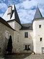 Ligueil
 Ligueil
 Ligueil
 Ligueil
 Ligueil
 Ligueil
| Wikimedia Commons has media related to Ligueil. |
This article is issued from Wikipedia - version of the 2/18/2015. The text is available under the Creative Commons Attribution/Share Alike but additional terms may apply for the media files.