Lickbla (civil parish)
| Lickbla | |
|---|---|
| Civil parish | |
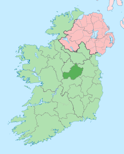
 Lickbla Location of Lickbla within County Westmeath in the Republic of Ireland | |
| Coordinates: 53°43′56″N 7°20′36″W / 53.73222°N 7.34333°WCoordinates: 53°43′56″N 7°20′36″W / 53.73222°N 7.34333°W | |
| Country |
|
| Province | Leinster |
| County | County Westmeath |
| Irish grid reference | N433760 |
Lickbla is a civil parish in County Westmeath, Ireland. It is located about 23.05 kilometres (14 mi) north of Mullingar.
Lickbla is one of 8 civil parishes in the barony of Fore in the Province of Leinster. The civil parish covers 8,819.5 acres (35.691 km2).
Lickbla civil parish comprises 24 townlands: Ardnagross, Ballynagall, Ballynagall Little, Ballynameagh, Balrath, Bigwood, Camagh, Carlanstown, Castletown Lower, Castletown Upper, Clonrobert, Clonsura, Curry, Derrycrave, Doon, Gilbertstown, Lickbla, Littlewood, Martinstown, Mullagh, Newcastle, Rathcreevagh, Robinstown and Rochestown.
The neighbouring civil parishes are: Foyran to the north, Rathgarve to the east and south, Mayne to the south, Street to the south and west and Abbeylara (County Longford) to the west.[1][2][3]
References
- ↑ Lickbla civil parish townlands.ie Retrieved on 21 July 2015.
- ↑ Lickbla civil parish The IreAtlas Townland Database. Retrieved on 21 July 2015
- ↑ Lickbla civil parish The Placename Database of Ireland. Retrieved on 21 July 2015
External links
- Lickbla civil parish at the IreAtlas Townland Data Base
- Lickbla civil parish at townlands.ie
- Lickbla civil parish at The Placename Database of Ireland