Liberty Township, Putnam County, Ohio
| Liberty Township, Putnam County, Ohio | |
|---|---|
| Township | |
|
Stubble field just southwest of West Leipsic | |
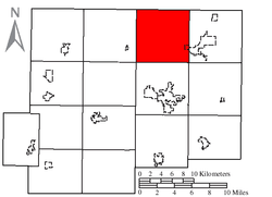 Location of Liberty Township in Putnam County | |
| Coordinates: 41°7′3″N 84°2′38″W / 41.11750°N 84.04389°WCoordinates: 41°7′3″N 84°2′38″W / 41.11750°N 84.04389°W | |
| Country | United States |
| State | Ohio |
| County | Putnam |
| Area | |
| • Total | 36.4 sq mi (94.3 km2) |
| • Land | 36.4 sq mi (94.3 km2) |
| • Water | 0.0 sq mi (0.0 km2) |
| Elevation[1] | 768 ft (234 m) |
| Population (2000) | |
| • Total | 1,575 |
| • Density | 43.2/sq mi (16.7/km2) |
| Time zone | Eastern (EST) (UTC-5) |
| • Summer (DST) | EDT (UTC-4) |
| FIPS code | 39-43288[2] |
| GNIS feature ID | 1086861[1] |

Liberty Township is one of the fifteen townships of Putnam County, Ohio, United States. The 2000 census found 1,575 people in the township, 1,304 of whom lived in the unincorporated portions of the township.[3]
Geography
Located in the northern part of the county, it borders the following townships:
- Marion Township, Henry County - north
- Bartlow Township, Henry County - northeast corner
- Van Buren Township - east
- Blanchard Township - southeast corner
- Ottawa Township - south
- Greensburg Township - southwest corner
- Palmer Township - west
- Pleasant Township, Henry County - northwest corner
The village of West Leipsic is located in far eastern Liberty Township.
Name and history
Liberty Township was established in 1837.[4] It is one of twenty-five Liberty Townships statewide.[5]
Government
The township is governed by a three-member board of trustees, who are elected in November of odd-numbered years to a four-year term beginning on the following January 1. Two are elected in the year after the presidential election and one is elected in the year before it. There is also an elected township fiscal officer,[6] who serves a four-year term beginning on April 1 of the year after the election, which is held in November of the year before the presidential election. Vacancies in the fiscal officership or on the board of trustees are filled by the remaining trustees.
References
- 1 2 "US Board on Geographic Names". United States Geological Survey. 2007-10-25. Retrieved 2008-01-31.
- ↑ "American FactFinder". United States Census Bureau. Archived from the original on September 11, 2013. Retrieved 2008-01-31.
- ↑ Putnam County, Ohio — Population by Places Estimates Ohio State University, 2007. Accessed 15 May 2007.
- ↑ Kinder, George D. (1915). History of Putnam County, Ohio : its peoples, industries, and institutions. B.F. Bowen. p. 123.
- ↑ "Detailed map of Ohio" (PDF). United States Census Bureau. 2000. Retrieved 2007-02-16.
- ↑ §503.24, §505.01, and §507.01 of the Ohio Revised Code. Accessed 4/30/2009.
External links
Municipalities and communities of Putnam County, Ohio, United States | ||
|---|---|---|
| Villages |  | |
| Townships | ||
| CDP | ||
| Unincorporated communities | ||
| Ghost towns | ||