Lee Township, Brown County, Illinois
| Lee Township | |
|---|---|
| Township | |
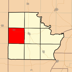 Location in Brown County | |
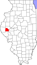 Brown County's location in Illinois | |
| Coordinates: 39°58′30″N 90°51′01″W / 39.97500°N 90.85028°WCoordinates: 39°58′30″N 90°51′01″W / 39.97500°N 90.85028°W | |
| Country | United States |
| State | Illinois |
| County | Brown |
| Established | November 8, 1853 |
| Area | |
| • Total | 37.67 sq mi (97.6 km2) |
| • Land | 37.63 sq mi (97.5 km2) |
| • Water | 0.04 sq mi (0.1 km2) 0.11% |
| Elevation | 728 ft (222 m) |
| Population (2010) | |
| • Total | 326 |
| • Density | 8.7/sq mi (3.4/km2) |
| Time zone | CST (UTC-6) |
| • Summer (DST) | CDT (UTC-5) |
| ZIP codes | 62353, 62375 |
| GNIS feature ID | 0429239 |
Lee Township is one of nine townships in Brown County, Illinois, USA. As of the 2010 census, its population was 326 and it contained 158 housing units.[1]
Geography
According to the 2010 census, the township has a total area of 37.67 square miles (97.6 km2), of which 37.63 square miles (97.5 km2) (or 99.89%) is land and 0.04 square miles (0.10 km2) (or 0.11%) is water.[1]
Cities
Unincorporated towns
Cemeteries
The township contains these seven cemeteries: Ausmus, Buckhorn, Cleaves, Fargo, Howe, Lee and Orton.
Major highways
Airports and landing strips
- Brown County Flyers Association Airport
- Mayfield Landing Strip
School districts
- Brown County Community Unit School District 1
Political districts
- Illinois' 18th congressional district
- State House District 93
- State Senate District 47
References
- "Lee Township, Brown County, Illinois". Geographic Names Information System. United States Geological Survey. Retrieved 2010-01-04.
- United States Census Bureau 2007 TIGER/Line Shapefiles
- United States National Atlas
- 1 2 "Population, Housing Units, Area, and Density: 2010 - County -- County Subdivision and Place -- 2010 Census Summary File 1". United States Census. Retrieved 2013-05-28.
External links
 |
Clayton Township, Adams County | Pea Ridge Township | | |
| Concord Township, Adams County | |
Mount Sterling Township | ||
| ||||
| | ||||
| Buckhorn Township | Elkhorn Township |
Municipalities and communities of Brown County, Illinois, United States | ||
|---|---|---|
| Cities | ||
| Villages | ||
| Townships | ||
| Unincorporated communities | ||
| Ghost towns | ||
This article is issued from Wikipedia - version of the 6/26/2015. The text is available under the Creative Commons Attribution/Share Alike but additional terms may apply for the media files.