Larsen Bay, Alaska
| Larsen Bay Uyaqsaq | |
|---|---|
| City | |
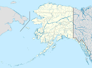 Larsen Bay Location in Alaska | |
| Coordinates: 57°32′12″N 153°59′29″W / 57.53667°N 153.99139°WCoordinates: 57°32′12″N 153°59′29″W / 57.53667°N 153.99139°W | |
| Country | United States |
| State | Alaska |
| Borough | Kodiak Island |
| Incorporated | 1974[1] |
| Government | |
| • Mayor | David Harmes[2] |
| • State senator | Gary Stevens (R) |
| • State rep. | Louise Stutes (R) |
| Area | |
| • Total | 7.6 sq mi (19.8 km2) |
| • Land | 5.4 sq mi (14.1 km2) |
| • Water | 2.2 sq mi (5.7 km2) |
| Elevation | 3 ft (1 m) |
| Population (2010) | |
| • Total | 87 |
| • Density | 16.1/sq mi (6.2/km2) |
| Time zone | Alaska (AKST) (UTC-9) |
| • Summer (DST) | AKDT (UTC-8) |
| ZIP code | 99624 |
| Area code | 907 |
| FIPS code | 02-43040 |
Larsen Bay (Uyaqsaq[3] in Alutiiq) is a city in Kodiak Island Borough, Alaska, United States. At the 2010 census the population was 87.
Geography
Larsen Bay is located at 57°32′12″N 153°59′29″W / 57.53667°N 153.99139°W (57.536651, -153.991440).[4]
According to the United States Census Bureau, the city has a total area of 7.6 square miles (20 km2), of which, 5.4 square miles (14 km2) of it is land and 2.2 square miles (5.7 km2) of it (28.7%) is water.
Demographics
| Historical population | |||
|---|---|---|---|
| Census | Pop. | %± | |
| 1940 | 38 | — | |
| 1950 | 53 | 39.5% | |
| 1960 | 72 | 35.8% | |
| 1980 | 168 | — | |
| 1990 | 147 | −12.5% | |
| 2000 | 115 | −21.8% | |
| 2010 | 87 | −24.3% | |
| Est. 2015 | 88 | [5] | 1.1% |
As of the census[7] of 2000, there were 115 people, 40 households, and 26 families residing in the city. The population density was 21.1 people per square mile (8.2/km²). There were 70 housing units at an average density of 12.9 per square mile (5.0/km²). The racial makeup of the city was 20.87% White, 78.26% Native American, and 0.87% from two or more races.
There were 40 households out of which 42.5% had children under the age of 18 living with them, 45.0% were married couples living together, 12.5% had a female householder with no husband present, and 35.0% were non-families. 27.5% of all households were made up of individuals and 5.0% had someone living alone who was 65 years of age or older. The average household size was 2.88 and the average family size was 3.54.
In the city the age distribution of the population shows 38.3% under the age of 18, 4.3% from 18 to 24, 28.7% from 25 to 44, 19.1% from 45 to 64, and 9.6% who were 65 years of age or older. The median age was 29 years. For every 100 females there were 113.0 males. For every 100 females age 18 and over, there were 102.9 males.
The median income for a household in the city was $40,833, and the median income for a family was $30,000. Males had a median income of $31,250 versus $50,625 for females. The per capita income for the city was $16,227. There were 27.3% of families and 20.5% of the population living below the poverty line, including 22.6% of under eighteen and 33.3% of those over 64.
References
- ↑ 1996 Alaska Municipal Officials Directory. Juneau: Alaska Municipal League/Alaska Department of Community and Regional Affairs. January 1996. p. 91.
- ↑ 2015 Alaska Municipal Officials Directory. Juneau: Alaska Municipal League. 2015. p. 97.
- ↑ ANLC : Alaska Native Place Names
- ↑ "US Gazetteer files: 2010, 2000, and 1990". United States Census Bureau. 2011-02-12. Retrieved 2011-04-23.
- ↑ "Annual Estimates of the Resident Population for Incorporated Places: April 1, 2010 to July 1, 2015". Retrieved July 2, 2016.
- ↑ "Census of Population and Housing". Census.gov. Retrieved June 4, 2015.
- ↑ "American FactFinder". United States Census Bureau. Retrieved 2008-01-31.
Municipalities and communities of Kodiak Island Borough, Alaska, United States | ||
|---|---|---|
| Cities | 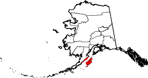 | |
| CDPs | ||
| Ghost towns | ||
