Lake Rosebery (Tasmania)
| Lake Rosebery | |
|---|---|
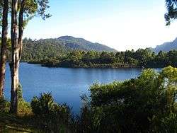 A view of Lake Rosebery | |
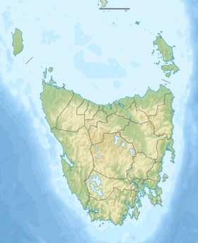 Lake Rosebery Location in Tasmania | |
| Location | West Coast, Tasmania, Australia |
| Coordinates | 41°44′11″S 145°32′00″E / 41.73639°S 145.53333°E |
| Type | Reservoir |
| Etymology | Rosebery, Tasmania |
| Primary inflows | |
| Primary outflows | Pieman River |
| First flooded | 1980 |
| Surface area | 850 hectares (2,100 acres)[1] |
| Water volume | 96,910 megalitres (3,422×106 cu ft)[2] |
| References | [2] |
Lake Rosebery is a man-made reservoir located in the West Coast region of Tasmania, Australia. The reservoir was formed by the damming of the Pieman River by the Bastyan Dam by Hydro Tasmania, near the village of Tullah. Feeder rivers include the dammed Mackintosh and Murchison rivers.
The diverted Emu Bay Railway line and the Wee Georgie Wood Railway line run close to the lake.
See also
References
- ↑ "Map of Lake Rosebery, TAS". Bonzle Digital Atlas of Australia. Retrieved 21 June 2016.
- 1 2 "Register of Large Dams in Australia" (Excel (requires download)). Dams information. Australian National Committee on Large Dams. 2010. Retrieved 23 June 2015.
Further reading
- Hepper, Marriott & Associates (1984). Lake Rosebery recreation development plan. Hobart: Hepper, Marriott. ISBN 1-86252-515-3.
- "Pieman Sustainability Review: Information review of the Anthony-Pieman hydropower scheme" (PDF). Hydro Tasmania. February 2015.
This article is issued from Wikipedia - version of the 6/21/2016. The text is available under the Creative Commons Attribution/Share Alike but additional terms may apply for the media files.