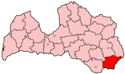
Krāslava District
| Krāslava | |
|---|---|
| District | |
 | |
| Country | Latvia |
| Area | |
| • Total | 2,285 km2 (882 sq mi) |
| Population | |
| • Total | 36,836 |
| • Density | 16/km2 (42/sq mi) |
Krāslava District (Latvian: Krāslavas rajons) was an administrative division of Latvia, located in Latgale region, in the country's east. It was organized into two cities and twenty three parishes, each with a local government authority.[1] The main city in the district was Krāslava.
The district was eliminated during the administrative-territorial reform in 2009, most of its part being divided between Dagda and Krāslava municipalities and three parishes in north-west joining Aglona Municipality.
Cities, municipalities and parishes of Krāslava District
^ In 2001, the two were amalgamated into Krāslava Municipality (a unit of local government within the two-tier Krāslava District).
References
- ↑ "Pašvaldības" (in Latvian). kraslavasrajons.lv. Retrieved 3 March 2008.
Coordinates: 55°53′N 27°10′E / 55.883°N 27.167°E
This article is issued from Wikipedia - version of the 5/27/2013. The text is available under the Creative Commons Attribution/Share Alike but additional terms may apply for the media files.