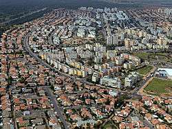
Kiryat Gat
Kiryat Gat
| |||
|---|---|---|---|
| Hebrew transcription(s) | |||
| • ISO 259 | Qiryat Gat | ||
 | |||
| |||
 Kiryat Gat Location of Kiryat Gat in Israel | |||
| Coordinates: 31°36′22″N 34°46′18″E / 31.60611°N 34.77167°ECoordinates: 31°36′22″N 34°46′18″E / 31.60611°N 34.77167°E | |||
| District | Southern | ||
| Founded | 1954 | ||
| Government | |||
| • Type | City | ||
| • Mayor | Aviram Dahari | ||
| Area | |||
| • Total | 17,102 dunams (17.102 km2 or 6.603 sq mi) | ||
| Population (2015)[1] | |||
| • Total | 51,483 | ||
| Website | www.qiryat-gat.muni.il | ||


Kiryat Gat (Hebrew: קִרְיַת גַּת), is a city in the Southern District of Israel. It lies 56 km (35 miles) south of Tel Aviv, 43 km (27 mi) north of Beersheba, 45 km (28 mi) from Gaza, and 68 km (42 mi) from Jerusalem. In 2015 it had a population of 51,483.
Etymology
Kiryat Gat is named for Gath, one of the five major cities of the Philistines. In Hebrew, "gat" means "winepress". In the 1950s, archaeologists found ruins at a nearby tell which were mistaken for the Philistine city of Gath. The location most favored for Gath now is Tel es-Safi, thirteen kilometers (8.1 miles) to the northeast.[2]
History

Kiryat Gat was founded in 1954, initially as a ma'abara. The following year it was established as a development town by 18 families from Morocco.[3] It was founded just west of the ruins of the Arab village of Iraq al-Manshiyya, which was depopulated in 1949 after the 1948 Arab–Israeli War.[4][5] The former location of Iraq al-Manshiyya is now within the built-up area of Kiryat Gat.[5][6] By 1992, Kiryat Gat had grown and spread also on to the land formerly belonged to the village of Al-Faluja.[7]
The population rose from 4,400 inhabitants in 1958 to 17,000 in 1969, mostly Jewish immigrants from North Africa. The economy was initially based on processing the agricultural produce of the Lachish region, such as cotton and wool. In December 1972, Kiryat Gat's municipal status was upgraded and it became Israel's 31st city.[8]
During the 1990s, the mass immigration of Soviet Jews to Israel brought many new residents to the town and its population grew to 42,500 by 1995.[9] The development of the Rabin industrial zone on the eastern edge of the city, and the opening of Highway 6 further improved the economy of the city.
Demographics
In 2012, the ethnic makeup of the city was 93.8 percent Jewish.[10] In its early years, Kiryat Gat was populated mainly by Jews of Sephardi/Mizrahi origin. Since the mass immigration of Soviet Jews, approximately one third of the inhabitants hail from the former Soviet Union.[11]
Economy
The Polgat textile factory was the main employer in the town until it closed in the 1990s. In 1999, Intel opened a chip fabrication plant, known as Fab 18, to produce Pentium 4 chips and flash memories. Intel received a grant of $525 million from the Israeli government to build the plant. In February 2006, the cornerstone was laid for Intel's second Kiryat Gat plant, Fab 28. Despite this, Kiryat Gat has one of Israel's highest unemployment rates.[11][12]
Transportation

Kiryat Gat is served by the Kiryat Gat Railway Station on the Tel Aviv - Be'er Sheva inter-city line of Israel Railways. Kiryat Gat is situated between two major highways, Highway 40 to the west of the town and Highway 6.
Schools and education
Kiryat Gat has 25 schools with an enrollment of 10,676. Of these schools, 18 are elementary schools with a student population of 5,498, and 13 are high schools with a student population of 5,178. In 2001, 54.7% of Kiryat Gat's 12th grade students graduated with a matriculation certificate. Kiryat Gat has a Pedagogic Center, science centers, a computerized library and a center devoted to industry, art and technology.[3] In 2012, a high school student from Kiryat Gat won first prize in the First Step to Nobel Prize in Physics competition.[13]
Twin towns — Sister cities
Kiryat Gat is twinned with:
Notable people

- Tali Fahima (born 1976), left-wing activist
- Adi Nes (born 1966), photographer
- Miri Regev (born 1965), politician and a former Brigadier General
- Ninet Tayeb (born 1983), singer and actress
References
| Wikimedia Commons has media related to Kiryat Gat. |
- ↑ "List of localities, in Alphabetical order" (PDF). Israel Central Bureau of Statistics. Retrieved 16 October 2016.
- ↑ Horton Harris (2011). "The location of Ziklag: a review of the candidate sites, based on Biblical, topographical and archaeological evidence". Palestine Exploration Quarterly. 143 (2): 119–133. doi:10.1179/003103211x12971861556954.
- 1 2 "Partnership 2000, Kiryat Gat". Jewish United Fund. Retrieved 2008-10-20.
- ↑ Khalidi, Walid (1992). All That Remains. Washington D.C.: Institute for Palestine Studies. p. 108. ISBN 0-88728-224-5.
- 1 2 Sheet Hebron of 100,000 topological map series, Survey of Israel, 1956.
- ↑ Google maps.
- ↑ Khalidi, 1992, p. 97
- ↑ Ed. Cecil Roth (ed.). "Kiryat Gat". Encyclopaedia Judaica (CD-ROM Edition Version 1.0). Keter Publishing House. ISBN 965-07-0665-8.
- ↑ "Kiryat Gat- Municipality Profile" (PDF) (in Hebrew). Israel Central Bureau of Statistics. 2005. Retrieved 2007-06-27.
- ↑ "Local Authorities in Israel 2012, Publication No. 1573. Kiryat Gat" הרשויות המקומיות בישראל 2012, פרסום מס' 1573. קריית גת (PDF) (in Hebrew). הלשכה המרכזית לסטטיסטיקה Israel Central Bureau of Statistics. Retrieved 2014-07-16.
- 1 2 Rosenthal, Donna (2003). The Israelis: Ordinary People in an Extraordinary Land. New York: Free Press. pp. 124–126. ISBN 0-684-86973-X.
- ↑ Gazzar, Brenda (2006-01-05). "Intel's Inside". The Jerusalem Post. Retrieved 2012-07-08.
- ↑ Kiryat Gat teen wins first prize in international physics competition, Haaretz
- ↑ "Buffalo, New York & Kiryat Gat, Israel". Sister Cities International. Retrieved 2014-07-16.
- ↑ "Градови побратими". Град Крушевац. Retrieved 2014-07-16.
External links
- Official website (Hebrew)
| Cities | ||
|---|---|---|
| Local councils | ||
| Regional councils | ||
| See also | ||
| ||