King Oscar Fjord
| King Oscar Fjord | |
|---|---|
1.jpg) Ice floe near the shore in King Oscar Fjord | |
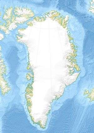 Location within Greenland | |
| Coordinates | 72°22′N 24°00′W / 72.367°N 24.000°WCoordinates: 72°22′N 24°00′W / 72.367°N 24.000°W |
| Ocean/sea sources | Greenland Sea |
| Basin countries | Greenland |
| Max. length | 110 km |
| Max. width | 25 km |
King Oscar Fjord (Danish: Kong Oscar Fjord) is a fjord in East Greenland, marking the northern border of the Scoresby Land Peninsula.
It was named by A.G. Nathorst on his 1899 expedition as Konung Oscars Fjord for Oscar II, King of Sweden from 1872–1907.
Geography
The Davy Sound (Danish: Davy Sund) becomes King Oscar Fjord after extending for about 20 km to the NW to the north of the Stauning Alps.[1] Kong Oscar Fjord is a major fjord, 10–25 km wide, bounded by Traill Island and Geographical Society Island. In the inner and northern end of the fjord lies Ella Island. Lyell Land and the Stauning Alps lie to the southwest.[2]
1.jpg) Antarctic Havn, a former trapper's cabin on the south shore of King Oscar Fjord. |
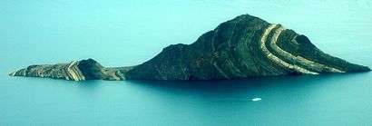 A fold on an island (at 72°28′0″N 24°41′49″W / 72.46667°N 24.69694°W) resulting from the Caledonian orogeny, where Segelselskapets Fjord mouths into King Oscar Fjord. |
See also
References
- ↑ Prostar Sailing Directions 2005 Greenland and Iceland Enroute, p. 118
- ↑ "Kong Oscar Fjord". Mapcarta. Retrieved 20 April 2016.
External links
 Media related to Kong Oscar Fjord at Wikimedia Commons
This article is issued from Wikipedia - version of the 6/18/2016. The text is available under the Creative Commons Attribution/Share Alike but additional terms may apply for the media files.
