Kew East, Victoria
| Kew East Melbourne, Victoria | |||||||||||||
|---|---|---|---|---|---|---|---|---|---|---|---|---|---|
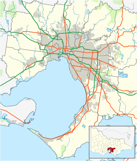 Kew East | |||||||||||||
| Coordinates | 37°47′49″S 145°3′25″E / 37.79694°S 145.05694°ECoordinates: 37°47′49″S 145°3′25″E / 37.79694°S 145.05694°E | ||||||||||||
| Population | 6,017 (2011 census)[1] | ||||||||||||
| • Density | 1,500/km2 (3,900/sq mi) | ||||||||||||
| Postcode(s) | 3102 | ||||||||||||
| Area | 4 km2 (1.5 sq mi) | ||||||||||||
| Location | 8 km (5 mi) from Melbourne | ||||||||||||
| LGA(s) | City of Boroondara | ||||||||||||
| State electorate(s) | Kew | ||||||||||||
| Federal Division(s) | Kooyong | ||||||||||||
| |||||||||||||
Kew East is a suburb of Melbourne, Victoria, Australia, 8 km east from Melbourne's Central Business District. Its local government area is the City of Boroondara. At the 2011 Census, Kew East had a population of 6,017.
History
A number of farming properties were established along the Yarra River following government land auctions, between 1845 and 1847.[2]
The Wills family established "Willsmere Estate", a grazing and dairying property, with the name now reflected in Willsmere Road and Willsmere Park.[3]
William Wade established a farm, named "Belford", next door.[3] A flood in December 1863 devastated the property, which later became the Kew Golf Course.[3]
The Harp of Erin Hotel, on the corner of Harp Road and High Street, was established in 1854, by Edward Glynn.[3] It was a centre for race meetings and gave its name to Harp Road, which was part of a route to Lilydale, used by Cobb and Co.[3]
Kew East Post Office opened around 1924.[4]
The East Kew Maternal and Child Health Centre, in Strathalbyn Street, Kew East, is listed on the Victorian Heritage Register. Opened in December 1925, it is the earliest purpose-built and intact baby health centre in the state.[5]
Street names
Windella Road was originally named Balfour Road, after Kew resident and politician James Balfour.[3] It was renamed to Windella Avenue, after Balfour's residence Windella, due to the similarity of the former name to that of nearby Belford Road. Longstaff, Leason, McCubbin, Newbury, Fraser and Lister Streets are all named after Australian painters.[3]
Demographics
As of 2011, 68.8% of residents were born in Australia, 3.1% born in the United Kingdom, 3.1% born in Italy, and 25% born elsewhere.[1][6]
Geography
The suburb is bounded to the east by Burke Road, to the north by the Yarra River and to the west by the Yarra River, parts of Kilby and Willsmere Roads and the property boundaries between Willsmere Road and Rattan Avenue. The southern boundary follows Carnegie Avenue, Park Crescent, Earl Street, Asquith Street, property boundaries near Belford Road (south), High Street and Harp Road.[7] The Eastern Freeway runs across the centre of the suburb from east to west.[7]
Education
There are two co-educational government schools located in Kew East — Kew High School, a secondary college located on Burke Road and Kew East Primary School on Kitchener Street. St Annes Catholic School is located on Beresford Street.[7]
Sport and recreation
Kew Golf Club[8] and Green Acres Golf Club on Elm Grove[9] are located in the north of the suburb. Parks in Kew East include Willsmere-Chandler Park, home of the suburb's only sport team (East Kew United Soccer Club) and the adjacent Kew Billabong, Hays Paddock on Glass Creek, Hyde Park, Harrison Park and Stradbroke Park.[7]
Shopping
The main shopping area, "Harp Village", is located on High Street, near the intersection with Harp Road.[7][10] A small local centre, Belford Court Shopping Centre, is located on Belford Road.[7]
Transport
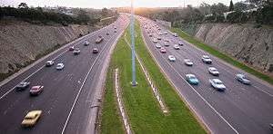
The Eastern Freeway is accessible via the Chandler Highway or Burke Road. The Main Yarra Trail, a shared bicycle and pedestrian path, runs along the north side of the freeway. Belford Road bridges the freeway, providing a link to the northern part of the suburb.[7] The suburb has a single tram line along High Street, which accommodates tram route 48.[7] There are also a number of bus routes which connect the suburb to surrounding areas.
Places of worship
Places of worship include:
- St Paul's Anglican Church, located on the corner of Windella Avenue and Hale Street.[7]
- East Kew Uniting Church, Normanby Road.
- MWP Centre, Westbrook Street.
- St Anne's Catholic Church, Windellla Avenue.[7]
- The Leo Baeck Centre for Progressive Judaism, Harp Road.
See also
- City of Kew - the former local government area of which Kew East was a part
References
- 1 2 Australian Bureau of Statistics (31 October 2012). "Kew East (State Suburb)". 2011 Census QuickStats. Retrieved 2012-07-22.
- ↑ Dawson, W.J. "Green Acres Golf Club The First Forty Years 1948 - 1988" (PDF). Retrieved 2009-04-28.
- 1 2 3 4 5 6 7 "City of Kew 1860-1960" (PDF). Retrieved 2009-04-28.
- ↑ Premier Postal History. "Post Office List". Retrieved 2008-04-11.
- ↑ "Maternal and Child Health Centre, Victorian Heritage Register (VHR) Number H0055, Heritage Overlay HO486". Victorian Heritage Database. Heritage Victoria. Retrieved 2014-11-20.
- ↑ https://www.homepriceguide.com.au/Research/Demographic.aspx?AddressLine=&LocationType=Address&State=VIC&StreetId=217087&StreetNumber=1485&UnitNumber=
- 1 2 3 4 5 6 7 8 9 10 "Kew East". www.street-directory.com.au. Retrieved 2009-04-26.
- ↑ Golf Select. "Kew". Retrieved 2009-05-11.
- ↑ Golf Select. "Green Acres". Retrieved 2009-05-11.
- ↑ "Shopping Centres". City of Boroondara. Archived from the original on 20 July 2008. Retrieved 2009-04-28.