Kenansville, North Carolina
| Kenansville, North Carolina | |
|---|---|
| Town | |
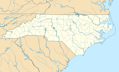 Kenansville Location within the state of North Carolina | |
| Coordinates: 34°57′44″N 77°57′56″W / 34.96222°N 77.96556°WCoordinates: 34°57′44″N 77°57′56″W / 34.96222°N 77.96556°W | |
| Country | United States |
| State | North Carolina |
| County | Duplin |
| Area | |
| • Total | 2.1 sq mi (5.5 km2) |
| • Land | 2.1 sq mi (5.5 km2) |
| • Water | 0.0 sq mi (0.0 km2) |
| Elevation | 125 ft (38 m) |
| Population (2010) | |
| • Total | 855 |
| • Density | 403/sq mi (155.7/km2) |
| Time zone | Eastern (EST) (UTC-5) |
| • Summer (DST) | EDT (UTC-4) |
| ZIP code | 28349 |
| Area code(s) | 910 |
| FIPS code | 37-35460[1] |
| GNIS feature ID | 1021026[2] |
| Website |
kenansville |
Kenansville is a town in Duplin County, North Carolina, United States. The population was 855 at the 2010 census.[3] It is the county seat of Duplin County.[4] The town was named for James Kenan,[5][6] a member of the North Carolina Senate whose family home Liberty Hall Plantation is in Kenansville.
History
The Needham Whitfield Herring House and Kenansville Historic District are listed on the National Register of Historic Places.[7]
Geography
Kenansville is located slightly west of the center of Duplin County at 34°57′44″N 77°57′56″W / 34.96222°N 77.96556°W (34.962119, -77.965658).[8] North Carolina Highways 11 and 50 pass through the center of town, while North Carolina Highway 24 bypasses the town as a four-lane highway on the southeast. NC 24 leads southwest 5 miles (8 km) to Interstate 40 at Exit 373 and east 38 miles (61 km) to Jacksonville. NC 11 leads northeast 33 miles (53 km) to Kinston and south 18 miles (29 km) to Wallace, while NC 50 leads southeast 46 miles (74 km) to Holly Ridge and west 8 miles (13 km) to Warsaw.
According to the United States Census Bureau, Kenansville has a total area of 2.1 square miles (5.5 km2), all of it land.[3]
Demographics
| Historical population | |||
|---|---|---|---|
| Census | Pop. | %± | |
| 1880 | 376 | — | |
| 1890 | 291 | −22.6% | |
| 1900 | 271 | −6.9% | |
| 1910 | 270 | −0.4% | |
| 1920 | 302 | 11.9% | |
| 1930 | 450 | 49.0% | |
| 1940 | 571 | 26.9% | |
| 1950 | 674 | 18.0% | |
| 1960 | 724 | 7.4% | |
| 1970 | 762 | 5.2% | |
| 1980 | 931 | 22.2% | |
| 1990 | 856 | −8.1% | |
| 2000 | 1,149 | 34.2% | |
| 2010 | 855 | −25.6% | |
| Est. 2015 | 870 | [9] | 1.8% |
As of the census[1] of 2000, there were 1,149 people, 281 households, and 180 families residing in the town. The population density was 609.5 people per square mile (234.7/km²). There were 314 housing units at an average density of 166.6 per square mile (64.1/km²). The racial makeup of the town was 51.35% White, 45.95% African American, 0.26% Native American, 0.44% Asian, 1.83% from other races, and 0.17% from two or more races. Hispanic or Latino of any race were 2.70% of the population.
There were 281 households out of which 22.4% had children under the age of 18 living with them, 50.2% were married couples living together, 10.7% had a female householder with no husband present, and 35.6% were non-families. 32.7% of all households were made up of individuals and 17.4% had someone living alone who was 65 years of age or older. The average household size was 2.25 and the average family size was 2.83.
In the town the population was spread out with 11.8% under the age of 18, 8.2% from 18 to 24, 35.7% from 25 to 44, 21.3% from 45 to 64, and 23.0% who were 65 years of age or older. The median age was 42 years. For every 100 females there were 167.2 males. For every 100 females age 18 and over, there were 167.3 males.
The median income for a household in the town was $36,053, and the median income for a family was $41,307. Males had a median income of $27,917 versus $23,021 for females. The per capita income for the town was $11,933. About 11.9% of families and 28.5% of the population were below the poverty line, including 11.3% of those under age 18 and 56.9% of those age 65 or over.
Cultural resources
The Cowan Museum has artifacts from the early rural heritage of North Carolina and Duplin County. Also located in Kenansville is Liberty Hall Restoration, the ancestral home of the Kenan family after whom the town was named.
References
- 1 2 "American FactFinder". United States Census Bureau. Retrieved 2008-01-31.
- ↑ "US Board on Geographic Names". United States Geological Survey. 2007-10-25. Retrieved 2008-01-31.
- 1 2 "Geographic Identifiers: 2010 Demographic Profile Data (G001): Kenansville town, North Carolina". U.S. Census Bureau, American Factfinder. Retrieved November 30, 2015.
- ↑ "Find a County". National Association of Counties. Retrieved 2011-06-07.
- ↑ Gannett, Henry (1905). The Origin of Certain Place Names in the United States. Govt. Print. Off. p. 173.
- ↑ Proffitt, Martie (Apr 17, 1983). "Local history offers tasty tidbits". Star-News. pp. 8C. Retrieved 1 November 2015.
- ↑ National Park Service (2010-07-09). "National Register Information System". National Register of Historic Places. National Park Service.
- ↑ "US Gazetteer files: 2010, 2000, and 1990". United States Census Bureau. 2011-02-12. Retrieved 2011-04-23.
- ↑ "Annual Estimates of the Resident Population for Incorporated Places: April 1, 2010 to July 1, 2015". Retrieved July 2, 2016.
- ↑ "Census of Population and Housing". Census.gov. Retrieved June 4, 2015.
External links
Municipalities and communities of Duplin County, North Carolina, United States | ||
|---|---|---|
| Towns |  | |
| CDP | ||
| Other unincorporated communities | ||
| Footnotes | ‡This populated place also has portions in an adjacent county or counties | |