Karaganda Region
| Karaganda Region Қарағанды облысы Карагандинская область | ||
|---|---|---|
| Region | ||
|
| ||
| ||
 Map of Kazakhstan, location of Karagandy Region highlighted | ||
| Coordinates: 48°0′N 71°0′E / 48.000°N 71.000°ECoordinates: 48°0′N 71°0′E / 48.000°N 71.000°E | ||
| Country |
| |
| Capital | Karaganda | |
| Government | ||
| • Akim | Baurzhan Abdishev | |
| Area[1] | ||
| • Total | 427,982 km2 (165,245 sq mi) | |
| Highest elevation | 1,500 m (4,900 ft) | |
| Lowest elevation | 500 m (1,600 ft) | |
| Population (2013-02-01)[2] | ||
| • Total | 1,363,638 | |
| • Density | 3.2/km2 (8.3/sq mi) | |
| Time zone | East (UTC+6) | |
| • Summer (DST) | not observed (UTC+6) | |
| Postal codes | 100000 | |
| Area codes | +7 (721) | |
| ISO 3166 code | KZ-KAR | |
| Vehicle registration | 09, M | |
| Districts | 9 | |
| Cities | 11 | |
| Townships | 39 | |
| Villages | 557 [3] | |
| Website |
www | |


Karaganda Region (Kazakh: Қарағанды облысы, Qarağandı oblısı, قاراعاندى وبلىسى) is a region of Kazakhstan. Its capital is Karaganda. Population: 1,341,700 (2009 Census results);[4] 1,410,218 (1999 Census results);[4] that of the city is 459,778 (2009 Census results).[4]
History
The region was the site of intense coal mining during the days of the Soviet Union and also the site of several Gulag forced labor camps. Following World War II, Joseph Stalin, leader of the Soviet Union, had many ethnic Germans deported to the area.
Geography
With an area of 428,000 km2, Karaganda Region is Kazakhstan's largest region. Although it doesn't touch the borders of any country, it touches nearly every other region. They are: Aktobe Region to the West; Kostanay Region to the Northwest; Akmola Region to the North; Pavlodar Region to the Northeast; East Kazakhstan Region to the East; Almaty Region to the Southeast; Jambyl Region and South Kazakhstan Region to the South; and Kyzylorda Region to the Southwest.
The area is arid and flat, given to plains with occasional hills and seasonal streams. Karkaraly National Park, covering 90,300 hectares, is located in the region, as well as Kyzylarai mountain oasis, famous for its natural beauty and historical sights.
The Ishim (Esil) River, a tributary of the Irtysh River, begins in Karaganda Region; the Nura River is the region's other major river. Both river are replenished with water from the Irtysh, supplied by the 451 km long Irtysh–Karaganda Canal. Lake Balkhash is located on the Southeast side.
Demographics
44,68% of the population is ethnic Kazakh and 39,17% is ethnic Russian according to 2010 census. The minorities are Ukrainian (4,56%), German (2,93%), and Tatar (2,53).
Administrative divisions
The region is administratively divided into nine districts and the cities and towns of oblast significance of Karaganda, Balkhash, Jezkazgan, Karazhal, Saran, Shakhtinsk, and Temirtau. The districts are[5]
- Abay District, with the administrative center in the town of Abay;
- Aktogay District, the selo of Aktogay;
- Bukhar-Zhyrau District, the settlement of Botakara;
- Karkaraly District, the town of Karkaraly;
- Nura District, the settlement of Kiyevka;
- Osakarov District, the settlement of Osakarovka;
- Shet District, the selo of Aksu-Ayuly;
- Ulytau District, the selo of Ulytau;
- Zhanaarka District, the settlement of Atasu.
* The following nine localities in Karaganda Region have town status:[5] Karaganda, Balkhash, Jezkazgan, Karazhal, Priozersk, Saran, Satpayev, Shakhtinsk, and Temirtau.
For some decades during the USSR era, southern part of what is today Karaganda Region was a separate region, known as Jezkazgan Region, with the administrative center in Jezkazgan.
Elections
| Party | Votes | % | ||
|---|---|---|---|---|
| Nur Otan | 548,864 | 83.20 | ||
| Democratic Party of Kazakhstan Ak Zhol | 50,599 | 7.67 | ||
| Communist People's Party of Kazakhstan | 50,071 | 7.59 | ||
| Kazakhstani Social Democratic Party Auyl | 8,642 | 1.31 | ||
| Nationwide Social Democratic Party | 1,188 | 0.18 | ||
| Birlik | 330 | 0.05 | ||
| Invalid/blank votes | – | |||
| Total | ||||
| Registered voters/turnout | ||||
| Source: CEC, CEC | ||||
Sister cities
-
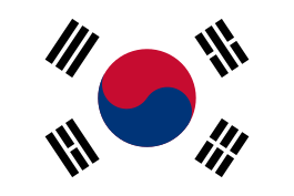 Ulsan, South Korea (2010)
External links
- Regional administration website
- Karaganda Region Chamber of Commerce and Industry
- Karaganda Region Customs
References
- ↑ Official site - General Information
- ↑ Agency of statistics of the Republic of Kazakhstan: Численность населения Республики Казахстан по областям с началa 2013 года до 1 февраля 2013 года (russisch; Excel-Datei; 55 kB).
- ↑ All-Biz Ltd. Карагандинская область
- 1 2 3 "Население Республики Казахстан" (in Russian). Департамент социальной и демографической статистики. Retrieved 8 December 2013.
- 1 2 Карта области (in Russian). Информационный портал Акимата Карагандинской области. Retrieved 20 July 2012.
 |
Kostanay Region | Akmola Region | Pavlodar Region | |
| Aktobe Region | |
East Kazakhstan Region | ||
| ||||
| | ||||
| Kyzylorda Region South Kazakhstan Region |
Jambyl Region | Almaty Region |
Capital: Karaganda | ||
| Districts |  | |
| Major cities | ||
| Regions |  | |
|---|---|---|
| Metropolitan cities | ||
