Kalanaur, Haryana
| Kalanaur | |
|---|---|
| city | |
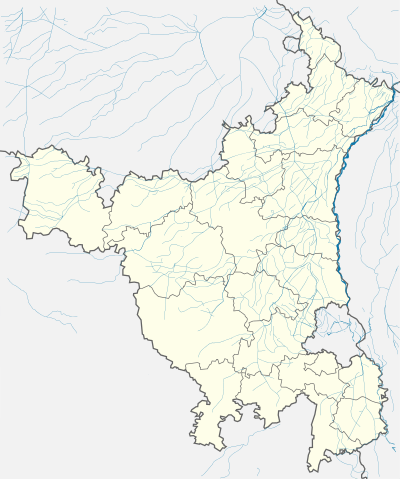 Kalanaur  Kalanaur Location in Haryana, India | |
| Coordinates: 28°50′N 76°24′E / 28.83°N 76.4°ECoordinates: 28°50′N 76°24′E / 28.83°N 76.4°E | |
| Country |
|
| State | Haryana |
| District | Rohtak |
| Elevation | 200 m (700 ft) |
| Population (2001) | |
| • Total | 16,847 |
| Languages | |
| • Official | Hindi |
| Time zone | IST (UTC+5:30) |
| Vehicle registration | HR |
| Website |
haryana |
Kalanaur is a city and a municipal committee in Rohtak district of the north Indian state of Haryana.
Location and historical background
Kalanaur is a significant town of Rohtak District in State of Haryana situated on Delhi–Rohtak–Bhiwani road. It is situated approximately 100 km from National Capital Delhi situated towards the western side of Delhi. It is situated at a distance of 20 km from Rohtak and 28 km from Bhiwani. The town of Bhiwani is towards the western direction, historical town Meham is situated in the northern side and Beri is situated in the southern direction of Kalanaur. The Delhi-Bhiwani Broadguage railway line passes through the town. Kalanaur is also surrounded by a group of small villages which includes Kherdi, Baund, Pilaur, Katesra, Gudhan, Sanghadhera, Ningana, Aanwal, Jindraan, Lahlii, Mokhra and Basana etc. There are many different beliefs regarding the evolution of Kalanaur, few of them are as under:
Kalanaur was established by Rao Kalyan Singh a parmara rajput (who was known as Kalan). Kalyan Singh was a resident of Ujjain City in Dhara Nagri. His son was married to the daughter of Anang Pal Singh (IInd King of Delhi). At the time of their marriage King Anang Pal Singh gifted this region to Kalyan Singh. Kalyan Singh resumed this region to secure the established village Bhali on the bank of drain (presently known as Drain No. 8) and thereafter he built his Gaddi in Gaddi Kheri. After this kalanaur town was established in the year 1071. Kalayan Singh had three sons. Kalanaur was divided as per their names. But at present it is known as Kalanaur Kalan and Kalanaur Khurd. In local language, it is known as Chotta Panna and Bada Panna.
Kalanaur achieved great development during the period of Mughals. The story of development of Kalanaur region is explained by buildings, which were made during the Mughal Empire. Kalanaur town is known as region of wells, mosques, dharamshalas and ponds e.g. the pond of Jhaujad wala is in the northern direction, pond of Jasar wala in the west and the Nittaraian is located in the East of Kalanaur. Kalanaur was surrounded by a deep mine (Khai).
Besides Mughals, Kalanaur also contains important symbols of history dating back to 1000 AD. In 1000 AD it was the only important town between Lahore and Nagarkot (Kangra).
The historians of the district lament that even the government has been apathetic to the history in and around Kalanaur. Bricks from most of the important historical buildings in and Kalanaur were used for the construction of the Amritsar-Pathankot railway line in 1884.
The historians have demanded that history in Kalanaur should be conserved by the government.
Geography
Kalanaur is located at 28°50′N 76°24′E / 28.83°N 76.4°E.[1] It has an average elevation of 200 metres (656 feet).
Climatic conditions
Kalanaur is situated at 221.35 metres above from the mean sea level. Type of soil in this region is sandy and loamy. The climate in this region is Hot and Cold. Hot months of this region are May and June, these are the warmest months of Kalanaur. Hot air (known as loo) blows in the summer. Rainy months are July, August and September. Usually 443 mm. rainfall is measured in this region annually.
Kalanaur town is a Block and Sub-Tehsil Headquarters of Rohtak District with following facilities:
Utilities
Supply of water and electricity is sufficient in the existing town. The water supply work was done by Meham Municipal Committee till April, 1993 and later on this work was handed over to the Public Health Department. At present the existing water works is having a capacity of 100 LPCD. The electricity supply in Kalanaur town is provided through 3 Nos. of Sub stations (132KV Sub Station Kalanaur, 33KV Beri and 33KV Kahanor). The water supply in Kalanaur town is canal based. The distance from the source of water is 0.5 km (Dadri Feeder). Present water supply in the town is 70 Lpcd. Total household connections are 2500 and there are three water works/ storage reservoirs exist in the town.
Social infrastructure
Education: Kalanaur is developing in the field of education. There is one Government Girls School which was established during the Muslim period and now has been upgraded to Middle School. In 1971, Jamuna Dass (Owner of Sant Jinda Kalyan Ashram) established Sant Jinda Kalyan Middle School. There are three Government primary schools. Kalanaur and its adjoining villages have some primary, middle and secondary schools. There is one college (Sant Jinda Kalyana) and one Senior Secondary School in Kalanaur Kalan. The Industrial Training Institute has been recently started in this town. A new famous private engineering college named Maa Saraswati Institute of engineering and Technology has been set up in Kalanaur in 2013.
Cultural
Kalanaur is famous for some festivals. Main festivals are Fair of Guga-Pir,durga astmi mela, navratra special, Dushera and Fair of Animals.
Administrative setup
At the Administrative level, Kalanaur has one Police Station established in the year 1880, One Community Health Centre, Municipal Water Works, Panchayat Bhawan, Railway Station and Grain Market etc. Kalanaur has all major offices i.e. Block Development & Panchayat Office, Naib Tehsildar, C.D.P.O, B.A.O (Agriculture), Food & Supply and Fishery Office.
Religious Places
- Siddheshver Mandir
- Devi Mata Mandir
- BankeBihari Mandir
- Mahavir Mandir
- Ravidas Mandir
- Sat Jinda Kalyana
- Tikana Sati Bhai Sai Dass
- Tikana lau vala
- Tikana sat bhai Rama sat bhai jvaya
- Gurudwara Nanak sariya
- Kutiya baba Brahma dass
- Maharshi Valmiki Mandir
- Goga Peer Ki Maidi (Mandir)
- Shiv Mandir
- Old Masjid
- Shani Dev Mandir
- Arya Smaj Mandir
- Sai Baba Mandir
- Railway Station Church
- Gaddi Shri Dadu Dwara
- Lakshmi Narayan Mandir
- Sita Ram Mandir
- Sheetla Mata Mandir
- Santoshi Mata Mandir
Schools and colleges
- Triveni Public School
- Sati bhai Sai Dass school(SBSD)
- SDVP Model School
- SDVP College of Education
- Siddhartha public school.
- Swami Guru Charan Dass Sanatan Dharm Sr. Sec. School (SGDSD)
- Ved Model Sr. Sec School.
- Panchthirthi Public School (PPS)
- D A V CENTENARY PUBLIC SCHOOL
- M.R Hindu Public School
- J K M Sr. Sec School
- Indian Public School
- Adarsh Public School
- B.L.model School
- Kids Velly School
- Industrial Training Institute(ITI State Level)
- Sat Jinda Kalyana College of Education (SJK)
- MSIET ( Maa Saraswati Institute of Engineering & Technology ) Kalanaur, Rohtak. www.msiet.com
Demographics
As of 2001 India census,[2] Kalanaur had a population of 16,847. Males constitute 53% of the population and females 47%. Kalanaur has an average literacy rate of 65%, higher than the national average of 59.5%: male literacy is 72%, and female literacy is 58%. In Kalanaur, 15% of the population is under 6 years of age. According to 2011 Kalanaur had population of 22,752. Total growth is +5,899 and 35 %.
| Year | Population | Decadal Growth | Percentage Growth |
|---|---|---|---|
| 1971 | 7,225 | - | - |
| 1981 | 12,380 | +5,155 | 71.35 |
| 1991 | 14,524 | +2,144 | 17.31 |
| 2001 | 16,853 | +2,329 | 16.03 |
| 2011* | 22,752 | +5,899 | 35 |
References
- ↑ "Maps, Weather, and Airports for Kalanaur, India". www.fallingrain.com. Retrieved 2016-11-11.
- ↑ "Census of India 2001: Data from the 2001 Census, including cities, villages and towns (Provisional)". Census Commission of India. Archived from the original on 2004-06-16. Retrieved 2008-11-01.
Rohtak district topics | ||
|---|---|---|
| Geography |  | |
| Cities and towns | ||
| Transport | ||
| Education | ||
| Lok Sabha constituencies | ||