Jolivue, Virginia
| Jolivue, Virginia | |
|---|---|
| Census-designated place | |
 Location of Jolivue, Virginia | |
| Coordinates: 38°6′55″N 79°4′18″W / 38.11528°N 79.07167°WCoordinates: 38°6′55″N 79°4′18″W / 38.11528°N 79.07167°W | |
| Country | United States |
| State | Virginia |
| County | Augusta |
| Area | |
| • Total | 1.9 sq mi (4.9 km2) |
| • Land | 1.9 sq mi (4.9 km2) |
| • Water | 0.0 sq mi (0.0 km2) |
| Elevation | 1,601 ft (488 m) |
| Population (2010) | |
| • Total | 1,129 |
| • Density | 595/sq mi (229.9/km2) |
| Time zone | Eastern (EST) (UTC-5) |
| • Summer (DST) | EDT (UTC-4) |
| FIPS code | 51-41144[1] |
| GNIS feature ID | 1499610[2] |
Jolivue is a census-designated place (CDP) in Augusta County, Virginia, United States. The population was 1,129 at the 2010 census.[3] It is part of the Staunton–Waynesboro Micropolitan Statistical Area.
History
Located near Jolivue is the Valley Railroad Stone Bridge, listed on the National Register of Historic Places in 1974.[4]
Geography
Jolivue is located at 38°6′55″N 79°4′18″W / 38.11528°N 79.07167°W (38.115146, -79.071791).[5]
According to the United States Census Bureau, the CDP has a total area of 1.9 square miles (4.9 km2), all of it land.[3]
Demographics
As of the census[1] of 2000, there were 1,037 people, 551 households, and 249 families residing in the CDP. The population density was 527.2 people per square mile (203.2/km²). There were 594 housing units at an average density of 302.0/sq mi (116.4/km²). The racial makeup of the CDP was 92.67% White, 2.80% African American, 1.54% Asian, 0.96% from other races, and 2.03% from two or more races. Hispanic or Latino of any race were 3.09% of the population.
There were 551 households out of which 17.8% had children under the age of 18 living with them, 34.5% were married couples living together, 7.8% had a female householder with no husband present, and 54.8% were non-families. 49.4% of all households were made up of individuals and 26.7% had someone living alone who was 65 years of age or older. The average household size was 1.88 and the average family size was 2.76.
In the CDP the population was spread out with 17.7% under the age of 18, 6.1% from 18 to 24, 30.3% from 25 to 44, 20.9% from 45 to 64, and 25.0% who were 65 years of age or older. The median age was 42 years. For every 100 females there were 74.3 males. For every 100 females age 18 and over, there were 70.6 males.
The median income for a household in the CDP was $27,672, and the median income for a family was $40,150. Males had a median income of $29,313 versus $25,395 for females. The per capita income for the CDP was $18,905. About 6.0% of families and 10.4% of the population were below the poverty line, including 21.5% of those under age 18 and 13.7% of those age 65 or over.
Climate
The climate in this area is characterized by hot, humid summers and generally mild to cool winters. According to the Köppen Climate Classification system, Jolivue has a humid subtropical climate, abbreviated "Cfa" on climate maps.[6]
References
- 1 2 "American FactFinder". United States Census Bureau. Retrieved 2008-01-31.
- ↑ "US Board on Geographic Names". United States Geological Survey. 2007-10-25. Retrieved 2008-01-31.
- 1 2 "Geographic Identifiers: 2010 Demographic Profile Data (G001): Jolivue CDP, Virginia". U.S. Census Bureau, American Factfinder. Retrieved August 30, 2013.
- ↑ National Park Service (2010-07-09). "National Register Information System". National Register of Historic Places. National Park Service.
- ↑ "US Gazetteer files: 2010, 2000, and 1990". United States Census Bureau. 2011-02-12. Retrieved 2011-04-23.
- ↑ Climate Summary for Jolivue, Virginia
Municipalities and communities of Augusta County, Virginia, United States | ||
|---|---|---|
| Towns | 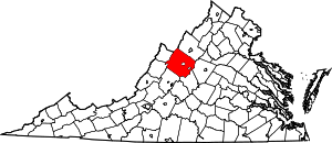 | |
| CDPs | ||
| Unincorporated communities | ||
| Footnotes | ‡This populated place also has portions in an adjacent county or counties | |