Johnstown, Rock County, Wisconsin
| Johnstown, Wisconsin | |
|---|---|
| Town | |
 Location in Rock County and the state of Wisconsin. | |
| Coordinates: 42°43′2″N 88°50′3″W / 42.71722°N 88.83417°W | |
| Country | United States |
| State | Wisconsin |
| County | Rock |
| Area | |
| • Total | 36.2 sq mi (93.8 km2) |
| • Land | 36.2 sq mi (93.8 km2) |
| • Water | 0.0 sq mi (0.0 km2) |
| Elevation[1] | 1,030 ft (314 m) |
| Population (2000) | |
| • Total | 802 |
| • Density | 22.2/sq mi (8.6/km2) |
| Time zone | Central (CST) (UTC-6) |
| • Summer (DST) | CDT (UTC-5) |
| Area code(s) | 608 |
| FIPS code | 55-38450[2] |
| GNIS feature ID | 1583458[1] |
| Website | http://www.townofjohnstown.net |
Johnstown is a town in Rock County, Wisconsin, United States. The unincorporated communities of Johnstown and Johnstown Center are located in the town.
Geography
According to the United States Census Bureau, the town has a total area of 36.2 square miles (93.8 km²), all of it land.
Demographics
As of the census[2] of 2000, there were 802 people, 289 households, and 232 families residing in the town. The population density was 22.2 people per square mile (8.6/km²). There were 306 housing units at an average density of 8.5 per square mile (3.3/km²). The racial makeup of the town was 99.25% White, 0.62% Native American, and 0.12% from two or more races.
There were 289 households out of which 32.5% had children under the age of 18 living with them, 69.6% were married couples living together, 5.5% had a female householder with no husband present, and 19.4% were non-families. 14.2% of all households were made up of individuals and 4.5% had someone living alone who was 65 years of age or older. The average household size was 2.78 and the average family size was 3.06.
In the town the population was spread out with 27.6% under the age of 18, 5.0% from 18 to 24, 28.3% from 25 to 44, 27.1% from 45 to 64, and 12.1% who were 65 years of age or older. The median age was 40 years. For every 100 females there were 106.7 males. For every 100 females age 18 and over, there were 115.2 males.
The median income for a household in the town was $55,313, and the median income for a family was $61,667. Males had a median income of $35,313 versus $25,982 for females. The per capita income for the town was $22,452. About 2.6% of families and 4.9% of the population were below the poverty line, including 5.1% of those under age 18 and none of those age 65 or over.
Notable people
- George W. Hull, Wisconsin state senator, was born in the town.
- A. Warren Phelps, politician, lived in Johnstown.
- The poet and mystic Ella Wheeler Wilcox was born in Johnstown.
Coordinates: 42°42′00″N 88°48′22″W / 42.70000°N 88.80611°W
References
- 1 2 "US Board on Geographic Names". United States Geological Survey. 2007-10-25. Retrieved 2008-01-31.
- 1 2 "American FactFinder". United States Census Bureau. Retrieved 2008-01-31.
Municipalities and communities of Rock County, Wisconsin, United States | ||
|---|---|---|
| Cities | 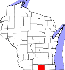 | |
| Villages | ||
| Towns | ||
| CDP | ||
| Unincorporated communities |
| |
| Ghost towns | ||
| Footnotes | ‡This populated place also has portions in an adjacent county or counties | |
