Inangahua Junction
| Inangahua Junction | |
|---|---|
|
New Zealand State Highway 6 passing through Inangahua Junction | |
 Inangahua Junction | |
| Coordinates: 41°51′27″S 171°57′8″E / 41.85750°S 171.95222°E | |
| Country | New Zealand |
| Region | West Coast |
| District | Buller District |
| Population (2006) | |
| • Total | 159 |


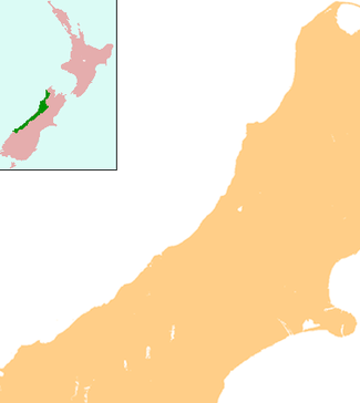
Inangahua Junction is a small town in the northwest of New Zealand's South Island. It is located at the confluence of the Inangahua and Buller Rivers, 34 kilometres (21 mi) north of Reefton and 46 kilometres (29 mi) southeast of Westport. Murchison is 52 kilometres (32 mi) to the east. The town of Inangahua is just to the east of the junction.[1][2] The town's main industries include forestry, coal, farming and sawmilling. There is a small primary school, shops, fire station and earthquake museum. The population was 159 in the 2006 Census, an increase of 9 people from 2001.[3] The name of the town refers to inanga, the Māori word for whitebait. Inangahua Junction was formerly known as Christies Junction.
Earthquake

The town was substantially affected by an earthquake on Friday, 24 May 1968. At 5:24am, the earthquake measuring 7.1 on the Richter scale struck the town, and many landslides and aftershocks followed. The entire population of around 100 was temporarily evacuated. Two people were killed,[4] and another three died later when a helicopter evacuating survivors crashed.
Railways
Inangahua Junction is located on the Stillwater - Westport Line railway, and was intended to be the junction of this line with the never-completed Nelson Section. In 1914, the railway was opened to Inangahua Junction from its former terminus in Cronadun, but subsequent progress through the Buller Gorge was slow. In July 1942, trains began running the full length of the line between Stillwater and Westport, but the line was not officially opened until 5 December 1943. With the commencement of through services, passenger trains were operated by RM class Vulcan railcars, which connected in Stillwater with services that ran along the Midland Line between Greymouth and Christchurch. In 1967, the passenger services ceased, and today, the primary traffic is coal, with multiple coal trains passing through Inangahua Junction daily. Today the town is served by the daily inter city bus between Nelson and Westport.
PHAT Music Festival
Inangaha was the host of the PHAT New Year's Eve music festivals. PHAT07, PHAT08, PHAT09, PHAT10, PHAT11 featured New Zealand and many international acts. PHAT is held on flat clearings surrounded by native bush on Rough Creek Road, off Browns Creek Road, south of Inangahua and owned by the Storer family. Approximately 5000 people attend the PHAT music festivals, with 48+ hours of continuous performance on two stages.
The other annual event held on the Inangahua site was PHAT MOON, a slightly smaller version of the bigger New Year's Eve's event. PHAT MOON was held over Easter weekend. The music runs for 24 hours, but people are invited to come and camp the night before. This ceased quite a few years ago, the site has returned to a being a farm.
Education
Inangahua Junction School is a coeducational contributing primary (years 1–6) school with a decile rating of 6 and a roll of 9.[5] The school was in existence in 1887.[6]
Inangahua College merged with Reefton School to form Reefton Area School in 2004.[7] The College, which existed for 38 years, replaced the Reefton District High School.[8]
References
- ↑ Peter Dowling (editor) (2004). Reed New Zealand Atlas. Reed Books. map 64. ISBN 0-7900-0952-8.
- ↑ Roger Smith, GeographX (2005). The Geographic Atlas of New Zealand. Robbie Burton. map 141. ISBN 1-877333-20-4.
- ↑ Quickstats about Inangahua Junction
- ↑ "GeoNet – M 7.1, Inangahua, May 24, 1968". GeoNet. Retrieved 8 June 2011.
- ↑ "Te Kete Ipurangi - Inangahua Junction School". Ministry of Education.
- ↑ "Nelson Education Board Exam Schedules - Inangahua Junction 1887-1900".
- ↑ "School Mergers, Closures and New Schools" (XLS). Education Counts. 2004.
- ↑ "District School Reunion" (PDF). 2003.
External links
![]() Media related to Inangahua Junction at Wikimedia Commons
Media related to Inangahua Junction at Wikimedia Commons
Coordinates: 41°51′S 171°57′E / 41.850°S 171.950°E