Hull, Georgia
| Hull, Georgia | |
|---|---|
| City | |
 Location in Madison County and the state of Georgia | |
| Coordinates: 34°0′48″N 83°17′40″W / 34.01333°N 83.29444°WCoordinates: 34°0′48″N 83°17′40″W / 34.01333°N 83.29444°W | |
| Country | United States |
| State | Georgia |
| County | Madison |
| Area | |
| • Total | 0.3 sq mi (0.9 km2) |
| • Land | 0.3 sq mi (0.9 km2) |
| • Water | 0 sq mi (0 km2) |
| Elevation | 820 ft (250 m) |
| Population (2010) | |
| • Total | 198 |
| • Density | 533.3/sq mi (177.8/km2) |
| Time zone | Eastern (EST) (UTC-5) |
| • Summer (DST) | EDT (UTC-4) |
| ZIP code | 30646 |
| Area code(s) | 706 |
| FIPS code | 13-40532[1] |
| GNIS feature ID | 0315807[2] |
Hull is a city in Madison County, Georgia, United States. The population was 160 at the 2000 census and 198 at the 2010 census.
Geography
Hull is located at 34°0′48″N 83°17′40″W / 34.01333°N 83.29444°W (34.013201, -83.294470).[3]
According to the United States Census Bureau, the city has a total area of 0.3 square miles (0.78 km2), all of it land.
Hull, is known as "The Well City" from a long-standing water well in the center of town.
Demographics
| Historical population | |||
|---|---|---|---|
| Census | Pop. | %± | |
| 1910 | 133 | — | |
| 1920 | 148 | 11.3% | |
| 1930 | 130 | −12.2% | |
| 1940 | 174 | 33.8% | |
| 1950 | 169 | −2.9% | |
| 1960 | 141 | −16.6% | |
| 1970 | 222 | 57.4% | |
| 1980 | 188 | −15.3% | |
| 1990 | 156 | −17.0% | |
| 2000 | 160 | 2.6% | |
| 2010 | 198 | 23.8% | |
| Est. 2015 | 201 | [4] | 1.5% |
As of the census[1] of 2000, there were 160 people, 70 households, and 42 families residing in the city. The population density was 483.7 people per square mile (187.2/km²). There were 78 housing units at an average density of 235.8 per square mile (91.3/km²). The racial makeup of the city was 86.88% White, 8.12% African American, 0.62% Native American, 4.38% from other races. Hispanic or Latino of any race were 5.00% of the population.
There were 70 households out of which 31.4% had children under the age of 18 living with them, 41.4% were married couples living together, 12.9% had a female householder with no husband present, and 38.6% were non-families. 31.4% of all households were made up of individuals and 7.1% had someone living alone who was 65 years of age or older. The average household size was 2.29 and the average family size was 2.84.
In the city the population was spread out with 25.0% under the age of 18, 10.0% from 18 to 24, 30.0% from 25 to 44, 22.5% from 45 to 64, and 12.5% who were 65 years of age or older. The median age was 35 years. For every 100 females there were 102.5 males. For every 100 females age 18 and over, there were 110.5 males.
The median income for a household in the city was $31,250, and the median income for a family was $30,417. Males had a median income of $25,625 versus $19,792 for females. The per capita income for the city was $13,942. About 18.9% of families and 20.1% of the population were below the poverty line, including 23.3% of those under the age of eighteen and 33.3% of those sixty five or over.
References
- 1 2 "American FactFinder". United States Census Bureau. Retrieved 2008-01-31.
- ↑ "US Board on Geographic Names". United States Geological Survey. 2007-10-25. Retrieved 2008-01-31.
- ↑ "US Gazetteer files: 2010, 2000, and 1990". United States Census Bureau. 2011-02-12. Retrieved 2011-04-23.
- ↑ "Annual Estimates of the Resident Population for Incorporated Places: April 1, 2010 to July 1, 2015". Retrieved July 2, 2016.
- ↑ "Census of Population and Housing". Census.gov. Retrieved June 4, 2015.
Municipalities and communities of Madison County, Georgia, United States | ||
|---|---|---|
| Cities | 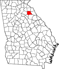 | |
| Footnotes | ‡This populated place also has portions in an adjacent county or counties | |