Hosmer, South Dakota
| Hosmer, South Dakota | |
|---|---|
| City | |
|
Main Street of Hosmer, South Dakota in January 2011 | |
 Location in Edmunds County and the state of South Dakota | |
| Coordinates: 45°34′38″N 99°28′26″W / 45.57722°N 99.47389°WCoordinates: 45°34′38″N 99°28′26″W / 45.57722°N 99.47389°W | |
| Country | United States |
| State | South Dakota |
| County | Edmunds |
| Founded | 1887[1] |
| Government | |
| • Mayor | Lew Paulson [2] |
| Area[3] | |
| • Total | 0.99 sq mi (2.56 km2) |
| • Land | 0.99 sq mi (2.56 km2) |
| • Water | 0 sq mi (0 km2) |
| Elevation | 1,906 ft (581 m) |
| Population (2010)[4] | |
| • Total | 208 |
| • Estimate (2012[5]) | 205 |
| • Density | 210.1/sq mi (81.1/km2) |
| Time zone | Central (CST) (UTC-6) |
| • Summer (DST) | CDT (UTC-5) |
| ZIP code | 57448 |
| Area code(s) | 605 |
| FIPS code | 46-30140[6] |
| GNIS feature ID | 1255678[7] |

Hosmer is a city in Edmunds County, South Dakota, United States. The population was 208 at the 2010 census.
History
Hosmer was laid out in 1887.[8] The name for the town of Hosmer came from a railroad agent's wife's maiden name, Stella A. Hosmer.
Geography
Hosmer is located at 45°34′38″N 99°28′26″W / 45.577178°N 99.473964°W.[9]
According to the United States Census Bureau, the city has a total area of 0.99 square miles (2.56 km2), all of it land.[3]
Hosmer has been assigned the ZIP code 57448 and the FIPS place code 30140.
According to Mapquest.com, Hosmer is roughly 60 miles from the nearest Wal-Mart, located in Aberdeen, South Dakota.
Demographics
| Historical population | |||
|---|---|---|---|
| Census | Pop. | %± | |
| 1910 | 217 | — | |
| 1920 | 419 | 93.1% | |
| 1930 | 524 | 25.1% | |
| 1940 | 579 | 10.5% | |
| 1950 | 533 | −7.9% | |
| 1960 | 433 | −18.8% | |
| 1970 | 437 | 0.9% | |
| 1980 | 385 | −11.9% | |
| 1990 | 310 | −19.5% | |
| 2000 | 287 | −7.4% | |
| 2010 | 208 | −27.5% | |
| Est. 2015 | 203 | [10] | −2.4% |
2010 census
As of the census[4] of 2010, there were 208 people, 100 households, and 48 families residing in the city. The population density was 210.1 inhabitants per square mile (81.1/km2). There were 151 housing units at an average density of 152.5 per square mile (58.9/km2). The racial makeup of the city was 98.1% White, 0.5% Asian, and 1.4% from two or more races.
There were 100 households of which 12.0% had children under the age of 18 living with them, 41.0% were married couples living together, 5.0% had a female householder with no husband present, 2.0% had a male householder with no wife present, and 52.0% were non-families. 48.0% of all households were made up of individuals and 20% had someone living alone who was 65 years of age or older. The average household size was 1.81 and the average family size was 2.58.
The median age in the city was 57 years. 10.6% of residents were under the age of 18; 4.3% were between the ages of 18 and 24; 13% were from 25 to 44; 33.2% were from 45 to 64; and 38.9% were 65 years of age or older. The gender makeup of the city was 50.5% male and 49.5% female.
2000 census
As of the census[6] of 2000, there were 287 people, 115 households, and 67 families residing in the city. The population density was 288.2 people per square mile (110.8/km2). There were 162 housing units at an average density of 162.7 per square mile (62.5/km2). The racial makeup of the city was 98.95% White, 0.35% Asian, and 0.70% from two or more races. Hispanic or Latino of any race were 1.39% of the population.
There were 115 households out of which 23.5% had children under the age of 18 living with them, 48.7% were married couples living together, 8.7% had a female householder with no husband present, and 41.7% were non-families. 37.4% of all households were made up of individuals and 24.3% had someone living alone who was 65 years of age or older. The average household size was 2.20 and the average family size was 2.96.
In the city the population was spread out with 22.0% under the age of 18, 3.5% from 18 to 24, 17.8% from 25 to 44, 19.5% from 45 to 64, and 37.3% who were 65 years of age or older. The median age was 50 years. For every 100 females there were 75.0 males. For every 100 females age 18 and over, there were 75.0 males.
The median income for a household in the city was $26,667, and the median income for a family was $37,813. Males had a median income of $23,438 versus $15,781 for females. The per capita income for the city was $13,952. None of the families and 8.3% of the population were living below the poverty line, including no under eighteens and 19.0% of those over 64.
Schools
Hosmer was home to the Hosmer Tigers until the end of the 1990-1991 school year, when they combined with the Roscoe Hornets of Roscoe, South Dakota, to make Edmunds Central, home of the Raiders. The Hosmer school was then used for some of the Edmunds Central elementary classes. The school in Hosmer is now closed. Due to the state's open enrollment policy, parents may choose to send their children where they wish, although most primary and secondary students living in the Hosmer school district have continued attending Edmunds Central in Roscoe.
Tourism
Hosmer sees little tourism throughout the majority of the year, however, because the surrounding area is home to a rather abundant population of pheasant, throughout the Fall season the town does see an influx of people that arrive from all areas of the country for the pheasant hunting season. The increase in traffic brings business to the local grocery, gas station, bar, and café. Many visitors stay with families within or near the town, bringing excitement and company to the residents. A well-maintained city park offers tourist families a place to play tennis on a provided court, allow children to play on playground equipment, and relax under a large shelter. Outside of town is the Hosmer State Public Shooting Area and a park for baseball.
References
- ↑ "SD Towns" (PDF). South Dakota State Historical Society. Retrieved 2010-02-13.
- ↑ "Residents, Staff Say Goodbye To Hosmer Home". KDLT-TV. Associated Press. 2013-06-09.
- 1 2 "US Gazetteer files 2010". United States Census Bureau. Retrieved 2012-06-21.
- 1 2 "American FactFinder". United States Census Bureau. Retrieved 2012-06-21.
- ↑ "Population Estimates". United States Census Bureau. Retrieved 2013-05-29.
- 1 2 "American FactFinder". United States Census Bureau. Retrieved 2008-01-31.
- ↑ "US Board on Geographic Names". United States Geological Survey. 2007-10-25. Retrieved 2008-01-31.
- ↑ Federal Writers' Project (1940). South Dakota place-names, v.1-3. University of South Dakota. p. 43.
- ↑ "US Gazetteer files: 2010, 2000, and 1990". United States Census Bureau. 2011-02-12. Retrieved 2011-04-23.
- ↑ "Annual Estimates of the Resident Population for Incorporated Places: April 1, 2010 to July 1, 2015". Retrieved July 2, 2016.
- ↑ "Census of Population and Housing". Census.gov. Retrieved June 4, 2015.
Hosmer SD, Centennial Book, 1887–1987
Municipalities and communities of Edmunds County, South Dakota, United States | ||
|---|---|---|
| Cities | 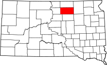 | |
| Unincorporated communities | ||
| Townships |
| |