Hoonah, Alaska
| Hoonah | |
|---|---|
| City | |
|
Aerial photo of Hoonah, Alaska | |
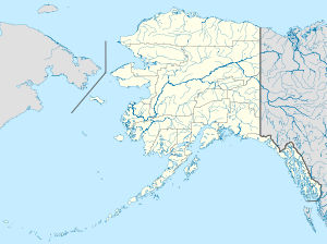 Hoonah Location in Alaska | |
| Coordinates: 58°06′34″N 135°26′11″W / 58.10944°N 135.43639°WCoordinates: 58°06′34″N 135°26′11″W / 58.10944°N 135.43639°W | |
| Country | United States |
| State | Alaska |
| Census Area | Hoonah-Angoon |
| Incorporated | June 8, 1946[1] |
| Government | |
| • Mayor | Kenneth Skaflestad[2] |
| • State senator | Bert Stedman (R) |
| • State rep. | Jonathan Kreiss-Tomkins (D) |
| Area | |
| • Total | 8.7 sq mi (22.5 km2) |
| • Land | 6.6 sq mi (17.1 km2) |
| • Water | 2.1 sq mi (5.4 km2) |
| Elevation | 52 ft (16 m) |
| Population (2000) | |
| • Total | 860 |
| • Density | 130.2/sq mi (50.3/km2) |
| Time zone | Alaska (AKST) (UTC-9) |
| • Summer (DST) | AKDT (UTC-8) |
| ZIP code | 99829 |
| Area code | 907 |
| FIPS code | 02-33360 |
| GNIS feature ID | 1403488 |
| Website | http://www.cityofhoonah.org/ |

Hoonah (Xunaa in Tlingit) is a largely Tlingit community on Chichagof Island, located in Alaska's panhandle in the southeast region of the state. It is 30 miles west of Juneau, across the Alaskan Inside Passage. Hoonah is the only first-class city on Chichagof Island, the 109th largest island in the world and the 5th largest island in the United States. At the 2000 census the population was 860, though summer population can swell to over 1,300 depending on fishing, boating, hiking and hunting conditions. Hoonah became the official spelling in 1901, with establishment of the Hoonah branch of the United States Post Office.[3] Xunaa means "protected from the North Wind" in the Tlingit language.
History
The clans comprising the Huna Tlingit originally settled what is now Glacier Bay National Park as well as Icy Strait, Cross Sound, and the outer coast north to Sea Otter Creek. Two catastrophic events forced the Tlingit from their homeland; rapid glacial advance in Glacier Bay and a landslide-induced tsunami in Lituya Bay along the outer coast. Tlingit oral tradition recounts these events as well as the clans' ultimate resettlement in Xunaa.
A partial timeline of modern Hoonah history is below:
- 1750's - Xunaa was settled by clans fleeing glacial advance in Glacier Bay
- 1880 - The North West Trading Company built the first store in Hoonah.
- 1881 - The Presbyterian Home Mission and school was built.
- 1887 - 450 to 500 people were wintering in the village.
- 1901 - Hoonah post office was opened.
- 1912 - The Hoonah Packing Co. built a large cannery north of town. The cannery was shut down and is now a tourist attraction at Icy Strait Point.
- 1934, 1936 Hoonah Indian Association constituted as a federally recognized tribe, authorized to act on behalf of the Huna Tlingit
- 1944 - A fire destroyed much of Hoonah, including many priceless Tlingit cultural objects. The United States federal government assisted in rebuilding Hoonah.
- 1953 - Last year that Icy Strait Salmon Company operated as a full-fledged canning operation. From this point until 1999 the property functioned as a maintenance and support facility for the seine boat fishing fleet.[4]
- 1964 - First High School graduating class from Hoonah High School graduated in May
- 2001 - Groundbreaking ceremony for Icy Strait Point, at abandon Hoonah Packing Company site.[4]
- 2004 - Celebrity MV Mercury makes inaugural call at Icy Strait Point.[4]
- 2007 - ZipRider! The world's largest zipline opens at Icy Strait Point.
- 2010 - Alaska State Troopers assisted Hoonah police in a 2-day manhunt for a man who was reported to be armed in a wooded area in the city. He was later apprehended without incident.
- 2010 - A fire and subsequent series of explosions destroyed the Icy Strait Lumber Mill. No criminal activity was suspected in the fire.[5]
- 2010 - Two police officers from the city were shot and killed in an ambush on Front Street. The suspect subsequently barricaded himself inside of his own home on August 29, 2010. State, local and federal law enforcement officers and SWAT personnel from agencies throughout Alaska responded in the wake of the shooting. The suspect, John Marvin, was taken into custody the next day.[6]
The officers killed in the incident were: Officer Matthew D. Tokuoka, 39 and Sgt. Anthony M. Wallace, 32. Tokuoka was a former Marine who served in special operations; Wallace was a former All-American collegiate wrestler and one of only a handful of legally deaf police officers in the United States. Police identified the alleged lone gunman as John Marvin Jr., 45, a local resident with a lengthy criminal record. Marvin was arrested after a 2-day standoff and charged with 2 counts of 1st degree murder and other charges arising from the incident. The murders of the two officers in the 4-officer agency was the highest per capita loss of lives for police in modern Alaska history. Over 1100 citizens and peace officers from all over Alaska, the U.S. mainland and Canada attended the slain officer's funeral, along with Governor Sean Parnell and U.S. Senator Lisa Murkowski. The service was the largest officer funeral in Alaska police history and the largest gathering in the history of Hoonah. The State of Alaska provided an extra ferry and charged no fee for those attending the funeral.[7]
- The town of Hoonah appears in episodes of the Discovery Channel show "Alaskan Bush People".
Education & Schools
Sheldon Jackson established the first school house & teacher's residence in November 1881. The school was initially overseen by Mr. and Mrs. Walter B. Styles of New York until their transfer to Sitka in 1882. The Reverend and Mrs. John McFarland assumed responsibility for the school in 1884 and by 1885 219 Tlingit students were enrolled, 69, boys, 76 girls and 74 adults.[8] A Territorial school and Government school were built in 1923. In 1932 the Government school was demolished and replaced by a Bureau of Indian Affairs school.[9]
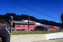
Hoonah City Schools currently serves the needs of Hoonah's elementary and secondary students. Six graduating seniors made up Hoonah City Schools class of 2015.[10]
Hoonah Packing Company
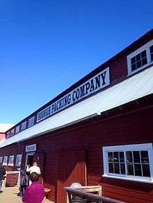
Hoonah Packing Company ("HPC") built in 1912 was one of eight canneries operating in the area during the early twentieth century, representing Hoonah's major industry at the time. HPC was sold several times until coming to be owned by Wards Cove Packing which also owned Hoonah Trading. The Cannery ceased operating in 1954, but continued to see use by commercial fishermen for storing and repairing their boats and gear.[9]
Geography
Hoonah is on the north shore of Chichagof Island, on Icy Strait, at 58°6′34″N 135°26′11″W / 58.10944°N 135.43639°W (58.109435, -135.436349).[11] The communities of Whitestone Logging Camp, Alaska, which was being dismantled in early 2011 and Game Creek are also in its urban area. The port at Hoonah is called Port Frederick. Other small communities nearby on Chichagof Island also include Tenake Springs and Pelican. A study began in 2009 regarding the feasibility of a road from Hoonah to Pelican and possibly connecting to Tenake Springs to allow an energy corridor to hot spring thermal energy sources in the region for Hoonah, to lower heating and energy costs. Most Tenake residents expressed opposition to the road, while Pelican has generally supported the idea. The road would save the Alaska Department of Transportation ferry costs in summer snow-free months, by connecting these areas to Hoonah.
According to the United States Census Bureau, the city has a total area of 8.7 square miles (23 km2), of which, 6.6 square miles (17 km2) of it is land and 2.1 square miles (5.4 km2) of it (24.05%) is water.
Tongass National Forest borders the area and has an unpaved road system of over 300 miles. recreation areas include Game Creek, Kennel Creek, Freshwater Bay which has a small boat harbor, all to the east and Whitestone boat landing and False Bay recreation area to the southeast. These areas are inaccessible in winter due to deep snow.
Climate
According to the Köppen climate classification system, Hoonah has an Oceanic climate (Cfb).
| Climate data for Hoonah | |||||||||||||
|---|---|---|---|---|---|---|---|---|---|---|---|---|---|
| Month | Jan | Feb | Mar | Apr | May | Jun | Jul | Aug | Sep | Oct | Nov | Dec | Year |
| Record high °F (°C) | 54 (12) |
49 (9) |
59 (15) |
72 (22) |
78 (26) |
85 (29) |
85 (29) |
84 (29) |
73 (23) |
61 (16) |
55 (13) |
52 (11) |
85 (29) |
| Average high °F (°C) | 33.5 (0.8) |
36.6 (2.6) |
39.4 (4.1) |
47.6 (8.7) |
56.4 (13.6) |
61.5 (16.4) |
63.4 (17.4) |
63.8 (17.7) |
57.3 (14.1) |
47.6 (8.7) |
37.8 (3.2) |
35.2 (1.8) |
48.3 (9.1) |
| Average low °F (°C) | 25.1 (−3.8) |
26.8 (−2.9) |
28 (−2) |
32.4 (0.2) |
39.3 (4.1) |
46.4 (8) |
50.7 (10.4) |
50.4 (10.2) |
44.7 (7.1) |
37.6 (3.1) |
30 (−1) |
27.6 (−2.4) |
36.6 (2.6) |
| Record low °F (°C) | 3 (−16) |
0 (−18) |
6 (−14) |
13 (−11) |
27 (−3) |
31 (−1) |
39 (4) |
33 (1) |
22 (−6) |
22 (−6) |
2 (−17) |
1 (−17) |
0 (−18) |
| Average precipitation inches (mm) | 6.3 (160) |
3.84 (97.5) |
4.17 (105.9) |
2.67 (67.8) |
2.65 (67.3) |
2.61 (66.3) |
3.58 (90.9) |
4.72 (119.9) |
7.06 (179.3) |
10.17 (258.3) |
7.29 (185.2) |
7.17 (182.1) |
62.23 (1,580.6) |
| Average snowfall inches (cm) | 24.7 (62.7) |
13.6 (34.5) |
17.8 (45.2) |
1.1 (2.8) |
0 (0) |
0 (0) |
0 (0) |
0 (0) |
0 (0) |
0.4 (1) |
12.2 (31) |
17.2 (43.7) |
87 (221) |
| Average precipitation days | 18 | 14 | 15 | 15 | 16 | 15 | 18 | 17 | 20 | 24 | 18 | 19 | 209 |
| Source: [12] | |||||||||||||
Demographics
| Historical population | |||
|---|---|---|---|
| Census | Pop. | %± | |
| 1900 | 447 | — | |
| 1910 | 462 | 3.4% | |
| 1920 | 402 | −13.0% | |
| 1930 | 514 | 27.9% | |
| 1940 | 716 | 39.3% | |
| 1950 | 563 | −21.4% | |
| 1960 | 686 | 21.8% | |
| 1970 | 748 | 9.0% | |
| 1980 | 680 | −9.1% | |
| 1990 | 795 | 16.9% | |
| 2000 | 860 | 8.2% | |
| 2010 | 759 | −11.7% | |
| Est. 2015 | 757 | [13] | −0.3% |
Hoonah is the principal village for the Huna Tlingit who originally settled Glacier Bay, Icy Strait, Cross Sound, and the Outer Coast. The four original Tlingit clans present are: Chookaneidi, T'aakdeintaan, Wooshkeetaan, and Kaagwaantaan. Numerous other clans migrated to, or married into, the community as have non-native peoples.
As of the census[15] of 2000, there were 860 people, 300 households, and 215 families residing in the city. The population density was 130.2 people per square mile (50.2/km²). There were 348 housing units at an average density of 52.7 per square mile (20.3/km²). The racial makeup of the city was 28.72% White, 0.23% Black or African American, 60.58% Native American, 0.12% Asian, 0.81% from other races, and 9.53% from two or more races. 3.60% of the population were Hispanic or Latino of any race.
There were 300 households out of which 33.7% had children under the age of 18 living with them, 52.3% were married couples living together, 12.3% had a female householder with no husband present, and 28.3% were non-families. 22.7% of all households were made up of individuals and 5.0% had someone living alone who was 65 years of age or older. The average household size was 2.83 and the average family size was 3.34.
In the city the age distribution of the population shows 29.2% under the age of 18, 9.4% from 18 to 24, 26.5% from 25 to 44, 27.3% from 45 to 64, and 7.6% who were 65 years of age or older. The median age was 36 years. For every 100 females there were 112.9 males. For every 100 females age 18 and over, there were 115.2 males.
The median income for a household in the city was $39,028, and the median income for a family was $45,125. Males had a median income of $37,083 versus $23,958 for females. The per capita income for the city was $16,097. About 14.3% of families and 16.6% of the population were below the poverty line, including 14.1% of those under age 18 and 10.4% of those age 65 or over.
The old fish cannery, which ceased operations in the 1950s, located near Icy Strait was obtained by the Huna Totem Corporation (HTC), the village ANCSA Corporation. The road to the site, Cannery Road was paved in 2000 and the site was converted into a tourism destination for cruise ship passengers. From May–September, cruise ships anchor off Icy Strait Point and visits from ship passengers enhance Hoonah's warm weather economy weekly. The former Hoonah Air Force Station, once a White Alice Communications System facility during the Cold War, which closed in the mid-1970s, is now the start point of a zip-line, one of the longest in the world, which ends at the cannery site. The cruise ship passengers, visiting fishing vessels and summer time boaters who dock in the Hoonah city small boat harbor, all bring revenue to the city. The closing of the logging industry in southeast Alaska hurt the town economically in the early 1990s but limited logging, tourism and fishing have helped to replace the void.
Hunters, hikers, campers, boaters and fishers all visit Hoonah as tourists throughout the year. The mild weather, much like that of Seattle, attracts tourists to the city.
Transportation
Hoonah, being an island community, is only accessible by boat or plane. The Alaska Marine Highway serves Hoonah with the M/V LeConte and the M/V Taku which offers residents a slower but more dependable and cheaper option to travel to and from Hoonah to Juneau.
The city of Hoonah operates a small boat harbor, a large vessel mooring harbor and a new boat haulout facility. The AK Dept. of Transportation built a new ferry facility that opened in early 2001 in Hoonah.
Airport
The Hoonah Airport was expanded in 2011. Hoonah Airport has a 3000-ft runway. The airport is planned for expansion to better allow military C-130's from the Coast Guard and Air national Guard land in Hoonah.
The airport offers service via bush carriers Wings of Alaska, Alaska Seaplanes and Air Excursions which offer up to five flights a day between Hoonah and Juneau and to other local communities. Connections can often be made in Juneau with either Alaska Airlines for regional or interstate travel or other bush carriers to go to other villages or communities.
Infrastructure
Hoonah has a K-12 school which has approximately 120 students, 2 stores, one with a fuel dealership and hardware store, a bar, a hotel and restaurant-bar, 2 cafes, an auto service center, several gift shops, several bed and breakfasts, a U.S. Post Office, a regional U.S. Forest Service Office for Tongass National Forest, a cold storage plant, and a sporting goods store. In 2015, a local brewery was established under the name Hoonah Brewing Company. Plans are underway to build a new jail.
The city is a first class city and provides all municipal services including police, utilities and road maintenance. The city also maintains a city park near the harbor built in 2010 and a youth center.
Public safety: The police department has a 5-bed jail and employs 4 paid police officers along with several volunteer reserve officers. The Hoonah volunteer Emergency Medical Service (EMS) was recognized by the State of Alaska in 2009 for excellence and the Hoonah Volunteer Fire Department was accredited by the Alaska Fire Commission in 2010. The Alaska State Troopers have an office post in Hoonah with one "brown shirt" wildlife enforcement trooper-pilot posted there.
The Alaska Courts maintain a court house in Hoonah for district court, presided over by a Magistrate.
Hoonah Indian Association maintains a tribal office, a senior citizens center and other services to local tribal members.
Health care
Hoonah Health Center (or Hoonah Medical Center) is the primary health clinic in the community. The facility operates as part of the Southeast Alaska Regional Health Consortium (or SEARC).[16] It is open daily for basic and urgent care, and offers assistance after hours in emergency situations. Bartlett Regional Hospital in Juneau, roughly 40 miles away (or an approximately 20 minute flight), is the nearest hospital medical center. Because no roads lead in or out of Hoonah, individuals in need of dire medical attention are often airlifted to Juneau via helicopter or air ambulance. The community is also served by local EMS. The EMS Team retains two fully functioning ambulances as well as a modified ambulance for off-road emergencies. In the summer of 2015, the clinic was moved to a larger, updated facility.
Religion
Hoonah has 8 churches:
- Sacred Heart Parish (Roman Catholic Church)
- St. Nicholas Orthodox Church
- Harbor of Faith Lutheran Church
- Hoonah United Presbyterian Church (PCUSA)
- Abundant Life Christian Fellowship (Assemblies of God)
- Hoonah Pentecostal Church (United Pentecostal)
- The Salvation Army Corps, Center for Worship and Service
- Hoonah Baptist Fellowship
Bibliography
- Dombrowski, Kirk (2001) Against Culture: Development, Politics, and Religion in Indian Alaska. Lincoln: University of Nebraska Press.
References
- ↑ 1996 Alaska Municipal Officials Directory. Juneau: Alaska Municipal League/Alaska Department of Community and Regional Affairs. January 1996. p. 66.
- ↑ 2015 Alaska Municipal Officials Directory. Juneau: Alaska Municipal League. 2015. p. 72.
- ↑ Donald J. Orth, Dictionary of Alaska Place Names, U.S. Gov't. Printing Office, Washington, D.C., 1967
- 1 2 3 "Icy Strait Point".
- ↑ Explosion and fire destroys Hoonah saw mill, Juneau Empire, July 23, 2010
- ↑ "Suspect in killing of Hoonah officers arrested". adn.com. Retrieved 2010-08-30.
- ↑ "Standoff continues after 2 police officers killed in Hoonah". adn.com. Retrieved 2010-08-30.
- ↑ Rev. Sheldon Jackson, D.O. Report on Education in Alaska U.S. Gov't Printing Office, Washington, D.. 1886
- 1 2 J. Hembree, S. Ashton, S. Hanlon et al., Hoonah History, 1975
- ↑ http://www.hoonahschools.org/
- ↑ "US Gazetteer files: 2010, 2000, and 1990". United States Census Bureau. 2011-02-12. Retrieved 2011-04-23.
- ↑ "HOONAH, ALASKA (503695)". Western Regional Climate Center. Retrieved November 18, 2015.
- ↑ "Annual Estimates of the Resident Population for Incorporated Places: April 1, 2010 to July 1, 2015". Retrieved July 2, 2016.
- ↑ "Census of Population and Housing". Census.gov. Retrieved June 4, 2015.
- ↑ "American FactFinder". United States Census Bureau. Retrieved 2008-01-31.
- ↑ Hoonah Health Center (SEARC), October 29, 2014
External links
Municipalities and communities of Hoonah–Angoon Census Area, Alaska, United States | ||
|---|---|---|
| Cities |  | |
| CDPs | ||
| Unincorporated community | ||
| Footnotes | ‡This populated place also has portions in adjacent boroughs or census areas | |
