Holy Cross, Alaska
| Holy Cross Deloy Chet, Ingirraller | |
|---|---|
| City | |
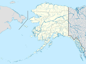 Holy Cross Location in Alaska | |
| Coordinates: 62°11′53″N 159°46′24″W / 62.19806°N 159.77333°WCoordinates: 62°11′53″N 159°46′24″W / 62.19806°N 159.77333°W | |
| Country | United States |
| State | Alaska |
| Census Area | Yukon-Koyukuk |
| Incorporated | April 20, 1968[1] |
| Government | |
| • Mayor | Rebecca Demientieff[2] |
| • State senator | Lyman Hoffman (D) |
| • State rep. | Bryce Edgmon (D) |
| Area | |
| • Total | 37.4 sq mi (97 km2) |
| • Land | 31.3 sq mi (81 km2) |
| • Water | 6.2 sq mi (16 km2) |
| Elevation | 135 ft (41 m) |
| Population (2007)[3] | |
| • Total | 204 |
| • Density | 7.3/sq mi (2.8/km2) |
| Time zone | Alaska (AKST) (UTC-9) |
| • Summer (DST) | AKDT (UTC-8) |
| ZIP codes | 99602 |
| Area code | 907 |
| FIPS code | 02-33030 |
Holy Cross (Deloy Chet[4] in Deg Xinag, Ingirraller in Central Alaskan Yup'ik) is a city in Yukon-Koyukuk Census Area, Alaska, United States. At the 2000 census the population was 227.
Geography
Holy Cross is located at 62°11′53″N 159°46′24″W / 62.19806°N 159.77333°W (62.198048, -159.773418).[5]
According to the United States Census Bureau, the city has a total area of 37.4 square miles (97 km2), of which, 31.3 square miles (81 km2) of it is land and 6.2 square miles (16 km2) of it (16.51%) is water.
Demographics
| Historical population | |||
|---|---|---|---|
| Census | Pop. | %± | |
| 1930 | 337 | — | |
| 1940 | 226 | −32.9% | |
| 1950 | 157 | −30.5% | |
| 1960 | 256 | 63.1% | |
| 1970 | 199 | −22.3% | |
| 1980 | 241 | 21.1% | |
| 1990 | 277 | 14.9% | |
| 2000 | 227 | −18.1% | |
| 2010 | 178 | −21.6% | |
| Est. 2015 | 177 | [6] | −0.6% |
As of the census[8] of 2000, there were 227 people, 64 households, and 49 families residing in the city. The population density was 7.3 people per square mile (2.8/km²). There were 81 housing units at an average density of 2.6 per square mile (1.0/km²). The racial makeup of the city was 3.52% White and 96.48% Native American.
There were 64 households out of which 43.8% had children under the age of 18 living with them, 46.9% were married couples living together, 15.6% had a female householder with no husband present, and 23.4% were non-families. 17.2% of all households were made up of individuals and 3.1% had someone living alone who was 65 years of age or older. The average household size was 3.55 and the average family size was 4.00.
In the city the age distribution of the population shows 38.8% under the age of 18, 7.9% from 18 to 24, 28.6% from 25 to 44, 17.2% from 45 to 64, and 7.5% who were 65 years of age or older. The median age was 27 years. For every 100 females there were 136.5 males. For every 100 females age 18 and over, there were 127.9 males.
The median income for a household in the city was $21,875, and the median income for a family was $26,250. Males had a median income of $37,813 versus $16,250 for females. The per capita income for the city was $8,542. About 33.3% of families and 45.6% of the population were below the poverty line, including 45.2% of those under the age of eighteen and 47.1% of those sixty five or over.
References
- ↑ "Directory of Borough and City Officials 1974". Alaska Local Government. Juneau: Alaska Department of Community and Regional Affairs. XIII (2): 38. January 1974.
- ↑ 2015 Alaska Municipal Officials Directory. Juneau: Alaska Municipal League. 2015. p. 70.
- ↑ "Annual Estimates of the Population for Incorporated Places in Alaska". United States Census Bureau. 2008-07-10. Retrieved 2008-07-14.
- ↑ ankn.uaf.edu: Deg Xinag Ałixi Ni’elyoy / Deg Xinag Learners' Dictionary (2007)
- ↑ "US Gazetteer files: 2010, 2000, and 1990". United States Census Bureau. 2011-02-12. Retrieved 2011-04-23.
- ↑ "Annual Estimates of the Resident Population for Incorporated Places: April 1, 2010 to July 1, 2015". Retrieved July 2, 2016.
- ↑ "Census of Population and Housing". Census.gov. Retrieved June 4, 2015.
- ↑ "American FactFinder". United States Census Bureau. Retrieved 2008-01-31.
Municipalities and communities of Yukon–Koyukuk Census Area, Alaska, United States | ||
|---|---|---|
| Cities | 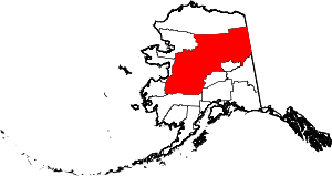 | |
| CDPs | ||
| Unincorporated communities | ||
| Ghost towns | ||
