Higashi-ku, Niigata
| Higashi-ku 東区 | |
|---|---|
| Ward | |
| Higashi Ward | |
|
Higashi-ku Ward Office | |
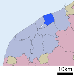 Location of Higashi-ku in Niigata City | |
 Higashi-ku
| |
| Coordinates: 37°55′29.4″N 139°5′33.6″E / 37.924833°N 139.092667°E | |
| Country | Japan |
| Region | Kōshin'etsu, Hokuriku (Chūbu) |
| Prefecture | Niigata |
| City | Niigata |
| Area | |
| • Total | 38.62 km2 (14.91 sq mi) |
| Population (June 1, 2016) | |
| • Total | 137,315 |
| • Density | 3,600/km2 (9,200/sq mi) |
| Time zone | Japan Standard Time (UTC+9) |
| Address | 1-4-1 Shimokido, Higashi-ku, Niigata-shi, Niigata-ken 950-8709 |
| Phone number | 025-272-1000 |
| Website |
www |

Higashi-ku (東区 Higashi-ku) is one of the eight wards of Niigata City, Niigata Prefecture, in the Hokuriku region of Japan. As of 1 June 2016, the ward had an estimated population of 137,222 and a population density of 3550 persons per km². Its total area was 38.62 square kilometres (14.91 sq mi). After Chūō-ku, Higashi-ku is the second smallest ward in Niigata City, making up about 5% of the total land area. It ranks third for largest population, with about 17% of Niigata's residents living in the Higashi-ku.
Geography

Higashi-ku is located in north-east Niigata city, directly east of the central Chūō-ku and is bordered by the Sea of Japan to the north. The Shinano River is to the west. In the south is the Nihonkai-Tōhoku Expressway. The Agano River in the eastern part of the ward is on the border with neighboring Kita-ku. Most housing districts are located in the northern and southern parts of the ward, while the center consists mainly of business and manufacturing districts. Niigata Airport and Niigata Harbor are located in Higashi-ku.
Surrounding municipalities
History
The area of present-day Higashi-ku was part of ancient Echigo Province. The town of Nuttari was established on April 1, 1889 within Kitakanbara District, Niigata with the establishment of the municipalities system. The villages of Ogata (大形) and Ishiyama (石山) were created on November 1, 1901. The city of Niigata annexed Nuttari (沼垂) in 1914, and Ogata and Ishiyama in 1943. Niigata became a government-designated city on April 1, 2007 and was divided into wards.
Education
University
Primary and secondary schools
Higashi-ku has 12 public elementary schools and nine public middle schools. The ward has two public high schools operated by the Niigata Prefectural Board of Education. The is also one North Korean school, Niigata Elementary and Junior High School (新潟朝鮮初中級学校).[1]
Transportation
Railway
Transit bus
- Transit bus operated by Niigata Kotsu[2]
Highways
Airport
Points of interest
Places
- Yamanoshita Minato Tower
References
- ↑ Home page. Niigata Elementary and Junior High School. Retrieved on October 14, 2015. "新潟県新潟市空港西2-14-1"
- ↑ 運行便別時刻表 [Bus Lines and Timetables (2016.3- )] (in Japanese). Niigata Kotsu. Retrieved 9 October 2016.
- ↑ 路線図(中心部) [Bus Map for East Niigata (2016.3- )] (PDF) (in Japanese). Niigata Kotsu. Retrieved 9 October 2016.
- ↑ 路線図(南方面) [Bus Map for East Niigata (2016.3- )] (PDF) (in Japanese). Niigata Kotsu. Retrieved 9 October 2016.
- ↑ 路線図(東方面) [Bus Map for East Niigata (2016.3- )] (PDF) (in Japanese). Niigata Kotsu. Retrieved 9 October 2016.
External links
![]() Media related to Higashi-ku, Niigata at Wikimedia Commons
Media related to Higashi-ku, Niigata at Wikimedia Commons
- Niigata official website (Japanese)
- Niigata Higashi-ku website (Japanese)
- Niigata City Official Tourist Information (multilingual)
- Niigata Pref. Official Travel Guide (multilingual)
