Hereford, Colorado
| Hereford, Colorado | |
|---|---|
| Unincorporated community | |
|
The welcome sign in Hereford. | |
| Coordinates: 40°58′30″N 104°18′19″W / 40.97500°N 104.30528°WCoordinates: 40°58′30″N 104°18′19″W / 40.97500°N 104.30528°W | |
| Country |
|
| State |
|
| Counties | Weld[1] |
| Elevation[1] | 5,279 ft (1,609 m) |
| Time zone | MST (UTC-7) |
| • Summer (DST) | MDT (UTC-6) |
| ZIP code[2] | 80732 |
| Area code(s) | 970 |

Hereford is an unincorporated community and a U.S. Post Office in Weld County, Colorado, United States. The Hereford Post Office has the ZIP Code 80732.[2]
Geography
Hereford is located at 40°58′30″N 104°18′19″W / 40.97500°N 104.30528°W (40.974973,-104.305401).
References
- 1 2 "US Board on Geographic Names". United States Geological Survey. 2007-10-25. Retrieved 2008-01-31.
- 1 2 "ZIP Code Lookup" (JavaScript/HTML). United States Postal Service. December 28, 2006. Retrieved December 28, 2006.
Municipalities and communities of Weld County, Colorado, United States | ||
|---|---|---|
| Cities | 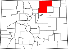 | |
| Towns | ||
| CDP | ||
| Unincorporated communities | ||
| Ghost towns | ||
| Footnotes | ‡This populated place also has portions in an adjacent county or counties | |
This article is issued from Wikipedia - version of the 3/29/2016. The text is available under the Creative Commons Attribution/Share Alike but additional terms may apply for the media files.