Harker Heights, Texas
| Harker Heights, Texas | ||
|---|---|---|
| City | ||
| City of Harker Heights | ||
| ||
| Motto: The Bright Star of Central Texas | ||
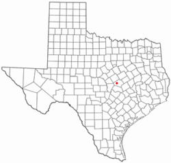 Location of Harker Heights, Texas | ||
 | ||
| Coordinates: 31°4′6″N 97°39′20″W / 31.06833°N 97.65556°WCoordinates: 31°4′6″N 97°39′20″W / 31.06833°N 97.65556°W | ||
| Country |
| |
| State |
| |
| County | Bell | |
| Area | ||
| • Total | 15.2 sq mi (39.4 km2) | |
| • Land | 15.2 sq mi (39.3 km2) | |
| • Water | 0.04 sq mi (0.1 km2) | |
| Elevation | 764 ft (233 m) | |
| Population (2015 est.) | ||
| • Total | 29,142 | |
| • Density | 1,759/sq mi (679.2/km2) | |
| Time zone | Central (CST) (UTC-6) | |
| • Summer (DST) | CDT (UTC-5) | |
| ZIP codes | 76542, 76543, 76548 | |
| Area code(s) | 254 | |
| FIPS code | 48-32312[1] | |
| GNIS feature ID | 1388539[2] | |
| Website |
ci | |

Harker Heights is a city in Bell County, Texas, United States. As of the 2010 census there were 26,700 people, 9,488 households, and 7,139 families residing in the city,[3] up from a population of 17,308 in 2000. This makes Harker Heights the third largest city in Bell County, after Killeen and Temple. Incorporated in 1960, the city derives its name from one of the two original landowners and founder, Harley Kern. Harker Heights is part of the Killeen–Temple–Fort Hood Metropolitan Statistical Area. People usually refer to the town as just "Heights".
History
Harker Heights is located near Fort Hood, a major United States Army post that was designated a permanent military facility in 1950. As the post grew in military population, the surrounding civilian population increased. Water Control and Improvement District No. 4 was established on land near the Killeen city limits and the military post in 1955, and included the land owned by Pinckney R. Cox and Harley Kern, two hog farmers. These two men subdivided their land in 1957 and began selling lots. By 1960, between 600 and 700 of the lots had been developed and new residents supplied with water and other utility services. Following a petition for an incorporation election, the city was established on September 24, 1960, and Cox was elected mayor. Kern had died before the incorporation, and the Harker in Harker Heights was a concatenation of Harley Kern's name as a tribute to one of the original landowners. The town's boundaries expanded to include Forest Hills, Highland Oaks, and Comanche Hills. Cox, Sam Garth Jr., and Barney Sissom created GIASISCO Corporation, which was meant to help expand the town from 400 to 950 acres (160 to 380 ha).[4]
Geography
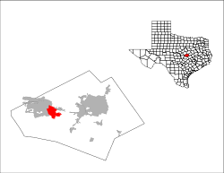
Harker Heights is located in west-central Bell County at 31°4′6″N 97°39′20″W / 31.06833°N 97.65556°W (31.068459, -97.655524).[5] It is bordered by the city of Killeen to the west and Nolanville to the east. The city limits extend south to hills overlooking Stillhouse Hollow Lake on the Lampasas River.
U.S. Highway 190 is a four-lane freeway that passes through the city, connecting Killeen to the west with Interstate 35 in Belton 12 miles (19 km) to the east, at a point approximately halfway between Waco and Austin.
According to the United States Census Bureau, Harker Heights has a total area of 15.2 square miles (39.4 km2), of which 15.2 square miles (39.3 km2) is land and 0.04 square miles (0.1 km2), or 0.32%, is water.[6]
Demographics
| Historical population | |||
|---|---|---|---|
| Census | Pop. | %± | |
| 1970 | 4,216 | — | |
| 1980 | 7,345 | 74.2% | |
| 1990 | 12,841 | 74.8% | |
| 2000 | 17,308 | 34.8% | |
| 2010 | 26,700 | 54.3% | |
| Est. 2015 | 29,142 | [7] | 9.1% |
The population is heavily engaged in economic activities directly or indirectly related to the U.S. Army at nearby Fort Hood. The population density was 1,759.1 people per square mile (523.7/km²). There were 10,347 housing units with 9,488 units occupied, and 859 units vacant. The racial makeup of the city was 62.9% White, 20.0% African American, 1.0% Native American, 3.90%Asian, 0.90% Pacific Islander, and Hispanic or Latino were 18.4% of the population.
There were 6,227 households out of which 42.8% had children under the age of 18 living with them, 62.8% were married couples living together, 9.2% had a female householder with no husband present, and 23.7% were non-families. 18.4% of all households were made up of individuals and 3.0% had someone living alone who was 65 years of age or older. The average household size was 2.76 and the average family size was 3.13.
In the city the population was spread out with 30.5% under the age of 18, 10.5% from 18 to 24, 34.8% from 25 to 44, 18.0% from 45 to 64, and 7.2% who were 65 years of age or older. The median age was 31.6 years. For every 100 females there were 101.0 males. For every 100 females age 18 and over, there were 99.0 males.
The median income for a household in the city was $59,491. The per capita income for the city was $24,161. About 7.4% of families and 10.0% of the population were below the poverty line, including 12.2% of those under age 18 and 4.9% of those age 65 or over.
Notable people
- Dominique Zeigler, former San Francisco 49ers wide receiver, former star at Harker Heights High School
Climate
The climate in this area is characterized by hot, humid summers and generally mild to cool winters. According to the Köppen Climate Classification system, Harker Heights has a humid subtropical climate, abbreviated "Cfa" on climate maps.[9]
References
- ↑ "American FactFinder". United States Census Bureau. Retrieved 2008-01-31.
- ↑ "US Board on Geographic Names". United States Geological Survey. 2007-10-25. Retrieved 2008-01-31.
- ↑ "Profile of General Population and Housing Characteristics: 2010 Demographic Profile Data (DP-1): Harker Heights city, Texas". U.S. Census Bureau, American Factfinder. Retrieved April 10, 2014.
- ↑ ed. Limmer, E.A. Jr. (1988). "Story of Bell County, Texas: Volume I", p. 129-130. Eakin Press, Austin.
- ↑ "US Gazetteer files: 2010, 2000, and 1990". United States Census Bureau. 2011-02-12. Retrieved 2011-04-23.
- ↑ "Geographic Identifiers: 2010 Demographic Profile Data (G001): Harker Heights city, Texas". U.S. Census Bureau, American Factfinder. Retrieved April 10, 2014.
- ↑ "Annual Estimates of the Resident Population for Incorporated Places: April 1, 2010 to July 1, 2015". Retrieved July 2, 2016.
- ↑ "Census of Population and Housing". Census.gov. Retrieved June 4, 2015.
- ↑ Climate Summary for Harker Heights, Texas
External links
Municipalities and communities of Bell County, Texas, United States | ||
|---|---|---|
| Cities | 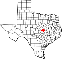 | |
| Towns | ||
| Village | ||
| CDP | ||
| Unincorporated communities |
| |
| Ghost towns |
| |
| Footnotes | ‡This populated place also has portions in an adjacent county or counties | |
