Graford, Texas
| Graford, Texas | |
|---|---|
| City | |
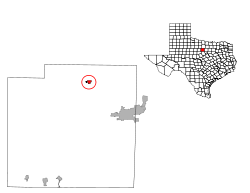
 Location of Graford, Texas | |
 | |
| Coordinates: 32°56′17″N 98°14′52″W / 32.93806°N 98.24778°WCoordinates: 32°56′17″N 98°14′52″W / 32.93806°N 98.24778°W | |
| Country | United States |
| State | Texas |
| County | Palo Pinto |
| Area | |
| • Total | 0.7 sq mi (1.8 km2) |
| • Land | 0.7 sq mi (1.8 km2) |
| • Water | 0.0 sq mi (0.0 km2) |
| Elevation | 958 ft (292 m) |
| Population (2010) | |
| • Total | 584 |
| • Density | 819.9/sq mi (316.6/km2) |
| Time zone | Central (CST) (UTC-6) |
| • Summer (DST) | CDT (UTC-5) |
| ZIP code | 76449 |
| Area code(s) | 940 |
| FIPS code | 48-30380[1] |
| GNIS feature ID | 1336782[2] |
Graford is a city in Palo Pinto County, Texas, United States. The population was 584 at the 2010 census.
Geography
Graford is located at 32°56′17″N 98°14′52″W / 32.93806°N 98.24778°W (32.937921, -98.247896).[3]
According to the United States Census Bureau, the city has a total area of 0.7 square miles (1.8 km2), all of it land.
Demographics
| Historical population | |||
|---|---|---|---|
| Census | Pop. | %± | |
| 1930 | 481 | — | |
| 1940 | 804 | 67.2% | |
| 1950 | 655 | −18.5% | |
| 1960 | 448 | −31.6% | |
| 1970 | 613 | 36.8% | |
| 1980 | 495 | −19.2% | |
| 1990 | 561 | 13.3% | |
| 2000 | 578 | 3.0% | |
| 2010 | 584 | 1.0% | |
| Est. 2015 | 575 | [4] | −1.5% |
As of the census[1] of 2000, there were 578 people, 213 households, and 145 families residing in the city. The population density was 819.9 people per square mile (318.8/km²). There were 238 housing units at an average density of 337.6 per square mile (131.3/km²). The racial makeup of the city was 94.64% White, 0.69% Native American, 3.63% from other races, and 1.04% from two or more races. Hispanic or Latino of any race were 4.84% of the population.
There were 213 households out of which 36.6% had children under the age of 18 living with them, 58.2% were married couples living together, 8.5% had a female householder with no husband present, and 31.5% were non-families. 26.8% of all households were made up of individuals and 14.6% had someone living alone who was 65 years of age or older. The average household size was 2.71 and the average family size was 3.38.
In the city the population was spread out with 30.1% under the age of 18, 7.3% from 18 to 24, 27.9% from 25 to 44, 23.2% from 45 to 64, and 11.6% who were 65 years of age or older. The median age was 34 years. For every 100 females there were 104.2 males. For every 100 females age 18 and over, there were 94.2 males.
The median income for a household in the city was $30,972, and the median income for a family was $33,676. Males had a median income of $25,885 versus $18,182 for females. The per capita income for the city was $12,648. About 9.1% of families and 12.1% of the population were below the poverty line, including 10.6% of those under age 18 and 19.7% of those age 65 or over.
Education
The City of Graford is served by the Graford Independent School District and home to the Graford High School Jackrabbits.
Notable people
- Billy Gillispie- Former Head Coach of the University of Kentucky, Texas A&M University and Texas Tech University's men's basketball teams.
References
- 1 2 "American FactFinder". United States Census Bureau. Retrieved 2008-01-31.
- ↑ "US Board on Geographic Names". United States Geological Survey. 2007-10-25. Retrieved 2008-01-31.
- ↑ "US Gazetteer files: 2010, 2000, and 1990". United States Census Bureau. 2011-02-12. Retrieved 2011-04-23.
- ↑ "Annual Estimates of the Resident Population for Incorporated Places: April 1, 2010 to July 1, 2015". Retrieved July 2, 2016.
- ↑ "Census of Population and Housing". Census.gov. Retrieved June 4, 2015.
Municipalities and communities of Palo Pinto County, Texas, United States | ||
|---|---|---|
| Cities |  | |
| CDP | ||
| Other unincorporated communities | ||
| Footnotes | ‡This populated place also has portions in an adjacent county or counties | |