Government Street (Mobile, Alabama)
Government Street is the name given to portions of U.S. Route 90 and U.S. Route 98 within the city limits of Mobile, Alabama. It is known as Government Street east of Pinehill Drive and as Government Boulevard west of Pinehill Drive. It is the most important road on Mobile's far south side and is the only nominally east–west road on Mobile's south side to come into the city from outside the western city limits and reach the downtown business district. The only other two east–west thoroughfares in the city to do so are Moffett Road/Springhill Avenue and Old Shell Road. Government is a four-lane highway throughout the city limits, from Water Street to the western city limits. It is the only thoroughfare in Mobile to have intersections with both Interstate 10 and Interstate 65 within the city limits.
Route description
Government Street begins at the intersection with the Old Spanish Trail on Blakeley Island, east of where it emerges from the Bankhead Tunnel. It expands after crossing Royal Street. U.S. Route 98 leaves the route at Broad Street, with the remainder of Government continuing as U.S. Highway 90. It continues onward for approximately 3.6 miles (5.8 km) to Pinehill Drive, where it becomes Government Boulevard. It then continues for approximately 10 miles (16 km) until it ends at the southwestern-most limits of the city, in Theodore. This area, along with the Tillmans Corner business district, was annexed into the city in September 2008.
History

Mobile Government Plaza, seat of government for the city of Mobile and Mobile County. Viewed from the corner of Government and South Jackson streets.
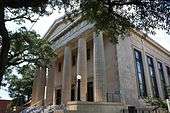
The street was laid out and named after the close of Mobile's colonial era, following the demolition of the obsolete Fort Conde. In the early 1820s the marshlands between the Mobile River and Royal Street were filled in with the bricks and other material from the demolished fort. Government Street was run westward from the old esplanade that had been situated beside the river and fort.[1] It has traditionally been a street where Mobile's government-related functions were concentrated. Barton Academy, Old City Hall, the Mobile County License Commissioner Offices, Mobile Government Plaza, the Mobile Public Library, Mobile Bar Association, and Social Security Administration all continue to lie along Government Street.[2]
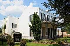
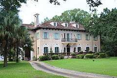
Government had a reputation as the "mansion or millionaire's row" in the city, although many of the largest and grandest of the 19th-century mansions once lining the street were demolished as late as the 1980s. The area east of Houston Street still has many 19th- to early 20th-century mansions that date back to the time when Government was the most prestigious address that one could have in Mobile.[1]
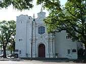
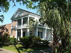
| Historic Government Street architecture |
|---|
| Le Vert House at 151–153 Government, built from 1827–47 and now demolished. Home of Madame Octavia Walton Le Vert, a noted antebellum socialite and author. |
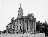
| Rudolph Benz-designed Mobile County Courthouse, built in 1889 and demolished in the 1950s. |
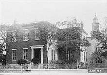
| Murray Forbes Smith House at 201, now demolished. Childhood home of Alva Smith Vanderbilt, noted socialite. |
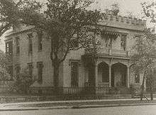
| Residential scene along Government in 1906. |
| William G. Chandler Mansion (later the McGill Institute) at 252, now demolished. Childhood home of Florence Chandler Maybrick, noted murderer. |
| Jonathan Emanuel Mansion at 251, now demolished. |
| First Baptist Church of Mobile at 806, built in 1909. |
| Government Street Methodist Church at 901, built from 1906–17. |
| Roberts-Taylor-Isbell House at 910, built in 1837. |
| Rapelje-DeLaney House at 1005, built in 1865. |
| Tacon-Barfield Mansion at 1216, built in 1901. |
| Paterson-Dean House at 1673, built in 1923. |
|
See also
References
- 1 2 Delaney, Caldwell (1953). The Story of Mobile. Mobile, Alabama: Gill Press Co. pp. 68, 156.
- ↑ "Water Street to Conception Street". University of South Alabama Archives. Retrieved 17 September 2009.
|
|---|
|
| History | |
|---|
|
| Culture | |
|---|
|
| Economy | |
|---|
|
| Education | |
|---|
|
| Geography | |
|---|
|
| Green spaces | |
|---|
|
| Historic sites | |
|---|
|
| Museums | |
|---|
|
| Structures | |
|---|
|
| Mayors | |
|---|
|
| Major media | |
|---|