Georgiana, Alabama
| Georgiana, Alabama | |
|---|---|
| Town | |
 Location in Butler County and the state of Alabama | |
| Coordinates: 31°38′24″N 86°44′21″W / 31.64000°N 86.73917°W | |
| Country | United States |
| State | Alabama |
| County | Butler |
| Area | |
| • Total | 6.3 sq mi (16.2 km2) |
| • Land | 6.3 sq mi (16.2 km2) |
| • Water | 0 sq mi (0 km2) |
| Elevation | 292 ft (89 m) |
| Population (2010) | |
| • Total | 1,738 |
| • Density | 279/sq mi (107.6/km2) |
| Time zone | Central (CST) (UTC-6) |
| • Summer (DST) | CDT (UTC-5) |
| ZIP code | 36033 |
| Area code | 334 |
| FIPS code | 01-29560 |
| GNIS feature ID | 0118914 |
Georgiana is a town in Butler County, Alabama, United States. As of the 2010 census, the population of the town was 1,738.[1]
Geography
Georgiana is located in southern Butler County at 31°38'24.313" North, 86°44'21.991" West (31.640087, -86.739442).[2] Interstate 65 passes to the northwest of the town, with access from exit 114 (State Route 106). U.S. Route 31 (Mobile Road) passes through the east side of the town, leading north 16 miles (26 km) to Greenville, the county seat. Via I-65, it is 58 miles (93 km) north to Montgomery, the state capital, and 110 miles (180 km) southwest to Mobile.
According to the U.S. Census Bureau, the town has a total area of 6.3 square miles (16 km2), all land.
Demographics
| Historical population | |||
|---|---|---|---|
| Census | Pop. | %± | |
| 1880 | 277 | — | |
| 1890 | 456 | 64.6% | |
| 1900 | 567 | 24.3% | |
| 1910 | 999 | 76.2% | |
| 1920 | 1,550 | 55.2% | |
| 1930 | 1,480 | −4.5% | |
| 1940 | 1,627 | 9.9% | |
| 1950 | 1,596 | −1.9% | |
| 1960 | 2,093 | 31.1% | |
| 1970 | 2,148 | 2.6% | |
| 1980 | 1,993 | −7.2% | |
| 1990 | 1,933 | −3.0% | |
| 2000 | 1,737 | −10.1% | |
| 2010 | 1,738 | 0.1% | |
| Est. 2015 | 1,667 | [3] | −4.1% |
| U.S. Decennial Census[4] 2013 Estimate[5] | |||
As of the census[6] of 2010, there were 1,738 people, 649 households, and 416 families residing in the town. The population density was 279 people per square mile (107.6/km²). There were 777 housing units at an average density of 123.3 per square mile (48.0/km²). The racial makeup of the town was 65.4% Black or African American, 33.1% White, 0.3% Native American, and 0.8% from two or more races. 0.3% of the population were Hispanic or Latino of any race.
There were 649 households out of which 25.9% had children under the age of 18 living with them, 34.1% were married couples living together, 25.0% had a female householder with no husband present, and 35.9% were non-families. 32.7% of all households were made up of individuals and 16.2% had someone living alone who was 65 years of age or older. The average household size was 2.42 and the average family size was 3.06.
In the town the age distribution of the population shows 21.3% under the age of 18, 8.2% from 18 to 24, 22.1% from 25 to 44, 24.2% from 45 to 64, and 24.1% who were 65 years of age or older. The median age was 43.3 years. For every 100 females there were 82.2 males. For every 100 women age 18 and over, there were 88.8 men.
The median income for a household in the town was $18,694, and the median income for a family was $20,139. Males had a median income of $30,625 versus $18,519 for females. The per capita income for the town was $11,181. About 39.4% of families and 43.6% of the population were below the poverty line, including 54.1% of those under age 18 and 32.5% of those age 65 or over.
Notable people
- Amasa Coleman Lee, Alabama lawyer and legislator
- Tom Morrow, former NFL safety for the Oakland Raiders
- Hank Williams, a country music legend
- William Herbert York, a bass player in Hank Williams' Drifting Cowboys band
See also
- SS Georgiana, Confederate cruiser wrecked March 19, 1863, while attempting to run the U.S. Navy's blockade at Charleston, South Carolina
References
- ↑ "Geographic Identifiers: 2010 Demographic Profile Data (G001): Georgiana town, Alabama". U.S. Census Bureau, American Factfinder. Retrieved September 18, 2013.
- ↑ "US Gazetteer files: 2010, 2000, and 1990". United States Census Bureau. 2011-02-12. Retrieved 2011-04-23.
- ↑ "Annual Estimates of the Resident Population for Incorporated Places: April 1, 2010 to July 1, 2015". Retrieved July 2, 2016.
- ↑ "U.S. Decennial Census". Census.gov. Retrieved June 6, 2013.
- ↑ "Annual Estimates of the Resident Population: April 1, 2010 to July 1, 2013". Retrieved June 3, 2014.
- ↑ "American FactFinder". United States Census Bureau. Retrieved 2015-07-09.
External links
Coordinates: 31°38′24″N 86°44′22″W / 31.640087°N 86.739442°W
Municipalities and communities of Butler County, Alabama, United States | ||
|---|---|---|
| City | 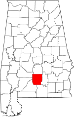 | |
| Towns | ||
| Unincorporated communities | ||
| Footnotes | ‡This populated place also has portions in an adjacent county or counties | |
