Geneseo Township, Henry County, Illinois
| Geneseo Township | |
|---|---|
| Township | |
 Location in Henry County | |
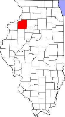 Henry County's location in Illinois | |
| Coordinates: 41°27′18″N 90°08′41″W / 41.45500°N 90.14472°WCoordinates: 41°27′18″N 90°08′41″W / 41.45500°N 90.14472°W | |
| Country |
|
| State |
|
| County | Henry |
| Established | November 4, 1856 |
| Area | |
| • Total | 36.39 sq mi (94.2 km2) |
| • Land | 36.31 sq mi (94.0 km2) |
| • Water | 0.08 sq mi (0.2 km2) 0.22% |
| Elevation | 643 ft (196 m) |
| Population (2010) | |
| • Total | 7,468 |
| • Density | 205.7/sq mi (79.4/km2) |
| Time zone | CST (UTC-6) |
| • Summer (DST) | CDT (UTC-5) |
| ZIP codes | 61235, 61254 |
| GNIS feature ID | 0429045 |
Geneseo Township is one of twenty-four townships in Henry County, Illinois, USA. As of the 2010 census, its population was 7,468 and it contained 3,407 housing units.[1]
Geography
According to the 2010 census, the township has a total area of 36.39 square miles (94.2 km2), of which 36.31 square miles (94.0 km2) (or 99.78%) is land and 0.08 square miles (0.21 km2) (or 0.22%) is water.[1]
Cities, towns, villages
Adjacent townships
- Phenix Township (north)
- Loraine Township (northeast)
- Atkinson Township (east)
- Cornwall Township (southeast)
- Munson Township (south)
- Osco Township (southwest)
- Edford Township (west)
- Hanna Township (west)
Cemeteries
The township contains these three cemeteries: Mizpan, North and Oakwood.
Major highways
Airports and landing strips
- Black Hawk Heliport
- Dewey E Greene Airport
- Gen Airpark
Landmarks
- Hennepin Canal Parkway State Park (east half)
- Hennepin Canal Pkwy State Park (west edge)
- Richmond Hill Park
School districts
- Geneseo Community Unit School District 228
Political districts
- Illinois's 14th congressional district
- State House District 71
- State House District 90
- State Senate District 36
- State Senate District 45
References
- United States Census Bureau 2008 TIGER/Line Shapefiles
- "Geneseo Township". Geographic Names Information System. United States Geological Survey. Retrieved 2009-09-17.
- United States National Atlas
- 1 2 "Population, Housing Units, Area, and Density: 2010 - County -- County Subdivision and Place -- 2010 Census Summary File 1". United States Census. Retrieved 2013-05-28.
External links
 |
Phenix Township | Loraine Township | | |
| Edford Township Hanna Township |
|
Atkinson Township | ||
| ||||
| | ||||
| Osco Township | Munson Township | Cornwall Township |
Municipalities and communities of Henry County, Illinois, United States | ||
|---|---|---|
| Cities | ||
| Towns | ||
| Villages | ||
| Townships | ||
| Unincorporated communities |
| |
| Footnotes | ‡This populated place also has portions in an adjacent county or counties | |
This article is issued from Wikipedia - version of the 12/4/2013. The text is available under the Creative Commons Attribution/Share Alike but additional terms may apply for the media files.