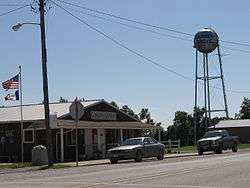
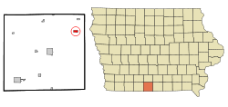
Garden Grove, Iowa
| Garden Grove, Iowa | |
|---|---|
| City | |
 | |
 Location of Garden Grove, Iowa | |
| Coordinates: 40°49′35″N 93°36′28″W / 40.82639°N 93.60778°WCoordinates: 40°49′35″N 93°36′28″W / 40.82639°N 93.60778°W | |
| Country |
|
| State |
|
| County | Decatur |
| Area[1] | |
| • Total | 0.69 sq mi (1.79 km2) |
| • Land | 0.69 sq mi (1.79 km2) |
| • Water | 0 sq mi (0 km2) |
| Elevation | 1,112 ft (339 m) |
| Population (2010)[2] | |
| • Total | 211 |
| • Estimate (2012[3]) | 204 |
| • Density | 305.8/sq mi (118.1/km2) |
| Time zone | Central (CST) (UTC-6) |
| • Summer (DST) | CDT (UTC-5) |
| ZIP code | 50103 |
| Area code(s) | 641 |
| FIPS code | 19-29775 |
| GNIS feature ID | 0456823 |
Garden Grove is a small town in Decatur County, Iowa, United States. The population was 211 at the 2010 census.
History
On April 24, 1846,[4] emigrants affiliated with The Church of Jesus Christ of Latter-day Saints under the direction of Brigham Young established a way station halfway into their trek across Iowa. This semi-permanent settlement was named Garden Grove because the entire grove was covered with wild onions as far as the eye could see.[5] Within three weeks of their arrival, the pioneers enclosed and planted 715 acres (2.89 km2).[6] They founded the village to assist those who did not have sufficient means to continue their journey, as well as to support and supply future companies of pioneers.[7]
When Brigham Young and the main company left Garden Grove on May 12, 1846,[8] the poorest and least prepared were left behind. After the Saints arrived in Winter Quarters, Captain James Allen brought orders from President James Polk to enlist a battalion of Mormons for the War with Mexico.[9] Brigham Young and other leaders rode back as far as Mt. Pisgah to encourage the men to enlist, and a letter was sent to the Saints in Garden Grove.[10] Only one man from the Garden Grove settlement, Edward Bunker, enlisted and served in the Mormon Battalion.[11]
In the fall of 1846, when the last of the Mormons were driven out of Nauvoo, Illinois, the exiles camped on the west shore of the Mississippi River. Two rescue parties were sent from Winter Quarters and Council Bluffs,[12] and an additional group was requested from Garden Grove. Luman Shurtliff lead the third rescue party and brought the poorest of the exiles to the settlement at Garden Grove.[13]
Through the winter of 1846/47, about 600 Latter-day Saints resided in Garden Grove.[14] By 1852, the Mormon settlers had moved on to Utah, selling the property and improvements to other American frontiersmen. Garden Grove is a site on the Mormon Pioneer National Historic Trail. A marker just west of the city, overlooking a wooded ravine, marks the site of the former Mormon Cemetery.
Garden Grove was a shipping point on the Chicago, Burlington and Quincy Railroad.[15]
Geography
Garden Grove is located at 40°49′35″N 93°36′28″W / 40.82639°N 93.60778°W (40.826479, -93.607732).[16]
According to the United States Census Bureau, the city has a total area of 0.69 square miles (1.79 km2), all of it land.[1]
Demographics
| Historical populations | ||
|---|---|---|
| Year | Pop. | ±% |
| 1880 | 549 | — |
| 1890 | 554 | +0.9% |
| 1900 | 651 | +17.5% |
| 1910 | 611 | −6.1% |
| 1920 | 666 | +9.0% |
| 1930 | 558 | −16.2% |
| 1940 | 558 | +0.0% |
| 1950 | 417 | −25.3% |
| 1960 | 335 | −19.7% |
| 1970 | 285 | −14.9% |
| 1980 | 297 | +4.2% |
| 1990 | 229 | −22.9% |
| 2000 | 250 | +9.2% |
| 2010 | 211 | −15.6% |
| 2014 | 202 | −4.3% |
| 2015 | 205 | +1.5% |
| Source:"American FactFinder". United States Census Bureau. and Iowa Data Center Source: | ||
2010 census
As of the census[2] of 2010, there were 211 people, 78 households, and 49 families residing in the city. The population density was 305.8 inhabitants per square mile (118.1/km2). There were 103 housing units at an average density of 149.3 per square mile (57.6/km2). The racial makeup of the city was 97.6% White, 0.9% African American, and 1.4% from two or more races. Hispanic or Latino of any race were 0.9% of the population.
There were 78 households of which 32.1% had children under the age of 18 living with them, 35.9% were married couples living together, 17.9% had a female householder with no husband present, 9.0% had a male householder with no wife present, and 37.2% were non-families. 26.9% of all households were made up of individuals and 6.4% had someone living alone who was 65 years of age or older. The average household size was 2.71 and the average family size was 2.96.
The median age in the city was 38.1 years. 27% of residents were under the age of 18; 6.7% were between the ages of 18 and 24; 28.4% were from 25 to 44; 29.9% were from 45 to 64; and 8.1% were 65 years of age or older. The gender makeup of the city was 51.7% male and 48.3% female.
2000 census
As of the census[18] of 2000, there were 250 people, 96 households, and 64 families residing in the city. The population density was 359.0 people per square mile (137.9/km²). There were 113 housing units at an average density of 162.3 per square mile (62.3/km²). The racial makeup of the city was 99.60% White and 0.40% Native American.
There were 96 households out of which 31.3% had children under the age of 18 living with them, 56.3% were married couples living together, 9.4% had a female householder with no husband present, and 32.3% were non-families. 28.1% of all households were made up of individuals and 11.5% had someone living alone who was 65 years of age or older. The average household size was 2.60 and the average family size was 3.26.
In the city the population was spread out with 29.2% under the age of 18, 8.8% from 18 to 24, 26.0% from 25 to 44, 21.6% from 45 to 64, and 14.4% who were 65 years of age or older. The median age was 36 years. For every 100 females there were 115.5 males. For every 100 females age 18 and over, there were 92.4 males.
The median income for a household in the city was $19,844, and the median income for a family was $29,464. Males had a median income of $21,875 versus $18,125 for females. The per capita income for the city was $10,301. About 28.3% of families and 35.5% of the population were below the poverty line, including 43.3% of those under the age of eighteen and 28.2% of those sixty five or over.
References
- 1 2 "US Gazetteer files 2010". United States Census Bureau. Retrieved 2012-05-11.
- 1 2 "American FactFinder". United States Census Bureau. Retrieved 2012-05-11.
- ↑ "Population Estimates". United States Census Bureau. Retrieved 2013-05-23.
- ↑ Leland H. Gentry, "The Mormon Way Stations: Garden Grove and Mt. Pisgah," BYU Studies, 24:4 (Fall 1981), 448.
- ↑ Nelson Wheeler Whipple, "Diaries, 1863-1887," p. 20, MSS SC 38, Harold B. Lee Library Special Collections, Brigham Young University, Provo, Utah.
- ↑ Stanley Buchholz Kimball, Heber C. Kimball: Mormon Patriarch and Pioneer (Urbana: University of Illinois Press, 1981), 135.
- ↑ Gentry, "The Mormon Way Stations," 449.
- ↑ William G. Hartley, "Mormons and Early Iowa History (1838 to 1858): Eight Distinct Connections," The Annals of Iowa 59:3 (Summer 2000), 236.
- ↑ Richard E. Bennett, Mormons at the Missouri: Winter Quarters, 1846-1852 (Norman: University of Oklahoma Press, 1987), 51.
- ↑ B. H. Roberts, The Mormon Battalion: Its History and Achievements (Provo, Utah: Maasai, 2001), 17.
- ↑ Edward Bunker, Autobiography of Edward Bunker (Provo: Brigham Young University, 1938), 7.
- ↑ Bennett, Mormons at the Missouri, 84.
- ↑ Luman Andros Shurtliff, "Journal of Luman Andros Shurtliff," pp. 64-66, 289.3701S562j, Stewart Library, Weber State University, Ogden, Utah.
- ↑ Bennett, Mormons at the Missouri, 90.
- ↑ Tuttle, Charles Richard (1876). An Illustrated History of the State of Iowa. Richard S. Peale. p. 483.
- ↑ "US Gazetteer files: 2010, 2000, and 1990". United States Census Bureau. 2011-02-12. Retrieved 2011-04-23.
- ↑ "Census of Population and Housing". Census.gov. Retrieved June 4, 2015.
- ↑ "American FactFinder". United States Census Bureau. Retrieved 2008-01-31.
External links
![]() Media related to Garden Grove, Iowa at Wikimedia Commons
Media related to Garden Grove, Iowa at Wikimedia Commons
- City Data Comprehensive Statistical Data and more about Garden Grove
Municipalities and communities of Decatur County, Iowa, United States | ||
|---|---|---|
| Cities | ||
| Townships | ||
