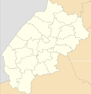
Duliby, Stryi Raion
| Duliby Дуліби | ||
|---|---|---|
| village | ||
| ||
 Duliby | ||
| Coordinates: UA 49°13′50″N 23°49′00″E / 49.23056°N 23.81667°ECoordinates: UA 49°13′50″N 23°49′00″E / 49.23056°N 23.81667°E | ||
| Country |
| |
| Province |
| |
| District |
| |
| Established | 1463 | |
| Area | ||
| • Total | 25,2 km2 (97 sq mi) | |
| Elevation/(average value of) | 305 m (1,001 ft) | |
| Population | ||
| • Total | 3,671 | |
| • Density | 145,67/km2 (37,730/sq mi) | |
| Time zone | EET (UTC+2) | |
| • Summer (DST) | EEST (UTC+3) | |
| Postal code | 82434 | |
| Area code | +380 3245 | |
| Website | село Дуліби (Ukrainian) | |
Duliby (Ukrainian: Дулі́би) is a village (selo) located along the Stryi River in the Stryi Raion (district) of the Lviv Oblast (province) in Western Ukraine.
The population of the village is about 3 671 people. Local government is administered by Dulibivska village council.[1]
Geography
The village is located in the direction of the Highway M06 (Ukraine) (![]() ) at a distance 3 kilometres (1.9 mi) from Stryi, 75 kilometres (47 mi) from the regional center of Lviv and 192 kilometres (119 mi) from Uzhhorod.[2]
) at a distance 3 kilometres (1.9 mi) from Stryi, 75 kilometres (47 mi) from the regional center of Lviv and 192 kilometres (119 mi) from Uzhhorod.[2]
History
The first mention recorded in the court documents dated 1463.[3]
Cult constructions and religion
Church of St. George 1923 (Wooden) and church of the Transfiguration (stone) is in the village.[4]
Gallery
-
Church of St. George 1923 (wooden).
-
The bell tower of the church of St. George.
-
St.George church 1920-1923, Duliby.
-
A monument to priest Michael Datsyshyn in the village Duliby.
Famous people
- Ostap Nyzhankivsky (1862 - 1919) – a priest of the UGCC, composer, conductor, and civic leader. In Duliby studied in elementary school. In 1900 he worked as a pastor-administrator. In 1919 he was shot by the Polish authorities.[5]
- Lev Shankovsky (1903 - 1995) – Ukrainian military historian and former UPA soldier. Born in the village Duliby.
- Michael Datsyshyn[6] (November 20, 1914 - December 14, 1993) – village pastor Ukrainian Greek Catholic Church from 1964 to 1993.
References
- ↑ Дулібська сільська рада (Ukrainian)
- ↑ DELLA
- ↑ Село Дуліби (Львівська обл., Стрийський р-н): карта вулиць (Ukrainian)
- ↑ DeCerkva, Дуліби, Св. Юрія 1923 (Ukrainian)
- ↑ Польська окупація Західної України в 1918-1939 роках. Як це було (Ukrainian)
- ↑ Фортуна.Тернистий шлях отця Михайла Дацишина] (Ukrainian)
External links
- Дуліби - Неофіційна сторінка м. Стрий (Ukrainian)
- weather.in.ua
- Сайт громади с. Дуліби (Ukrainian)
Literature
- Ukrainian: Історія міст і сіл УРСР : Львівська область. – К. : ГРУРЕ, 1968 р., сторінка 833
