Dubois, Wyoming
| Dubois, Wyoming | |
|---|---|
| Town | |
|
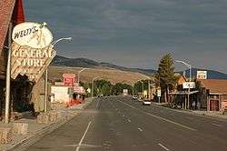
Along the main street in Dubois | |
| Motto: "Where Real Cowboys Work and Play" | |
 Location of Dubois, Wyoming | |
 Dubois, Wyoming Location in the United States | |
| Coordinates: 43°32′9″N 109°38′9″W / 43.53583°N 109.63583°WCoordinates: 43°32′9″N 109°38′9″W / 43.53583°N 109.63583°W | |
| Country | United States |
| State | Wyoming |
| County | Fremont |
| Government | |
| • Mayor | Twila Blakeman |
| Area[1] | |
| • Total | 3.43 sq mi (8.88 km2) |
| • Land | 3.42 sq mi (8.86 km2) |
| • Water | 0.01 sq mi (0.03 km2) |
| Elevation | 6,946 ft (2,117 m) |
| Population (2010)[2] | |
| • Total | 971 |
| • Estimate (2012[3]) | 1,002 |
| • Density | 283.9/sq mi (109.6/km2) |
| Time zone | Mountain (MST) (UTC-7) |
| • Summer (DST) | MDT (UTC-6) |
| ZIP code | 82513 |
| Area code(s) | 307 |
| FIPS code | 56-21415[4] |
| GNIS feature ID | 1609085[5] |
| Website | Dubois Wyoming |
Dubois /ˈdjuːbɔɪz/ DEW-boyz is a town in Fremont County, Wyoming. The population was 971 at the 2010 census, although it nearly doubles in the summer with many part-time residents.
History
The original residents of Dubois, Wyoming wanted to name the town "Tibo" after the name the local Shoshone tribe gave to the first missionary in the area. However, the postal service found the name unacceptable, so it endowed the town with the name Dubois after Fred Dubois, an Idaho senator at [6] In protest, the citizens of Dubois rejected the French pronunciation, instead opting for Du, with u as in "Sue"; bois, with oi as in "voice". The accent is on the first syllable.[7]

The first occupants of the mountains and valleys surrounding what is now Dubois were members of the Sheepeaters, a group of Mountain Shoshone, who included the Wind River area in their regular annual migrations from the Great Plains through the mountains of Yellowstone and beyond.[8] The Wind River Valley surrounding Dubois contains numerous remnants of these people who lived in the area for many hundreds of years before they were relocated into a nearby reservation.[8][9] Relics of their existence in the mountains and valleys around Dubois include numerous prehistoric petroglyphs, hunting traps and blinds, and stone tepee circles.
The first Europeans to enter the area were trappers Francois and Louis Verendrye in 1742–43. [10] In the years to follow, the Wind River valley was visited regularly by the Astorians and other fur trappers and hunters through the early 19th century. The mountain man Jim Bridger, visited the area en route to Yellowstone in 1807 and 1808, named nearby Union Pass and Union Peak. The first homesteaders arrived in the late 1870s.[10]
Butch Cassidy (Robert LeRoy Parker) owned and managed a ranch on the outskirts of Dubois, beginning in 1890.[11] It is said that he was a frequent customer at Welty's General Store in Dubois, which is still in operation. A statue recently erected in the center of Dubois is modeled after Butch Cassidy. In 1913, the town expanded with the addition of a hotel, a bar, and a general store, anticipating the arrival of Scandinavian lumber workers brought there by the Wyoming Tie and Timber Company the following year. (All of these structures are still standing.)
St. Thomas Episcopal Church was founded in 1910 by Reverend John Roberts, an Episcopal missionary who served the Native American tribes on the Wind River.[12]
Charles Moore built the first of many dude ranches in the area, Ramshorn Ranch and Camp Yellowstone, at the mouth of the DuNoir Creek west of Dubois in 1907.[10]
In the landscape surrounding Dubois are visible the remains of many wood flumes constructed by the tie hacks who provided the railroad ties that helped to develop the American West. These Scandinavian immigrants cut logs into ties and sent these via the flumes to the Wind River where they floated to Riverton, about 70 miles east, for processing.[13]
The Dubois Museum preserves and interprets the natural and social history of the Upper Wind River Valley[14] as the National Bighorn Sheep Interpretive Center focuses on public education about the biology and habitat of the Rocky Mountain Bighorn Sheep with specific focus on the currently largest herd of Rocky Mountain Bighorn sheep in the coterminous United States that winter in the Whisky Basin of Whisky Mountain adjacent to the Fitzpatrick Wilderness[15] in the Shoshone National Forest. The Center preserves and interprets the relationships of the Bighorn sheep.[16]
The town is on U.S. Route 26 and is the beginning of the Wyoming Centennial Scenic Byway, U.S. Route 26 crossing the Continental Divide at Togwotee Pass.
A significant proportion of Dubois residents are writers, artists, photographers, musicians and songwriters, drawn to the remote town in part by its relatively moderate climate and remarkable scenery. Annual cultural events include a national art show and a quilt show, a winterfest including dogsled races and ski-joring, and a workshop for aspiring songwriters led by country music artist Skip Ewing. During summer months, a square dance and a rodeo including local and regional competitors take place every week.
On December 30, 2014, several businesses burned to the ground in the downtown area. The air temperatures at the time of the blaze were hovering near -35 degrees with wind chills in the 50 below zero range. Firefighters battled freezing equipment and gear throughout the night to get the fire under control. The blaze was ruled accidental. The origin of the fire appeared to be inside the rear of the "Main Street Mart" building in the attic above a wood stove. The cause was more than likely from Pyrolysis resulting from the chimney coming in contact with building materials. Approximately half a block of Downtown Dubois was destroyed in the fire.
Geography
Dubois is located at 43°32′9″N 109°38′9″W / 43.53583°N 109.63583°W (43.535936, -109.635915)[17] and an elevation of 2115 m (6940 ft). The Wind River runs through the town.
According to the United States Census Bureau, the town has a total area of 3.43 square miles (8.88 km2), of which, 3.42 square miles (8.86 km2) of it is land and 0.01 square miles (0.03 km2) is water.[1]
Climate
Dubois experiences a semi-arid climate (Köppen BSk) with long, cold winters and short, warm summers.
| Climate data for Dubois, Wyoming | |||||||||||||
|---|---|---|---|---|---|---|---|---|---|---|---|---|---|
| Month | Jan | Feb | Mar | Apr | May | Jun | Jul | Aug | Sep | Oct | Nov | Dec | Year |
| Record high °F (°C) | 60 (16) |
66 (19) |
73 (23) |
79 (26) |
85 (29) |
93 (34) |
100 (38) |
95 (35) |
93 (34) |
85 (29) |
74 (23) |
61 (16) |
100 (38) |
| Average high °F (°C) | 32.4 (0.2) |
36.4 (2.4) |
41.9 (5.5) |
49.0 (9.4) |
59.1 (15.1) |
70.1 (21.2) |
78.1 (25.6) |
77.4 (25.2) |
66.6 (19.2) |
55.4 (13) |
40.0 (4.4) |
34.1 (1.2) |
53.38 (11.87) |
| Daily mean °F (°C) | 21.8 (−5.7) |
24.4 (−4.2) |
30.1 (−1.1) |
36.1 (2.3) |
45.3 (7.4) |
54.4 (12.4) |
60.7 (15.9) |
59.8 (15.4) |
50.5 (10.3) |
41.4 (5.2) |
28.8 (−1.8) |
23.4 (−4.8) |
39.73 (4.28) |
| Average low °F (°C) | 11.2 (−11.6) |
12.4 (−10.9) |
18.3 (−7.6) |
23.2 (−4.9) |
31.5 (−0.3) |
38.6 (3.7) |
43.3 (6.3) |
42.2 (5.7) |
34.3 (1.3) |
27.3 (−2.6) |
17.6 (−8) |
12.7 (−10.7) |
26.05 (−3.3) |
| Record low °F (°C) | −44 (−42) |
−35 (−37) |
−38 (−39) |
−12 (−24) |
3 (−16) |
20 (−7) |
22 (−6) |
25 (−4) |
8 (−13) |
−3 (−19) |
−26 (−32) |
−49 (−45) |
−49 (−45) |
| Average precipitation inches (mm) | 0.28 (7.1) |
0.26 (6.6) |
— | 1.16 (29.5) |
1.63 (41.4) |
1.18 (30) |
1.08 (27.4) |
0.85 (21.6) |
1.20 (30.5) |
0.64 (16.3) |
0.50 (12.7) |
0.29 (7.4) |
— |
| Source #1: NOAA (normals, 1971–2000) [18] | |||||||||||||
| Source #2: The Weather Channel (Records) [19] | |||||||||||||
Demographics
| Historical population | |||
|---|---|---|---|
| Census | Pop. | %± | |
| 1920 | 243 | — | |
| 1930 | 177 | −27.2% | |
| 1940 | 412 | 132.8% | |
| 1950 | 279 | −32.3% | |
| 1960 | 574 | 105.7% | |
| 1970 | 898 | 56.4% | |
| 1980 | 1,067 | 18.8% | |
| 1990 | 895 | −16.1% | |
| 2000 | 962 | 7.5% | |
| 2010 | 971 | 0.9% | |
| Est. 2015 | 987 | [20] | 1.6% |
2010 census
As of the census[2] of 2010, there were 971 people, 507 households, and 256 families residing in the town. The population density was 283.9 inhabitants per square mile (109.6/km2). There were 625 housing units at an average density of 182.7 per square mile (70.5/km2). The racial makeup of the town was 95.8% White, 0.4% African American, 0.9% Native American, 1.2% Asian, 0.2% from other races, and 1.4% from two or more races. Hispanic or Latino of any race were 0.4% of the population.
There were 507 households of which 14.4% had children under the age of 18 living with them, 41.4% were married couples living together, 5.9% had a female householder with no husband present, 3.2% had a male householder with no wife present, and 49.5% were non-families. 40.6% of all households were made up of individuals and 17.2% had someone living alone who was 65 years of age or older. The average household size was 1.92 and the average family size was 2.55.
The median age in the town was 51.6 years. 13.8% of residents were under the age of 18; 5.4% were between the ages of 18 and 24; 18.9% were from 25 to 44; 36.7% were from 45 to 64; and 25.1% were 65 years of age or older. The gender makeup of the town was 49.9% male and 50.1% female.
2000 census
As of the census[4] of 2000, there were 962 people, 451 households, and 274 families residing in the town. The population density was 370.3 people per square mile (142.9/km²). There were 556 housing units at an average density of 214.0 per square mile (82.6/km²). The racial makeup of the town was 96.15% White, 0.10% African American, 1.25% Native American, 0.31% Asian, 0.31% from other races, and 1.87% from two or more races. Hispanic or Latino of any race were 1.14% of the population.
There were 451 households out of which 22.6% had children under the age of 18 living with them, 49.4% were married couples living together, 8.4% had a female householder with no husband present, and 39.2% were non-families. 32.6% of all households were made up of individuals and 8.9% had someone living alone who was 65 years of age or older. The average household size was 2.13 and the average family size was 2.68.
In the town the population was spread out with 20.9% under the age of 18, 5.1% from 18 to 24, 25.9% from 25 to 44, 29.6% from 45 to 64, and 18.5% who were 65 years of age or older. The median age was 44 years. For every 100 females there were 99.2 males. For every 100 females age 18 and over, there were 100.8 males.
The median income for a household in the town was $28,194, and the median income for a family was $33,409. Males had a median income of $28,125 versus $16,719 for females. The per capita income for the town was $15,657. About 9.9% of families and 12.0% of the population were below the poverty line, including 13.8% of those under age 18 and 3.7% of those age 65 or over.
Education
Public education in the town of Dubois is provided by Fremont County School District #2. The district has one campus which serves Kindergarten - Grade 12. In 2014, Dubois Public Schools built onto the existing Elementary/Middle School to create a K-12 school. As of the 2014-2015 school year, the district enrollment for Dubois Schools was 146.
Highways
Cultural references
The geology of the area surrounding Dubois is unique in the world for featuring (almost in the same view) examples of all three major mountain-building forces: tectonic, volcanic, and glacial. This is described in detail in the nonfiction book Rising from the Plains by science writer John McPhee.
The body of Marine PFC Chance Phelps was taken to his parents' home in Dubois after his death in Iraq in 2004. The story is featured in the HBO film Taking Chance.
Notable natives
- Matthew Fox, (b 1966), actor most known for his work in the ABC drama series Lost.
- Chance Phelps (1984–2004), US Marine killed in Iraq, subject of the film Taking Chance.
Current/Former Residents
- Gale W. McGee, former United States Senator
- Jeffrey I. Sussman, President of Dreyfus Property Group
- Gerry Spence Trial Lawyers College at Thunderhead Ranch
- Michael Hossack, Drummer for The Doobie Brothers
- Anomalovaho, Designer
References
- 1 2 "US Gazetteer files 2010". United States Census Bureau. Retrieved 2012-12-14.
- 1 2 "American FactFinder". United States Census Bureau. Retrieved 2012-12-14.
- ↑ "Population Estimates". United States Census Bureau. Retrieved 2013-06-01.
- 1 2 "American FactFinder". United States Census Bureau. Retrieved 2008-01-31.
- ↑ "US Board on Geographic Names". United States Geological Survey. 2007-10-25. Retrieved 2008-01-31.
- ↑ Esther Mockler (2015). "Recollections of the Upper Wind River Valley". Pronghorn Press.
- ↑ All-Refer.com – Dubois, Wyoming
- 1 2 Lawrence L. Loendorf & Nancy Medaris Stone (2006). "Mountain Spirit: The Sheep Eater Indians of Yellowstone". The University of Utah Press.
- ↑ "The Mountain Shoshones". Wind River Rendezvous. 20 (3): 3–5. Jul–September 1990. Check date values in:
|date=(help) - 1 2 3 Allison, Mary (1991). Dubois, Wyoming Area History. Curtis Media Corp. ISBN 0-88107-179-X.
- ↑ Edward J. Farlow (1998). "Wind River Adventures: My Life in Frontier Wyoming". High Plains Press: 123.
- ↑ Dubois, Wyoming: Historic Walking Tour (PDF) (Map). Wind River Visitors Council. Retrieved 28 February 2015.
- ↑ Wyoming Recreation Commission (1976). "A Guide to Historic Sites": 83.
- ↑ "Dubois Museum – Museum Day Venues". Smithsonian Magazine. Retrieved February 10, 2012.
- ↑ "Whiskey Mountain". SummitPost.org. Retrieved February 10, 2012.
- ↑ "National Bighorm Sheep Interpretive Center and Whiskey Mountain Bighorn Sheep Area (WY)". Retrieved February 10, 2012.
- ↑ "US Gazetteer files: 2010, 2000, and 1990". United States Census Bureau. 2011-02-12. Retrieved 2011-04-23.
- ↑ "Climatography of the United States NO.81" (PDF). National Oceanic and Atmospheric Administration. Retrieved January 13, 2011.
- ↑ "Monthly Averages for Dubois, WY". The Weather Channel. Retrieved January 13, 2011.
- ↑ "Annual Estimates of the Resident Population for Incorporated Places: April 1, 2010 to July 1, 2015". Retrieved July 2, 2016.
- ↑ "Census of Population and Housing". Census.gov. Retrieved June 4, 2015.
External links
Municipalities and communities of Fremont County, Wyoming, United States | ||
|---|---|---|
| Cities | 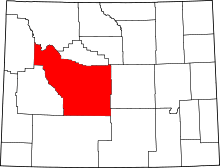 | |
| Towns | ||
| CDPs | ||
| Unincorporated communities | ||
| Ghost town | ||
| Indian reservation | ||