Denmark, South Carolina
| Denmark, South Carolina | |
|---|---|
| City | |
 Location of Denmark, South Carolina | |
| Coordinates: 33°19′16″N 81°8′32″W / 33.32111°N 81.14222°WCoordinates: 33°19′16″N 81°8′32″W / 33.32111°N 81.14222°W | |
| Country | United States |
| State | South Carolina |
| County | Bamberg |
| Area | |
| • Total | 3.84 sq mi (9.94 km2) |
| • Land | 3.83 sq mi (9.93 km2) |
| • Water | 0.004 sq mi (0.01 km2) |
| Elevation | 240 ft (73 m) |
| Population (2010) | |
| • Total | 3,538 |
| • Density | 922/sq mi (356.1/km2) |
| Time zone | Eastern (EST) (UTC-5) |
| • Summer (DST) | EDT (UTC-4) |
| ZIP code | 29042 |
| Area code(s) | 803 |
| FIPS code | 45-19105[1] |
| GNIS feature ID | 1247519[2] |
Denmark is a city in Bamberg County, South Carolina, United States. The population was 3,538 at the 2010 census.[3]
Geography
Denmark is located in northwest Bamberg County at 33°19′16″N 81°8′32″W / 33.32111°N 81.14222°W (33.321173, -81.142289).[4] U.S. Route 78 and U.S. Route 321 cross in Denmark just north of the downtown area. US 78 leads east 6 miles (10 km) to Bamberg, the county seat, and west 8 miles (13 km) to Blackville. US 321 leads north 9 miles (14 km) to Norway and south 7 miles (11 km) to Govan.
According to the United States Census Bureau, the city has a total area of 3.8 square miles (9.9 km2), of which 0.004 square miles (0.01 km2), or 0.09%, is water.[3]
Demographics
| Historical population | |||
|---|---|---|---|
| Census | Pop. | %± | |
| 1890 | 366 | — | |
| 1900 | 724 | 97.8% | |
| 1910 | 1,075 | 48.5% | |
| 1920 | 1,254 | 16.7% | |
| 1930 | 1,713 | 36.6% | |
| 1940 | 2,056 | 20.0% | |
| 1950 | 2,814 | 36.9% | |
| 1960 | 3,221 | 14.5% | |
| 1970 | 3,571 | 10.9% | |
| 1980 | 4,434 | 24.2% | |
| 1990 | 3,762 | −15.2% | |
| 2000 | 3,328 | −11.5% | |
| 2010 | 3,538 | 6.3% | |
| Est. 2015 | 3,315 | [5] | −6.3% |
| U.S. Decennial Census | |||
As of the census[1] of 2000, there were 3,328 people, 1,331 households, and 846 families residing in the city. The population density was 1,096.0 people per square mile (422.7/km²). There were 1,537 housing units at an average density of 506.2 per square mile (195.2/km²). The racial makeup of the city was 85.91% African American, 12.74% White, 0.09% Native American, 0.51% Asian, 0.06% from other races, and 0.69% from two or more races. Hispanic or Latino of any race were 0.75% of the population.
There were 1,331 households out of which 29.8% had children under the age of 18 living with them, 30.2% were married couples living together, 27.5% had a female householder with no husband present, and 36.4% were non-families. 32.0% of all households were made up of individuals and 11.7% had someone living alone who was 65 years of age or older. The average household size was 2.47 and the average family size was 3.15.
In the city the population was spread out with 26.8% under the age of 18, 9.7% from 18 to 24, 24.7% from 25 to 44, 24.1% from 45 to 64, and 14.7% who were 65 years of age or older. The median age was 36 years. For every 100 females there were 85.6 males. For every 100 females age 18 and over, there were 82.6 males.
The median income for a household in the city was $17,578, and the median income for a family was $22,346. Males had a median income of $22,110 versus $13,767 for females. The per capita income for the city was $11,243. About 33.4% of families and 35.2% of the population were below the poverty line, including 51.9% of those under age 18 and 30.8% of those age 65 or over.
History
Denmark was originally called Grahams Turnout, and under the latter name was founded in the 1830s when the railroad was extended to that point.[6] The present name is for B. A. Denmark, a railroad official.[7]
Historic sites
The American Telephone and Telegraph Company Building, Denmark High School, and Voorhees College Historic District are listed on the National Register of Historic Places.[8]
Transport
Amtrak, the national passenger rail system, serves Denmark, operating its Silver Star daily in each direction, between Miami, Florida by way of Tampa, Jacksonville, and Savannah, and New York, New York by way of Columbia, Richmond, Washington, and Philadelphia.
Education
Notable people
- Jim Harrison - artist, author, speaker
- Cleveland Sellers
- Bakari Sellers
- Woody Binnicker, businessman, former mayor, established the first Endurance Parachute Record, making 201 parachute jumps in 17 1/2 hours in February 1973[9]
- Drink Small, The Blues Doctor, jazz musician
- Dr. Jonathan M. Goodman, II - Educator and Inventor
References
- 1 2 "American FactFinder". United States Census Bureau. Retrieved 2008-01-31.
- ↑ "US Board on Geographic Names". United States Geological Survey. 2007-10-25. Retrieved 2008-01-31.
- 1 2 "Geographic Identifiers: 2010 Demographic Profile Data (G001): Denmark city, South Carolina". U.S. Census Bureau, American Factfinder. Retrieved April 2, 2014.
- ↑ "US Gazetteer files: 2010, 2000, and 1990". United States Census Bureau. 2011-02-12. Retrieved 2011-04-23.
- ↑ "Annual Estimates of the Resident Population for Incorporated Places: April 1, 2010 to July 1, 2015". Retrieved July 2, 2016.
- ↑ Boman, Roberta A. (Aug 20, 1981). "Railroad gave towns names". The Sumter Daily Item. pp. 6B. Retrieved 28 October 2015.
- ↑ Gannett, Henry (1905). The Origin of Certain Place Names in the United States. Govt. Print. Off. p. 104.
- ↑ National Park Service (2010-07-09). "National Register Information System". National Register of Historic Places. National Park Service.
- ↑ "Woody Binnicker". Ehrhardt SC. Retrieved 2013-09-24.
External links
Municipalities and communities of Bamberg County, South Carolina, United States | ||
|---|---|---|
| Cities | 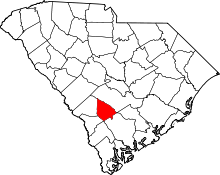 | |
| Towns | ||
| Unincorporated communities | ||