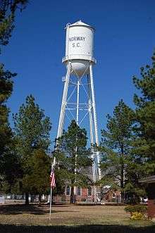
Norway, South Carolina
| Norway, South Carolina | |
|---|---|
| Town | |
 Location of Norway, South Carolina | |
| Coordinates: 33°27′N 81°8′W / 33.450°N 81.133°WCoordinates: 33°27′N 81°8′W / 33.450°N 81.133°W | |
| Country | United States |
| State | South Carolina |
| County | Orangeburg |
| Area | |
| • Total | 0.8 sq mi (2.2 km2) |
| • Land | 0.8 sq mi (2.2 km2) |
| • Water | 0.0 sq mi (0.0 km2) |
| Elevation | 236 ft (72 m) |
| Population (2000) | |
| • Total | 389 |
| • Density | 465.5/sq mi (179.7/km2) |
| Time zone | Eastern (EST) (UTC-5) |
| • Summer (DST) | EDT (UTC-4) |
| ZIP code | 29113 |
| Area code(s) | 803 |
| FIPS code | 45-51550[1] |
| GNIS feature ID | 1249902[2] |
Norway is a town in Orangeburg County, South Carolina, United States. The population was 389 at the 2000 census.
History
Norway was laid out in 1891 when the railroad was extended to that point.[3] A post office has been in operation at Norway since 1892.[4] The town was so named in order to fit with the railroad's "Scandinavian" naming sceme; other such examples include Sweden, South Carolina and Denmark, South Carolina.[3]
The Willow Consolidated High School was added to the National Register of Historic Places in 2006.[5]
Race riot
On July 4, 1903, the majority African-American population rose in protest, in reaction to the lynching on July 1 of resident Charles Evans, who was suspected of killing disabled Confederate veteran John T. Phillips. Along with the lynching of Evans, two other black residents of Norway were beaten by a white mob, with one later dying of his injuries. According to news reports at the time, the murder of Phillips was perpetrated in revenge for Phillips' son whipping black workers.[6] Nearly 200 armed black residents took over the town before a militia was called by Governor Duncan Clinch Heyward to restore white control. At the time, only 50 of Norway's 200 residents were white.
Geography
Norway is located at 33°27′N 81°8′W / 33.450°N 81.133°W (33.4497, -81.1260).[7]
According to the United States Census Bureau, the town has a total area of 0.8 square miles (2.1 km2), of which, 0.8 square miles (2.1 km2) of it is land and 1.19% is water. Located on Hwy 321.
Demographics
| Historical population | |||
|---|---|---|---|
| Census | Pop. | %± | |
| 1900 | 218 | — | |
| 1910 | 315 | 44.5% | |
| 1920 | 474 | 50.5% | |
| 1930 | 494 | 4.2% | |
| 1940 | 488 | −1.2% | |
| 1950 | 476 | −2.5% | |
| 1960 | 525 | 10.3% | |
| 1970 | 579 | 10.3% | |
| 1980 | 518 | −10.5% | |
| 1990 | 401 | −22.6% | |
| 2000 | 389 | −3.0% | |
| 2010 | 337 | −13.4% | |
| Est. 2015 | 328 | [8] | −2.7% |
As of the census[1] of 2000, there were 389 people, 153 households, and 104 families residing in the town. The population density was 465.5 people per square mile (178.8/km²). There were 164 housing units at an average density of 196.3 per square mile (75.4/km²). The racial makeup of the town was 50.39% White, 45.24% African American, 0.51% Native American, 0.26% Asian, 0.77% from other races, and 2.83% from two or more races. Hispanic or Latino of any race were 1.54% of the population.
There were 153 households out of which 26.1% had children under the age of 18 living with them, 43.8% were married couples living together, 20.3% had a female householder with no husband present, and 32.0% were non-families. 28.8% of all households were made up of individuals and 11.8% had someone living alone who was 65 years of age or older. The average household size was 2.54 and the average family size was 3.17.
In the town the population was spread out with 25.2% under the age of 18, 8.5% from 18 to 24, 23.7% from 25 to 44, 25.4% from 45 to 64, and 17.2% who were 65 years of age or older. The median age was 41 years. For every 100 females there were 103.7 males. For every 100 females age 18 and over, there were 91.4 males.
The median income for a household in the town was $27,083, and the median income for a family was $34,000. Males had a median income of $32,031 versus $19,250 for females. The per capita income for the town was $18,864. About 20.8% of families and 30.4% of the population were below the poverty line, including 48.0% of those under age 18 and 28.6% of those age 65 or over.
External links
References
- 1 2 "American FactFinder". United States Census Bureau. Retrieved 2008-01-31.
- ↑ "US Board on Geographic Names". United States Geological Survey. 2007-10-25. Retrieved 2008-01-31.
- 1 2 Boman, Roberta A. (Aug 20, 1981). "Railroad gave towns names". The Sumter Daily Item. pp. 6B. Retrieved 28 October 2015.
- ↑ "Orangeburg County". Jim Forte Postal History. Retrieved 28 October 2015.
- ↑ National Park Service (2010-07-09). "National Register Information System". National Register of Historic Places. National Park Service.
- ↑ "Negro Uprising in South Carolina" New York Times July 5, 1903
- ↑ "US Gazetteer files: 2010, 2000, and 1990". United States Census Bureau. 2011-02-12. Retrieved 2011-04-23.
- ↑ "Annual Estimates of the Resident Population for Incorporated Places: April 1, 2010 to July 1, 2015". Retrieved July 2, 2016.
- ↑ "Census of Population and Housing". Census.gov. Retrieved June 4, 2015.
Municipalities and communities of Orangeburg County, South Carolina, United States | ||
|---|---|---|
| City |  | |
| Towns | ||
| CDPs |
| |
| Unincorporated communities | ||